


WWMW: Tring - Chedd, 4 Peaks/4 Pubs
Details
Creation:
Last update:
–
–
-
 Activity: Walking
 -
 Distance: 9.15 mi
 -
 Average duration: 4h 45
 -
 Difficulty: Not specified
 -
-
 Back to start: No
 -
 Ascent: + 604 ft
 -
 Descent: - 682 ft
 -
-
 Highest point: 771 ft
 -
 Lowest point: 299 ft
-
 Country:
United Kingdom
Country:
United Kingdom
-
 Area: Chiltern Hills
 -
 City:
Aldbury
City:
Aldbury -
 Start: N 51.800989° / W 0.621649°
 -
 End: N 51.857119° / W 0.662429°
 -


 Hour-by-hour weather


Waypoints
- S : mi 0 - alt. 423 ft - Start on
- 1 : mi 0 - alt. 423 ft - Turn slight right
- 2 : mi 0.03 - alt. 427 ft - Turn right onto Station Road
- 3 : mi 0.7 - alt. 571 ft - Turn slight right
- 4 : mi 0.72 - alt. 587 ft - Turn left
- 5 : mi 1.92 - alt. 623 ft - Keep right
- 6 : mi 2.08 - alt. 600 ft - Turn left onto Stocks Road
- 7 : mi 2.13 - alt. 591 ft - Turn right
- 8 : mi 2.66 - alt. 692 ft - Turn left
- 9 : mi 2.74 - alt. 745 ft - Keep right
- 10 : mi 3.13 - alt. 676 ft - Turn slight right
- 11 : mi 3.25 - alt. 676 ft - Keep right
- 12 : mi 3.37 - alt. 689 ft - Keep left
- 13 : mi 3.5 - alt. 751 ft - Turn right
- 14 : mi 3.61 - alt. 558 ft - Turn right
- 15 : mi 3.66 - alt. 538 ft - Turn right onto B489
- 16 : mi 3.69 - alt. 545 ft - Turn left
- 17 : mi 6.08 - alt. 384 ft - Turn right onto Ladysmith Road
- 18 : mi 6.2 - alt. 354 ft - Turn right onto Station Road, B488
- 19 : mi 6.21 - alt. 354 ft - Turn left
- 20 : mi 6.22 - alt. 354 ft - Turn right
- 21 : mi 6.42 - alt. 348 ft - Turn right
- 22 : mi 6.84 - alt. 348 ft - Turn slight left onto Chequers Lane
- 23 : mi 6.99 - alt. 348 ft - Turn right onto Cheddington Road
- 24 : mi 7.34 - alt. 341 ft - Turn right
- 25 : mi 8.34 - alt. 344 ft - Turn right onto Church Lane
- 26 : mi 8.48 - alt. 348 ft - Keep left onto Church Path
- 27 : mi 8.88 - alt. 335 ft - Turn right onto Station Road
- 28 : mi 9.06 - alt. 331 ft - Turn left
- 29 : mi 9.07 - alt. 331 ft - Keep left
- E : mi 9.15 - alt. 328 ft
Other walks in the area
Tring Reservoirs Wild
 Tourist office6.72 mi
+102 ft
-98 ft
3h 10
Tourist office6.72 mi
+102 ft
-98 ft
3h 10
 Easy
Departure from Aldbury (Hertfordshire)
Easy
Departure from Aldbury (Hertfordshire)
Stroll along the waterside and look for waterbirds on this gentle 13km walk. Starting at Tring railway station, it takes in College Lake nature reserve, a section of the Grand Union Canal and three reservoirs.
Tring Park Wild
9.94 mi
+486 ft
-482 ft
5h 00
 Moderate
Departure from Aldbury (Hertfordshire)
Moderate
Departure from Aldbury (Hertfordshire)
Enjoy scenic views, wooded valleys and ancient parkland on this 10km circular walk through the Chilterns. Starting in Tring, the walk takes in Dancersend nature reserve and the Ridgeway National Trail.
Ivinghoe Beacon & Ashridge, Chilterns
 Association / Club / Walk leader8.71 mi
+902 ft
-902 ft
4h 50
Moderate
Departure from Aldbury (Hertfordshire)
Association / Club / Walk leader8.71 mi
+902 ft
-902 ft
4h 50
Moderate
Departure from Aldbury (Hertfordshire)
This walk follows the ancient Ridgeway with stunning views from the tops of both Pitstone Hill and Ivinghoe Beacon, before returning through the beautiful woodland of the National Trust’s Ashridge Estate.
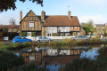
Across the Tring Gap by Ridgeway and Chiltern Way
 9.34 mi
+758 ft
-755 ft
4h 55
Moderate
Departure from Aldbury (Hertfordshire)
9.34 mi
+758 ft
-755 ft
4h 55
Moderate
Departure from Aldbury (Hertfordshire)
Experience the Ridgeway and Chiltern Way on a walk linking the woods of Ashridge with the woods above Tring Park across the Bulbourne Valley (Tring Gap).
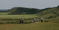
Aldbury to the Beacon and back through Ashridge
 9.93 mi
+801 ft
-807 ft
5h 15
Moderate
Departure from Aldbury (Hertfordshire)
9.93 mi
+801 ft
-807 ft
5h 15
Moderate
Departure from Aldbury (Hertfordshire)
From picturesque Aldbury you follow the Ridgeway to Ivinghoe beacon, returning via the Ashridge boundary trail and the Chiltern Way. You can enjoy the contrasts between the two LDPs: airy ridges on the Ridgeway and the patchwork of woods and fields on the Chiltern Way.
Ridgeway Loops from Ashridge
 Visorando Member9.98 mi
+1,040 ft
-1,024 ft
5h 30
Moderate
Departure from Aldbury (Hertfordshire)
Visorando Member9.98 mi
+1,040 ft
-1,024 ft
5h 30
Moderate
Departure from Aldbury (Hertfordshire)
A circular trail near Berkhamstead covering the Ridgeway, Grim's ditch, Pitstone Hill, Steps Hill, Ivinghoe Beacon, Beacon Hilll, Icknield Way trail. Starting at Ashridge monument where there is national trust parking.
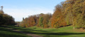
Ashridge and Little Gaddesden, Chilterns
 7.33 mi
+256 ft
-256 ft
3h 35
Moderate
Departure from Aldbury (Hertfordshire)
7.33 mi
+256 ft
-256 ft
3h 35
Moderate
Departure from Aldbury (Hertfordshire)
Visit some of the quieter parts of the Ashridge Estate on the way to Hudnall Common and Little Gaddesden.
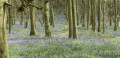
Ashridge Bluebell Walk, Chilterns AONB
 5.55 mi
+253 ft
-253 ft
2h 45
Moderate
Departure from Aldbury (Hertfordshire)
5.55 mi
+253 ft
-253 ft
2h 45
Moderate
Departure from Aldbury (Hertfordshire)
The National Trust Estate at Ashridge is one of the best places in the country to see bluebells in spring. This gentle walk will take you through carpets of this beautiful plant, and also looks at the history of the estate. There are wonderful views over the valley from Duncombe Terrace.
It’s a lovely walk at any time of year but can be very muddy in Winter so wear suitable footwear!
For more walks, use our search engine .
The GPS track and description are the property of this route's author. Please do not copy them without permission.

