


Weymouth To Lulworth Cove
Details
Creation:
Last update:
–
–
-
 Activity: Walking
 -
 Distance: 10.61 mi
 -
 Average duration: 6h 25
 -
 Difficulty: Not specified
 -
-
 Back to start: No
 -
 Ascent: + 1,778 ft
 -
 Descent: - 1,791 ft
 -
-
 Highest point: 535 ft
 -
 Lowest point: 7 ft
-
 Country:
United Kingdom
Country:
United Kingdom
-
 City:
Weymouth
City:
Weymouth -
 Start: N 50.620254° / W 2.450037°
 -
 End: N 50.618676° / W 2.249727°
 -


 Hour-by-hour weather


Waypoints
- S : mi 0 - alt. 23 ft
- 1 : mi 0.02 - alt. 26 ft - Turn slight left onto Westerhall Road, B3155
- 2 : mi 0.05 - alt. 33 ft - Turn slight left onto Greenhill, B3155
- 3 : mi 1.24 - alt. 7 ft - Turn right onto Bowleaze Cove Way
- 4 : mi 1.42 - alt. 75 ft - Turn slight right onto Bowleaze Cove Way
- 5 : mi 2.31 - alt. 118 ft - Turn slight right
- 6 : mi 2.43 - alt. 125 ft - Turn left
- 7 : mi 3.07 - alt. 82 ft - Turn slight left
- 8 : mi 3.28 - alt. 164 ft - Turn right
- 9 : mi 3.57 - alt. 246 ft - Turn slight right
- 10 : mi 4.11 - alt. 128 ft - Turn right
- 11 : mi 4.15 - alt. 108 ft - Turn right onto Mills Road
- 12 : mi 4.33 - alt. 52 ft - Turn left
- 13 : mi 4.4 - alt. 56 ft - Turn left
- 14 : mi 4.96 - alt. 66 ft - Turn right
- 15 : mi 5.41 - alt. 23 ft - Turn right
- 16 : mi 5.66 - alt. 36 ft - Turn right
- 17 : mi 5.88 - alt. 72 ft - Turn slight left
- 18 : mi 6.29 - alt. 285 ft - Turn right
- 19 : mi 6.35 - alt. 322 ft - Turn sharp right
- 20 : mi 7.08 - alt. 495 ft - Turn slight right onto Smugglers Path
- 21 : mi 7.08 - alt. 495 ft - Turn sharp right
- 22 : mi 7.65 - alt. 466 ft - Turn slight right
- 23 : mi 7.75 - alt. 440 ft - Turn slight right
- 24 : mi 9.05 - alt. 79 ft - Turn slight right
- 25 : mi 9.09 - alt. 72 ft - Turn right
- 26 : mi 9.28 - alt. 108 ft - Turn slight right
- 27 : mi 9.33 - alt. 105 ft - Turn left
- 28 : mi 9.65 - alt. 299 ft - Turn right
- 29 : mi 10.44 - alt. 46 ft - Turn slight left
- 30 : mi 10.45 - alt. 49 ft - Turn left
- 31 : mi 10.46 - alt. 49 ft - Turn right onto Main Road, B3070
- 32 : mi 10.6 - alt. 10 ft - Turn slight left
- E : mi 10.61 - alt. 7 ft
Other walks in the area
Portland circular from the Martleaves Farm Campsite
 Visorando Member8.54 mi
+554 ft
-564 ft
4h 25
Visorando Member8.54 mi
+554 ft
-564 ft
4h 25
 Moderate
Departure from Weymouth (Dorset)
Moderate
Departure from Weymouth (Dorset)
A nice, fairly easy wander around Portland from Martleaves campsite.
A nice stop-off for refreshments at Salt by the marina is worthwhile. Some of the climbs can be a bit challenging, but once at the top, the view from The View is stunning.
Osmington Bay
6.55 mi
+810 ft
-807 ft
3h 45
Moderate
Departure from Osmington (Dorset)
A hilly walk with fantastic views over Osmington Bay starting from the pretty village of Osmington. Not suitable for children as parts of the walk are along public roads with a few road crossings.
Rodden and Langton Herring from Abbotsbury
9.10 mi
+699 ft
-699 ft
4h 50
Moderate
Departure from Abbotsbury (Dorset)
A Dorset walk that explores the pleasant landscape to the east of the pretty village of Abbotsbury. The ropute includes a section of the South West Coast path including a potion along the shores of West Fleet, the lagoon behind Chesil Beach.
St. Catherine Chapel
 2.60 mi
+279 ft
-266 ft
1h 25
Moderate
Departure from Abbotsbury (Dorset)
2.60 mi
+279 ft
-266 ft
1h 25
Moderate
Departure from Abbotsbury (Dorset)
Easy walk with a short climb to St Catherine's Chapel, which is based on a small hill. At the top, it offers a nice 360° viewpoint.
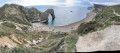
Lulworth Cove and Durdle Door
 2.07 mi
+505 ft
-502 ft
1h 25
2.07 mi
+505 ft
-502 ft
1h 25
 Easy
Departure from West Lulworth (Dorset)
Easy
Departure from West Lulworth (Dorset)
Lulworth Cover and Durdle Door are two of the best known features of Dorset's Jurassic Coast. This short walk includes some uphill walking but the path is good and well graded.
 Difficult
 For more walks, use our search engine .
The GPS track and description are the property of this route's author. Please do not copy them without permission.

