


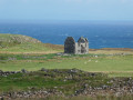
(S/E) The walk starts at the old church in Trumpan, steeped in the history of warfare between the region’s various clans.
The first 5 km follow a well-marked path at a reasonable distance from the cliffs, where the fierce westerly winds manage to transform the waterfalls into splendid jets of water.
Just before reaching the ruins of the hamlet of Unish (a stone house still clearly visible, a few old cattle pens, etc.), take the path that turns left and follow it towards the white lighthouse, avoiding as far as possible the adjacent paths or tracks that lead away from your destination.
(1) From the lighthouse, you can either retrace your steps or follow the very faint paths or tracks that run alongside the fence at the edge of the cliff…
We were treated to the sight of several dozen seals near the 7 km mark.
(2) 3 km past the lighthouse, things become much more complicated as there is no longer any real track to follow, and you have to rely on the general direction indicated by the GPS to reach the ‘summit’, approach an enclosure and follow the fence for about 2 km...
(3) before finally coming across a semblance of a path shortly after the 14 km mark.
Waternish Point


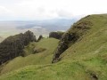
A haven of peace, total solitude, magnificent landscapes, a laborious – and at times very laborious – trek for just under half the route… that sets the scene.
But what a joy for a walker who values nature above all else!!!
Details
–
-
 Activity: Walking
 -
 Distance: 10.14 mi
 -
 Average duration: 5h 30
 -
 Difficulty: Difficult
 -
-
 Back to start: Yes
 -
 Ascent: + 991 ft
 -
 Descent: - 1,014 ft
 -
-
 Highest point: 761 ft
 -
 Lowest point: 30 ft
-
 Country:
United Kingdom
Country:
United Kingdom
-
 City:
Highland
City:
Highland -
 Start/End: N 57.555917° / W 6.641715°
 -


 Hour-by-hour weather
Photos
Description of the walk
Waypoints
- S/E : mi 0 - alt. 151 ft - Trumpan
- 1 : mi 4.06 - alt. 36 ft - Waternish Point Lighthouse
- 2 : mi 6.39 - alt. 269 ft - Start of the difficult section
- 3 : mi 8.83 - alt. 535 ft - Well-marked path
- S/E : mi 10.14 - alt. 151 ft - Trumpan
Notes
Don’t put too much stock in the distance or the cumulative elevation gain: these figures are based on the mapped route. The actual route requires so many little detours and side trips to avoid puddles, peat bogs, pools, marshes and fords that it’s reasonable to expect at least 10 per cent more in distance and 25 per cent more in cumulative elevation gain (as confirmed by my Apple Watch).
It should be noted that it is unfortunately impossible to visit the southern tip of Àrd Mòr, given the ban on access – even on foot – from the Steadings at Ardmore House: is this an encroachment on public land or not? No outsider will ever know the full extent of this restriction. Nevertheless, it’s a shame because there’s a double arch in a sea cliff near the hamlet of ‘Rogheadh’.
The ‘difficult’ classification is, here too, based on the difficulty of getting around the terrain (elusive paths, marshes, etc.) rather than on the distance and elevation gain, even those that have been observed.
And by the way, forget about finding any picnic tables, or even a bench… this is a complete tourist wasteland.
Other walks in the area
Access to Coral Beach
 Visorando Member2.61 mi
+105 ft
-98 ft
1h 20
Visorando Member2.61 mi
+105 ft
-98 ft
1h 20
 Easy
Easy
 Departure from Highland
Discovering Nest Point
 1.90 mi
+410 ft
-430 ft
1h 15
1.90 mi
+410 ft
-430 ft
1h 15
 Average
Departure from Highland
Average
Departure from Highland
The Fairy Glen
 0.93 mi
+105 ft
-108 ft
0h 30
Average
Departure from Highland
0.93 mi
+105 ft
-108 ft
0h 30
Average
Departure from Highland
A visit to Fairy Glen
 1.64 mi
+203 ft
-203 ft
0h 55
Easy
Departure from Highland
1.64 mi
+203 ft
-203 ft
0h 55
Easy
Departure from Highland
For more walks, use our search engine .
The GPS track and description are the property of this route's author. Please do not copy them without permission.

