
Cance Valley

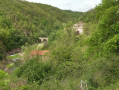
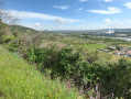
A lovely ride in the Ardèche along the banks of the Rhône. The climb up the Cance valley is very pleasant along a quiet little road with a steady, gentle gradient.

Details

n°9544521
Creation:
Last update:
Last review:
  • Touring/Gravel
    Activity: Touring/Gravel
  • ↔
    Distance: 19.66 mi
  • ◔
    Duration according to the author: 2.5 hrs 
  • ▲
    Difficulty: Moderate

  • ⚐
    Back to start: Yes
  • ↗
    Ascent: + 1,247 ft
  • ↘
    Descent: - 1,227 ft

  • ▲
    Highest point: 1,319 ft
  • ▼
    Lowest point: 423 ft

Photos

Description of the route

Start from the car park at Vernosc-les-Annonay Town Hall.

(S/E) Take the Route de la Gare almost opposite the Town Hall and continue straight on. Pass through the hamlet of La Gare and arrive at a four-way junction at Midon-Ouest. Turn left and continue for a few metres.

(1) At the ‘Give Way’ sign, turn right onto the D370 and follow it to the junction, just past the school in Talencieux.

(2) Turn right, following signs for “Village” then “Mairie”. Ride straight through the village, past the church, then turn right onto the small road, the D370b, towards Sarras, which winds down to the Rhône valley – watch out for the steep gradient! You’ll reach the hamlet of La Cance.

(3) At the Stop sign, turn right, cross the Cance bridge and follow the D86 for 500 metres. Take care! Heavy traffic.

(4) At the junction, turn right onto the D270, towards the Cance Valley. Drive up the valley for 15 km along this road until you reach Annonay. Enjoy the magnificent scenery and the tranquillity of this little road (it’s really lovely).

(5) Passing close to the Marc Seguin bridge.

(6) Passing near the Roche Péréandre.

(7) At the end of the D270, at the Stop sign, turn right towards Davézieu onto the D878, Boulevard Jacques de Sugny, and continue to the next roundabout. There is some traffic, but there is a good cycle lane.

(8) Turn right onto the D370, towards Talencieux.

(9) At the roundabout, turn right onto the D370a and head for the car park at Vernosc-les-Annonay Town Hall (S/E).

Waypoints

  1. S/E : mi 0 - alt. 1,296 ft - Town Hall
  2. 1 : mi 1.38 - alt. 1,260 ft - D370 road
  3. 2 : mi 3.75 - alt. 1,230 ft - Talencieux
  4. 3 : mi 6.01 - alt. 443 ft - Confluence of the Cance and - Rhône (River)
  5. 4 : mi 6.38 - alt. 433 ft - Take the D270 on the right. Head towards and follow the - Cance (rivière)
  6. 5 : mi 13.38 - alt. 863 ft - Pnt suspendu de Marc Seguin
  7. 6 : mi 13.65 - alt. 883 ft - La roche Péréandre
  8. 7 : mi 15.79 - alt. 994 ft - D278 Road – Boulevard Jacques Sugny
  9. 8 : mi 17.17 - alt. 1,243 ft - D370 road – Towards Talencieux
  10. 9 : mi 18.55 - alt. 1,280 ft - D370a road – Turn right
  11. S/E : mi 19.66 - alt. 1,296 ft - Town Hall

Notes

The elevation gain of 527 m is excessive; it should be closer to 350 m.

Reviews and comments

5 / 5
Based on 1 review

Reliability of the description
5 / 5
Ease of following the route
5 / 5
Route interest
5 / 5
randoTV180762
randoTV180762
• Edited:

Overall rating : 5 / 5

Date of your route : Jul 03, 2021
Reliability of the description : ★★★★★ Very good
Ease of following the route : ★★★★★ Very good
Route interest : ★★★★★ Very good
Very busy route : No

A lovely route to cycle on a hybrid or mountain bike! We avoided a few rather busy roads towards ANNONAY; there are other, smaller and more pleasant ones.

Machine-translated

For more walks, use our search engine .

The GPS track and description are the property of this route's author. Please do not copy them without permission.

