


Refine your search for walks in Valière (rivière) - Affluent de la Vilaine
Valière (rivière) - Affluent de la Vilaine walks


 The historic railway route between Argentré-du-Plessis and Vitré
 Local authority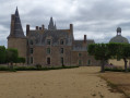
 6.58 mi
 +308 ft
 -308 ft
 3h 20
3h 20
 Difficult
 Departure from Vitré (Ille-et-Vilaine)
As its name suggests, it is clear that this route follows the greenway for a considerable distance, along which the railway line to Argentré-du-Plessis and then La Guerche-de-Bretagne once ran. It is now reserved for walkers, hikers and cycle tourists.
The route continues with a brief glimpse of Madame de Sévigné’s residence before returning towards Vitré via small, shaded roads and paths.
From Vitré to Argentré-du-Plessis via the Valière lake
 13.51 mi
+377 ft
-390 ft
6h 35
Difficult
Departure from Vitré (Ille-et-Vilaine)
13.51 mi
+377 ft
-390 ft
6h 35
Difficult
Departure from Vitré (Ille-et-Vilaine)
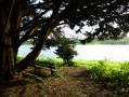
This route is the first stage of a 96 km circular through the Vitré countryside. Consisting mainly of sunken lanes, this route will take you, among other places, to the Château des Rochers-Sévigné and the Valière lake.