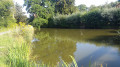
A lovely short walk through the pastures of Les Mars

This walk, described as a horse ride, can also be done on foot. It offers lovely views of the surrounding hills and a stretch along the River Cher. Part of the route follows theGR®4.

Details

n°45095241
Creation:
Last update:
Last review:
  • Horse riding
    Activity: Horse riding
  • ↔
    Distance: 5.39 mi
  • ◔
    Duration according to the author: 2 hrs 
  • ▲
    Difficulty: Easy

  • ⚐
    Back to start: Yes
  • ↗
    Ascent: + 358 ft
  • ↘
    Descent: - 384 ft

  • ▲
    Highest point: 2,110 ft
  • ▼
    Lowest point: 1,844 ft

Photos

Description of the walk

The start is near the town hall: parking available.

(S/E) With the town hall on your left, take the small road towards the cemetery.

(1) Turn left at the Fork in the road. From the houses onwards, the small road climbs slightly. At the bend, ignore the path opposite and continue along the road to pass through the hamlet of Guinebaudeix. Keep going in the same direction until the next Fork in the road.

(2) Follow the left-hand branch and continue between the hedges until you reach the wayside cross at the next junction.

(3) Take the small road on the right and pass a house on the left by a few metres.

(4) Turn at a right angle onto the path leading down to the right (GR® red and white markings). Stay on this path, which climbs slightly. Pass the turn-off to Barnicaud on your left.

(5) Carry on straight ahead, heading back down towards the Cher. Follow the river, joining a small road, until you reach Beaulieu.

(6) Turn left at a right angle and, as you come out of the bend, take the path on the right, following theGR® route. At the three-way junction after Le Coudouneix, veer left, leaving theGR®, and continue straight on to the road (D91) at Le Ricle.

(7) Turn right and join the D27.

(8) Follow the departmental road, taking care, to the old Mars railway station.

(9) Take the main track on the right, rejoining theGR® markings. Further on, leave the GR® markings again and continue straight on towards Le Bois, then to the junction with the track leading back to Les Mars.

(10) Turn left. At the entrance to the village, turn right onto the Route de Beaulieu, which leads to the town hall and the starting point (S/E).

Waypoints

  1. S/E : mi 0 - alt. 1,978 ft - Town hall
  2. 1 : mi 0.14 - alt. 2,008 ft - Cemetery
  3. 2 : mi 0.79 - alt. 2,070 ft - Fork in the road
  4. 3 : mi 1.15 - alt. 2,073 ft - Calvary
  5. 4 : mi 1.69 - alt. 2,070 ft - Junction with GR°°®°°41
  6. 5 : mi 2.2 - alt. 2,014 ft - Barnicaud junction
  7. 6 : mi 2.86 - alt. 1,854 ft - Beaulieu
  8. 7 : mi 3.63 - alt. 1,995 ft - Le Ricle, D91
  9. 8 : mi 4.02 - alt. 1,900 ft - D27
  10. 9 : mi 4.4 - alt. 1,942 ft - Former Mars railway station
  11. 10 : mi 4.99 - alt. 1,939 ft - The Hills
  12. S/E : mi 5.39 - alt. 1,978 ft - Town hall

Notes

Picnic tables between the town hall and the cemetery.
Water from the river.
The tarmac roads you’ll be using are generally quiet. Nevertheless, caution is advised.
You can shorten the route by staying on theGR® between Le Goudouneix and Le Bois.

Worth a visit

To the west, there’s a view of the Sermur tower in the first section.
Very pretty views of the hills and lakes.
If you’re on horseback, take care if your horse isn’t used to cows, as there are plenty of them!

Always be cautious and plan ahead when you're outdoors. Visorando and the author of this route cannot be held responsible for any accidents occurring on this route.

The GR® and PR® markings are the intellectual property of the Fédération Française de Randonnée Pédestre.

Reviews and comments

4.7 / 5
Based on 1 review

Reliability of the description
5 / 5
Ease of following the route
5 / 5
Route interest
4 / 5
User 1175706

Overall rating : 4.7 / 5

Date of your route : Oct 13, 2026
Reliability of the description : ★★★★★ Very good
Ease of following the route : ★★★★★ Very good
Route interest : ★★★★☆ Good
Very busy route : Yes

A very pleasant and easy walk

Machine-translated

For more walks, use our search engine .

The GPS track and description are the property of this route's author. Please do not copy them without permission.