


 Country:
 City:
City:


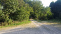
The route starts along the old railway line linking Commentry to Marcillat-en-Combraille. In this small square, there is space to park two or three vehicles (horseboxes or horse-transport lorries).
(S/E) Head south and ignore all turn-offs on the right.
(1) At the Chaumier water tower, turn left, then take the road furthest to the right (the one that climbs slightly) to continue along the embankment of the old railway line. Ignore any turn-offs to the right.
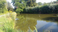
(2) Turn left (Chemin des Gannes) and follow the lake to the dam. Cross the dam and follow the lake again, along its southern bank. Continue straight on through the woods.
(3) At the junction before the road, turn left. The gradient becomes steeper. At Puy Mas, find a tarmac road and follow it eastwards.
(4) At the Stop sign in Fonturier, carry on straight ahead and pass a small pond on your right. You’ll come to a dirt track; cross the Gournet stream and carry on to the T-junction
(5) At the junction, turn left. At the Fork in the road, take the path furthest to the right.
(6) At the crossroads, you’ll come to a small tarmac road; take the road on the left towards “Chancaud” / “Courtanges”. Carry on straight ahead past Chancaud, then continue straight on until you see the sign for Courtanges.
(7) At the crossroads, follow “Courtanges” until you reach the hamlet. Then continue left along the dirt track. This descends to the Gânes stream, which you must cross (on the left, a good spot for a break).
(8) At the fork, take the path furthest to the left.
(9) At the crossroads, where the tarmac road rejoins, take the road on the right (caution: there is relatively heavy traffic on this stretch of road).
(10) At the Croix du Boeuf, in the dangerous bend, rejoin the dirt track on the left. At the hamlet of Le Boeuf, carry on straight ahead.
(11) Take the path furthest to the right, then carry on straight ahead until you reach the hamlet of Les Clous.
(12) At Les Clous, turn left.
(13) Carry on along a track and, at the Fork in the road that appears immediately, turn left (track not shown on the map). This track descends and you will cross the stream ‘Le Banne’ three times. You can even stop again on the left after the third crossing.
(14) At Les Mazelles, take the road on the right, then after 100 metres take the path on the left (Chemin des Prés Plats). Cross the “Le Banny” stream again. At the crossroads, go straight on (Chemin des Ebaupins). At the hairpin bend, take the dirt track on the left and follow the old railway line to the finish, which is also the starting point (S/E).


