Country:
 City:
City:


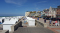
Park in the small car park to the left of the entrance to the Eu stadium.
(S/E) Head towards Eu. Follow the towpath to the end. Take the footpath, which veers to the left and passes under the two footbridges by the secondary school. Turn right onto Avenue de la Gare. You’ll reach a multi-way junction.
(1) Turn right. Just before crossing the bridge over the Bresle, turn left onto the path running alongside the Bresle. At the end of the path, turn left, leaving the two streets on your left, and cross the level crossing. Continue along Rue Digue Catrix. At the junction, take Rue la Busine straight ahead, which ends in a narrow lane on the right.
(2) Turn left onto Chaussée de Picardie. At the roundabout, take thesecond right onto Chemin de Saint-Laurent. Head uphill, ignoring Rue du Four à Chaux on your right. The road continues as a steeply ascending track. At the Y-junction, turn right and continue climbing to the top. At the Saint-Laurent Chapel – a beautiful viewpoint
– head off to the left. Leave Rue de l’Europe on your left and continue straight up for 230 m.
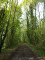
(3) Take the path on the left, directly opposite the tree-lined path. Cross the D925 to join Rue de la Targette. At the junction, turn left for 50 metres and then right (after the bus shelter) onto Chemin de Béthencourt. Continue on until you reach a further junction at a place called La Justice.
(4) Take the path on the left, turn left onto a path running at right angles to it, and follow it to the first houses. At the crossroads, ignore Rue Jean Hénin and head straight ahead.
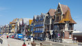
(5) At the right-hand bend in Rue du1er Mai, take the path opposite. Turn right into Rue du 11 Novembre. At the junction, take Rue d’Ault on the left and follow it to the roundabout at the entrance to Ault. Cross the RD940 and head down Avenue du Général Leclerc, which continues as Grande Rue.
(6) Facing the sea, turn left into Rue Ernest Jamart, then left again into Rue de l’Esplanade. Turn immediately right into Rue de la République to head up the street opposite the alleyway, Rue des Bessaints.
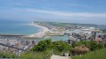
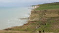
At the end of this street, take the path opposite. Follow the yellow markings along the cliff for about 1,500 metres. Be sure to follow the markings closely as they veer away from the cliff to avoid the risk of rockfalls. Head towards the TV relay mast in the Bois de Cise.
(7) Walk down the embankment. Head to the right, taking the Route des Mouettes, which winds its way down. After a bend (near a white house with a flat roof), head down to the right along the signposted path, which consists of steps, until you reach the square.
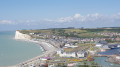
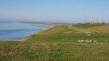
From the centre of the square, with your back to the sea, head towards the roundabout. Go up Allée du Muguet on the right (path/staircase) to the top. Turn right onto the path at the edge of the woodland and field; on your left, you’ll find the wooden gate to get over the fence. Then follow the cliff edge along the yellow-marked coastal path.
Caution here: Make sure you follow the markings closely, as they lead away from the cliff edge for safety reasons – the cliff face regularly collapses. Cross the few gates for walkers and a few small valleys.
Reach the top of Mers-les-Bains, at the statue of the Virgin Mary.
(8) Head straight down the path. This leads onto Rue de la Falaise; follow it down to the right. Ignore the campsite and Rue Jules Mopin, then take the steps on the right, admire the church (1928) and continue downhill.
(9) Turn right, then left to enjoy the Esplanade du Général Leclerc; follow it to the end. When you reach the Stop sign, opposite the Centre Aquatique des 2 Falaises, turn left for 100 metres, then turn right onto Rue Frédéric Petit, which becomes Rue Paul Viguier after the left-hand bend. Turn right onto Rue du 19 Mai 1962. You’ll arrive opposite the fire station.
(10) Turn right to go through the tunnel under the railway line. Watch your head. Follow the path on the left leading to Rue Albert Cauet. After the warehouses belonging to the Tréport Chamber of Commerce and Industry, turn left onto Chemin de Halage for about 2 km to return to the starting car park at the Eu stadium (S/E).

 Visorando Member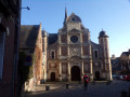

 Easy
Easy