


Let’s start with Holyrood Park and the city’s iconic hill, Arthur’s Seat, which rises to a height of 251 metres. It offers a lovely view over the whole city and the bay, stretching as far as the Forth Road Bridge on a clear day.
A slightly challenging descent towards Queen’s Drive takes you to the St Leonard’s neighbourhood and the university before heading towards the famous Grassmarket, where you can enjoy a superb view of the castle.
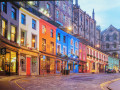
Don’t miss West Bow and Victoria Street before heading towards the castle and then strolling along Royal Mill and High Street.
The route leaves the Old Town, gradually descending towards Princes Gardens before reaching the West End and the iconic Dean Village.
A short stroll along the Water of Leith walkway takes you towards St Bernard’s Bridge and Stock Bridge, leading to Circus Place and Queen Street Gardens – which, unfortunately, are closed to the general public.
Crossing St Andrew’s Square and the St James Quarter leads – via a short detour through an old cemetery – to the city’s observatory and the National Monument of Scotland, before returning to the starting point via London Road Gardens and another lovely park.
A little tour of Edinburgh


This walk offers a one-day outdoor tour of Edinburgh! No museums, no in-depth tours of religious monuments, no gourmet lunch… the whole route can be completed at your own pace by a keen walker.
Details
Creation:
Last update:
Last review:
–
–
-
 Activity: Walking
 -
 Distance: 10.04 mi
 -
 Average duration: 5h 35
 -
 Difficulty: Average
 -
-
 Back to start: Yes
 -
 Ascent: + 1,122 ft
 -
 Descent: - 1,109 ft
 -
-
 Highest point: 771 ft
 -
 Lowest point: 69 ft
-
 Country:
United Kingdom
Country:
United Kingdom
-
 City:
Edinburgh
City:
Edinburgh -
 Start/End: N 55.953807° / W 3.159074°
 -


 Hour-by-hour weather
Photos
Description of the walk
Waypoints
- S/E : mi 0 - alt. 128 ft - Meadowbank car park
- 1 : mi 0.89 - alt. 738 ft - Arthur’s Seat
- 2 : mi 1.93 - alt. 262 ft - St Leonards
- 3 : mi 2.53 - alt. 305 ft - University Quarter
- 4 : mi 3.06 - alt. 240 ft - Grassmarket
- 5 : mi 3.25 - alt. 302 ft - West Bow & Victoria Street
- 6 : mi 3.54 - alt. 348 ft - Castle Esplanade
- 7 : mi 3.77 - alt. 315 ft - High Street
- 8 : mi 4.83 - alt. 174 ft - Princes Gardens
- 9 : mi 5.39 - alt. 220 ft - West End
- 10 : mi 6.04 - alt. 128 ft - Dean Village
- 11 : mi 6.43 - alt. 125 ft - Water of Leith Walkway
- 12 : mi 6.66 - alt. 85 ft - St Bernard’s Bridge
- 13 : mi 6.79 - alt. 72 ft - Stock Bridge
- 14 : mi 6.94 - alt. 125 ft - Royal Circus
- 15 : mi 7.27 - alt. 187 ft - Queen Street Gardens
- 16 : mi 7.67 - alt. 243 ft - St Andrew Square
- 17 : mi 7.89 - alt. 249 ft - St James Quarter
- 18 : mi 8.36 - alt. 335 ft - National Monument of Scotland
- 19 : mi 8.99 - alt. 180 ft - London Road Gardens
- 20 : mi 9.68 - alt. 118 ft - Parade Ground
- S/E : mi 10.04 - alt. 128 ft - Meadowbank car park
Notes
NB: There are, of course, many other things to discover in Edinburgh… everyone can choose their own shortcuts and detours.
Other walks in the area
A short walk in Duddingston
 Visorando Member
 2.51 mi
+564 ft
-564 ft
1h 40
2.51 mi
+564 ft
-564 ft
1h 40
 Easy
Easy
 Departure from Edinburgh
A charming little village to the south-east of Edinburgh, Duddingston is well worth a visit.Old Church Lane is separated from Duddingston Loch by a few gardens open to the public, notably the beautifully landscaped Dr Neil’s Garden.The pretty Duddingston Kirk is surrounded by an old cemetery, which is so small that, unfortunately, there isn’t much room to step back and take a decent photo.The Sheep Heid Inn, a little further on, does, however, offer a few seats in the garden where you can enjoy whatever takes your fancy… before setting off up Crow Hill, situated just below Edinburgh’s iconic hill, Arthur’s Seat… which we suggest you explore on the ‘A Short Tour of Edinburgh’ walk.After taking in the beautiful view from the top of the hill, head back to the starting point via Dunsapie Loch and Meadowfield Park.
Portobello to Firrhill : Figate, Braid and Balerno burn
8.49 mi
+367 ft
-10 ft
4h 15
Average
Departure from Edinburgh
Portobello to Firrhill along Figate, Braid and Balerno burn (lower reaches). The walk begins at Tumbles Leisure Centre on Portobello promenade where the Figgate Burn discharges into the Firth of Forth. This walks is part of the Edinburgh’s five rivers: Source to Sea collection.
Leith to Barnton, Edinburgh
8.16 mi
+299 ft
-190 ft
4h 00
Easy
Departure from Edinburgh
The aim of the walk is to enjoy Edinburgh’s suburbs, outlying areas, and Green Belt setting (while it still exists) by making use of footpaths, tracks, disused railway lines and riverbanks, ascending mine tips, passing alongside farmland, docks and seafronts, and heading through quiet housing-estates as well as shopping-centres and University campus. This one-way walk goes from Wester Hailes to Kaimes and represents the leg 4/5 of a stroll around Edinburgh.
From Ocean Terminal to Whitecraig Village, Edinburgh Circumnavigation
9.37 mi
+102 ft
-3 ft
4h 25
Average
Departure from Edinburgh
Linear via Docks, Swing Bridge, Leith Links, Sewage Works, Portobello, Joppa, Musselburgh and River Esk. Walk around the outskirts of Edinburgh and through its hinterland.The aim of this walk is to follow the coast to Musselburgh, while avoiding busy roads and streets. This is leg 1/5 of the Edinburgh Circumnavigation Walk.
Edinburgh Circumnavigation
43.82 mi
+1,742 ft
-1,745 ft
5 days
Average
Departure from Edinburgh
Circular route (in five sections) around the outskirts of Edinburgh. Walk around the outskirts of Edinburgh and through its hinterland. The full circuit has been designed as a quiet, almost traffic-free, scenic route along quiet footpaths and lanes through outer Edinburgh and its ever-varied suburban, post-industrial and Greenbelt/rural hinterland.
Tour of Braids
5.47 mi
+676 ft
-682 ft
3h 05
Easy
Departure from Edinburgh
Circular walking tour of the Braids using lesser known byways, back-alleys and backwaters.
For more walks, use our search engine .
The GPS track and description are the property of this route's author. Please do not copy them without permission.

