


TRS Sthlm Nord - Jarlabanke
Details
Creation:
Last update:
–
–
-
 Activity: Walking
 -
 Distance: 5.66 mi
 -
 Average duration: 2h 45
 -
 Difficulty: Not specified
 -
-
 Back to start: Yes
 -
 Ascent: + 135 ft
 -
 Descent: - 138 ft
 -
-
 Highest point: 180 ft
 -
 Lowest point: 46 ft
-
 Country:
Sweden
Country:
Sweden
-
 Start/End: N 59.486685° / E 18.082809°
 -


 Hour-by-hour weather


Waypoints
- S/E : mi 0 - alt. 75 ft
- S/E : mi 5.66 - alt. 72 ft
Other walks in the area
A stroll through Stockholm
 Visorando Member
 8.00 mi
+423 ft
-440 ft
4h 05
8.00 mi
+423 ft
-440 ft
4h 05
 Moderate
 Departure from Sweden
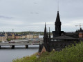
This pleasant city walk, easily accessible by metro, invites you to discover the most iconic aspects of the Swedish capital in a single day. Throughout this route, you’ll have the chance to explore exceptional sites that are entirely free to visit, ranging from the elegance of Östermalm’s market halls and the Strandvägen waterfront to the medieval alleyways of Gamla Stan, home to Stortorget Square, the Royal Palace and the cathedral. The route will also take you to the island of Södermalm to explore the trendy atmosphere of SoFo, the green spaces of Tantolunden, as well as the city’s most beautiful panoramic views from the heights of Skinnarviksberget and the Monteliusvägen trail, before ending at the Parliament.
For more walks, use our search engine .
The GPS track and description are the property of this route's author. Please do not copy them without permission.

