


TeesdaleWay(S3)HwckHd-MiddtnTees
Teesdale Way - Holwick Head to Middleton-in-Teesdale - Section 3 of 14. Reviewed 27th July 2025.
Details
Creation:
Last update:
-
 Activity: Walking
 -
 Distance: 4.52 mi
 -
 Average duration: 2h 05
 -
 Difficulty: Not specified
 -
-
 Back to start: No
 -
 Ascent: + 36 ft
 -
 Descent: - 272 ft
 -
-
 Highest point: 938 ft
 -
 Lowest point: 702 ft
-
 Country:
United Kingdom
Country:
United Kingdom
-
 City:
Holwick
City:
Holwick -
 Start: N 54.649623° / W 2.173533°
 -
 End: N 54.622544° / W 2.08399°
 -


 Hour-by-hour weather


Waypoints
- S : mi 0 - alt. 938 ft - Start on Holwick Head Bridge
- 1 : mi 4.42 - alt. 719 ft - Turn sharp left onto B6277
- E : mi 4.52 - alt. 715 ft
Other walks in the area
High Force Hotel : High and Low Force Waterfalls
 Visorando Member
 4.63 mi
+354 ft
-364 ft
2h 25
4.63 mi
+354 ft
-364 ft
2h 25
 Easy
Departure from Forest and Frith (County Durham)
Easy
Departure from Forest and Frith (County Durham)
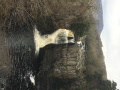
Easy and circular walk around High and Low Force Waterfalls.
High Force and Upper Teesdale
 8.87 mi
+919 ft
-932 ft
4h 55
8.87 mi
+919 ft
-932 ft
4h 55
 Moderate
Departure from Forest and Frith (County Durham)
Moderate
Departure from Forest and Frith (County Durham)
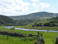
A lovely circular walk with a variety of interest. From the popular waterfall of High Force through upland pasture and then the more desolate upland landscape of Thistle Green before descending to the River Tees and following its course with a final leg through farmland.
Bowlees to Selset Reservoir - Durham Round Trail
4.97 mi
+768 ft
-558 ft
2h 55
Moderate
Departure from Newbiggin (County Durham)
The 16th section of the Durham Round Trail begins in Bowlees, crosses the Tees once more, and then crosses moorland to the first of several reservoirs in the area. This section includes a climb for the first half of the walk which is rewarded with stunning views across the Pennines.
Tees Circular
 7.49 mi
+591 ft
-617 ft
4h 00
Moderate
Departure from Newbiggin (County Durham)
7.49 mi
+591 ft
-617 ft
4h 00
Moderate
Departure from Newbiggin (County Durham)
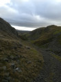
This Tees circular walk from Bowlees takes in the spectacular scenery of Teesdale, Low Force, the Iconic view of High Force, the geographically famous Holwick Scars and views of the Royal residency at Holwick Lodge.
Bowlees circular taking in he Pennine way via Kircarrion
10.11 mi
+1,024 ft
-1,024 ft
5h 30
Moderate
Departure from Newbiggin (County Durham)
A circular walk from Bowlees. Following the river Tees downstream to Middleton-in Teesdale before climbing out through open moorland via the mysterious corpse of ancient Kircarrion, with wonderful views over Lunedale before descending the dramatic Holwick scar back to base.
Bowlees to Middleton Teesdale
10.69 mi
+1,158 ft
-1,178 ft
5h 55
Moderate
Departure from Newbiggin (County Durham)
A very mixed terrain walk, taking you over the military-built wire swing bridge over the Tees at Low Force, offering amazing views of the cascading water from both banks of the river.
You will see glimpses of Holwick Hall Royal residence, the fabulous rocky formation of Holwick Scar, before taking to the open fells to climb from Teesdale to Lunedale, though quickly returning to Teesdale for the descent towards Middleton in Teesdale.
The remainder of this interesting walk follows the river Tees upstream back to Low Force via the well-signposted Pennine Way.
For more walks, use our search engine .
The GPS track and description are the property of this route's author. Please do not copy them without permission.

