Bowlees to Middleton Teesdale

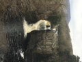
A very mixed terrain walk, taking you over the military-built wire swing bridge over the Tees at Low Force, offering amazing views of the cascading water from both banks of the river.

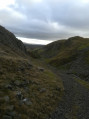
You will see glimpses of Holwick Hall Royal residence, the fabulous rocky formation of Holwick Scar, before taking to the open fells to climb from Teesdale to Lunedale, though quickly returning to Teesdale for the descent towards Middleton in Teesdale.

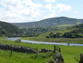
The remainder of this interesting walk follows the river Tees upstream back to Low Force via the well-signposted Pennine Way.

Details

94898168
Creation:
Last update:
Last review:
  • Walking
    Activity: Walking
  • ↔
    Distance: 10.69 mi
  • ◔
    Average duration: 5h 55 
  • ▲
    Difficulty: Moderate

  • ⚐
    Back to start: Yes
  • ↗
    Ascent: + 1,158 ft
  • ↘
    Descent: - 1,178 ft

  • ▲
    Highest point: 1,657 ft
  • ▼
    Lowest point: 722 ft

Description of the walk

Start: The start of this walk is in the car park behind the Bowless visitors centre, with ample parking if you arrive before 10 am and great value at £3 per day.

(S/E) Leave the car park by crossing the wooden bridge, pass (A) Bowlees Visitor Centreand walk directly onto the main road. Cross the road and take a gate to your right, leading through meadows and a gap in the wall to drop down to the swing bridge.

(1) Take the stile diagonally left to follow a well-worn track to an ancient stone bridge, which you cross and continue climbing through 3 fields via stiles to reach a black top road.

(2) Walk directly up the hill on this road to the next junction.

(3) Turn right, pass a farm building on your left and continue on the lane to an indistinct junction in the lane.

(4) The route, though indistinct, is quite clear as you drop down a steep bank to cross a stream and pick up a path ascending (B) Holwick Scar. Pulling through the scar, cross a stile in the fence and make your way across open fells to a visible gate in a wall to your left.

(5) Continue on this path, through another two walls at (6) and (7). Once you've crossed the second wall, turn right to head up the side of the wall.

(8) The route takes you slightly away from the wall and steeply climbs the fell to a line of small crags.

(9) Here it swings left and contours the fell in an upward way to come to another walled junction.

(10) Crossing the wall, the route swings right before turning left after a few hundred meters.

(11) Pass a hunting lodge on your right. Following the lane, take the right branch at the junction to reach a corner of a wall. Follow the wall down on a well-defined lane passing through another two gates and passing a barn (12) before reaching a junction. Here you will join the Pennine way.

(13) Turn right and keep to the ascent passing a number of walls and paddocks and old farm barns to reach a gate into open fells again, with a wall coming towards you on your left.

(14) Follow the open fell downhill to pass a farm and enter the road to Holwick.

(15) Take a right turn, then quickly left onto the main road leading to Middleton in Tessdale. Follow the road for around 400 meters to reach a cattle Mart.

(16) Take the signposted Pennine Way on your left.

(17) Pass through another gate by old farm buildings. The route forward is well defined and waymarked, being a National Footpath. You will reach a footbridge over the Tees to Newbiggin.

(18) Continue on the right side of the river back to the Low Force swing bridge.

(1) Follow the route back to the car park.(S/E)

Waypoints

  1. S/E : mi 0 - alt. 922 ft - Bowlees car park
  2. 1 : mi 0.37 - alt. 873 ft - Swing Bridge at Low Force
  3. 2 : mi 0.67 - alt. 938 ft - Road to Holwick House
  4. 3 : mi 0.9 - alt. 968 ft - Road Junction at Holwick Village
  5. 4 : mi 1.07 - alt. 1,050 ft - Footpath Junction
  6. 5 : mi 1.36 - alt. 1,178 ft - Gate in Wall
  7. 6 : mi 1.68 - alt. 1,237 ft - Gate in Wall
  8. 7 : mi 1.96 - alt. 1,309 ft - Gate in Wall
  9. 8 : mi 2.08 - alt. 1,362 ft - Footpath swings away from wall
  10. 9 : mi 2.45 - alt. 1,594 ft - Turn in Footpath under rocky scar
  11. 10 : mi 3.32 - alt. 1,631 ft - Gate in Wall
  12. 11 : mi 3.4 - alt. 1,611 ft - Hunting Lodge
  13. 12 : mi 3.97 - alt. 1,398 ft - Barn
  14. 13 : mi 4.58 - alt. 1,230 ft - Junction in Farm Lane
  15. 14 : mi 5.59 - alt. 1,388 ft - Gate in Wall
  16. 15 : mi 6.7 - alt. 791 ft - Road at Farm Building
  17. 16 : mi 6.92 - alt. 722 ft - Cattle Mart
  18. 17 : mi 7.21 - alt. 745 ft - Gate in Wall
  19. 18 : mi 9.77 - alt. 840 ft - River Bridge to Newbiggen
  20. S/E : mi 10.69 - alt. 922 ft - Bowlees car park

Notes

Always be prepared with food and drink for a full day on the hills; suitable boots and rainwear are recommended.

Though this route is well defined in all areas, I always recommend having a map and compass with the knowledge of their use; printing this map off will suffice.

(4) The climb down and up Holwick Scar can be slippy in wet conditions, be sure to take it carefully. The route above Holwick Scar can be boggy following rainfall.

(11) If the hunting lodge is not open, it has sheltered seating and benches where lunch or a break can be taken.

Worth a visit

(A) Bowlees Visitor Centre is a visitor information point, café, and gift shop. It serves as the gateway to the North Pennines National Landscape and UNESCO Global Geopark, offering resources for exploring nearby attractions such as Low Force. If the cafe is open, it is well worth the visit.

(1) At the swing bridge, either at the start or the end of your walk, you can follow the River Tees upstream to Low Force Waterfall. It's a spectacular natural landmark, managed by Raby Estates, the same organisation responsible for Raby Castle and High Force, and sits within the dramatic heritage landscapes of the Durham Dales.

Though there is no public access, Holwick Lodge is a grand estate and shooting lodge located in the hamlet of Holwick. It serves as the private residence of the Earl of Strathmore, who is a cousin of the late Queen Elizabeth II, and the property is noted for occasionally hosting royalty.

(B) Holwick Scar is part of the Great Whin Sill, an igneous rock formation (dolerite) created approximately 295 million years ago during the Carboniferous period, which predates the Jurassic. It is a prominent landscape feature in County Durham, popular for walking and rock climbing

The views down to Lunesdale are spectacular on a clear day. You will see Hurry, Blackton, Baldersdale, Selset and Grassholme reservoirs.

(16) If you have the time, Middleton in Teesdale village is 5 minutes walk. Refreshments can be had there in several venues.

Other walks in the area

For more walks, use our search engine .

The GPS track and description are the property of this route's author. Please do not copy them without permission.