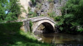
On the River Cure via Pierre-Perthuis

A tributary of the Yonne, the Cure is an iconic river of the Morvan. This river descent, by kayak or canoe, takes place amidst woodland and meadows, close to villages with a rich heritage.

Please disregard the elevation gain shown: this is indeed a river descent.

Details

124050
Creation:
Last update:
Last review:
  • Boating/Canoeing/Kayaking
    Activity: Boating/Canoeing/Kayaking
  • ↔
    Distance: 4.24 mi
  • ◔
    Duration according to the author: 1.5 hrs 
  • ▲
    Difficulty: Moderate

  • ⚐
    Back to start: No
  • ↗
    Ascent: + 3 ft
  • ↘
    Descent: - 43 ft

  • ▲
    Highest point: 525 ft
  • ▼
    Lowest point: 479 ft

Photos

Description of the walk

The start is just downstream of the Malassis dam. Access from Domecy-sur-Cure is via a small road (Chemin de Malassis) which heads north-west from the castle, then turns right and descends to the dam.

(S) A very short portage is required to reach the river via a path that descends into the hairpin bend upon reaching the dam (on the left when coming from Domecy, on the right if you have gone to the end of the road to turn round). Begin the descent, taking care to watch out for the large boulders protruding in places.

(1) You’ll come to a fork: take the left-hand branch (signposted). You’ll then reach Pierre-Perthuis and its two bridges (the old and the new).

(2) Once you’ve passed under both bridges, the descent becomes gentler. You’ll reach the small dam at Moulin de Seigland (signposted).

(3) Pass through the stone weir via an opening in the middle designed for kayaks or canoes (position yourself facing the weir and avoid crossing it sideways). Once you have passed the weir, it is best to keep to the right-hand side of the river. Pass under the bridge at Foissy-lès-Vézelay (signpost).

(4) Continue downstream. When you reach a fork in the river, take the right-hand branch. You’ll see the church of Saint-Père on your left and, in the background on its hilltop, the Basilica of Vézelay.

Further on, slalom poles signal that the finish is near. After the last set of poles, pull up on the right bank, where the river runs very close to the road, near the buildings of the leisure centre situated before the village of Saint-Père (E).


Waypoints

  1. S : mi 0 - alt. 522 ft - Malassis Dam - Cure (la)
  2. 1 : mi 0.85 - alt. 512 ft - Gingon Mill
  3. 2 : mi 1.53 - alt. 505 ft - Vieux Pont de Pierre-Perthuis
  4. 3 : mi 2.53 - alt. 502 ft - Moulin de Seigland Dam
  5. 4 : mi 2.99 - alt. 492 ft - Foissy-lès-Vézelay Bridge
  6. E : mi 4.24 - alt. 482 ft - Saint-Père - Cure (la)

Notes

Although not particularly difficult, the first part of the descent, between (S) and (2), is the most challenging.
A possible stop can be made just upstream of the first bridge at Pierre-Perthuis (2), on the left bank.
Don’t take anything with you that might get damaged by water...

This river descent should also be possible by canoe (not tested).

The author has completed this trip twice by kayak, the first time on1 October 2011 and the second on 13 June 2015.

This route passes through a protected area, which may be subject to special regulations:

Worth a visit

Along the route: the old Pierre-Perthuis bridge (18th century) and the more modern bridge (late 19th century) just behind it.

In Saint-Père:
- The Gallo-Roman site of Les Fontaines Salées.
- The Gothic Church of Notre-Dame (13th–15th centuries).

In Vézelay (well worth a visit):
- The Romanesque Basilica of Sainte-Marie-Madeleine (12th century).
- Village on the slopes of the hill, panoramic view from the hill.

Reviews and comments

5 / 5
Based on 2 reviews

Reliability of the description
5 / 5
Ease of following the route
5 / 5
Route interest
5 / 5
Cyril Drion
Cyril Drion

Overall rating : 5 / 5

Date of your route : May 03, 2025
Reliability of the description : ★★★★★ Very good
Ease of following the route : ★★★★★ Very good
Route interest : ★★★★★ Very good
Very busy route : Yes

A short kayaking trip organised by the Saint Père Leisure Centre.
A perfect first experience. Not too much current, not too deep, and surrounded by nature!

Machine-translated

Sylvia32
Sylvia32

Overall rating : 5 / 5

Date of your route : May 22, 2021
Reliability of the description : ★★★★★ Very good
Ease of following the route : ★★★★★ Very good
Route interest : ★★★★★ Very good
Very busy route : No

A lovely circular walk, suitable for everyone, with no major difficulties.
Impeccable description, varied scenery, beautiful views.

Machine-translated

For more walks, use our search engine .

The GPS track and description are the property of this route's author. Please do not copy them without permission.