


Shottermill And Marley Common
A nice walk from Shottermill across Marley Common with woodlands and meadows thrown in.
Details
Creation:
Last update:
-
 Activity: Walking
 -
 Distance: 3.98 mi
 -
 Average duration: 2h 15
 -
 Difficulty: Not specified
 -
-
 Back to start: Yes
 -
 Ascent: + 459 ft
 -
 Descent: - 433 ft
 -
-
 Highest point: 689 ft
 -
 Lowest point: 397 ft
-
 Country:
United Kingdom
Country:
United Kingdom
-
 Area: South Downs
 -
 City:
Linchmere
City:
Linchmere -
 Start/End: N 51.084606° / W 0.741302°
 -


 Hour-by-hour weather


Waypoints
- S/E : mi 0 - alt. 397 ft - Start out going south on B2131/Shottermill Road.
- 1 : mi 0.06 - alt. 413 ft - Enter next roundabout and take the 1st exit onto B2131/Camelsdale Road.
- 2 : mi 0.37 - alt. 446 ft - Turn right onto walkway. Proceed south (See map for details).
- 3 : mi 1.29 - alt. 682 ft - Turn sharp right.
- 4 : mi 1.32 - alt. 682 ft - Turn left onto walkway. Proceed south through South Downs National Park (See map for details).
- 5 : mi 3.11 - alt. 630 ft - Turn slight left.
- 6 : mi 3.28 - alt. 594 ft - Stay straight to go onto walkway. Proceed northeast through South Downs National Park (See map for details).
- 7 : mi 3.8 - alt. 423 ft - Turn left onto Marley Lane.
- 8 : mi 3.87 - alt. 413 ft - Turn left onto B2131/Camelsdale Road.
- 9 : mi 3.89 - alt. 413 ft - Enter next roundabout and take the 1st exit onto B2131/Shottermill Road.
- S/E : mi 3.98 - alt. 397 ft
Other walks in the area
Marley Heights and Linchmere Circuit
 Visorando Member3.81 mi
+417 ft
-417 ft
2h 05
Visorando Member3.81 mi
+417 ft
-417 ft
2h 05
 Easy
Easy
 Departure from Linchmere (West Sussex)
A walk with two high sections and a bracing climb in the middle!
Marley to Blackdown, Fernhurst, Shulbrede, Canadian Memorial and back
14.27 mi
+1,749 ft
-1,765 ft
8h 05
 Moderate
Departure from Linchmere (West Sussex)
Moderate
Departure from Linchmere (West Sussex)
A 23km tour of the hills to the south of Haslemere, with woodland, views and Shulbrede Priory, taking in elements of the Serpent Trail, Sussex Border Path and LipChis Way.
Gibbet Hill & the Devil's Punch Bowl from Haslemere
8.37 mi
+942 ft
-945 ft
4h 40
Moderate
Departure from Haslemere (Surrey)
This Surrey walk combines two well know local landmarks in a circular walk. The route starts from Haslemere and climbs onto Gibbet Hill before continuing to take in the Devil's Punchbowl, which is a depression of sandy heath.
Black Down, West Sussex, from Haslemere
 10.84 mi
+1,388 ft
-1,368 ft
6h 10
Moderate
Departure from Haslemere (Surrey)
10.84 mi
+1,388 ft
-1,368 ft
6h 10
Moderate
Departure from Haslemere (Surrey)
Starting and finishing at Haslemere, Surrey, the main objective, Black Down, lies in nearby West Sussex. Black Down is the highest point in West Sussex rising to 917 feet above sea level. The walk passes through a variety of landscape and offers some suggestions for alternative routes.
Titty Hill Circular - Milland
3.83 mi
+154 ft
-154 ft
1h 55
Easy
Departure from Milland (West Sussex)
Mainly off-road cross-country walk, ideal post-lunch at the Rising Sun. The road heads south towards Titty Hill before picking up the Serpent Trail west to the Roman road. Take the Roman road back north into Milland.
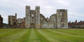
Cowdray Castle
 1.74 mi
+49 ft
-52 ft
0h 50
Easy
Departure from Midhurst (West Sussex)
1.74 mi
+49 ft
-52 ft
0h 50
Easy
Departure from Midhurst (West Sussex)
Visited by King Henry VIII and Queen Elizabeth I, Cowdray Castle was partially destroyed by fire in 1793.
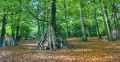
Alice Holt Forest & Gruffalo Trail
 5.57 mi
+272 ft
-266 ft
2h 50
Easy
Departure from Binsted (Hampshire)
5.57 mi
+272 ft
-266 ft
2h 50
Easy
Departure from Binsted (Hampshire)
In the mood for a forest walk? The Alice Holt Forest walk is perfect for that. Discover the wonderful Alice Holt Forest and its variety of trails, ideal for a day out with the kids or for grown-ups wanting a break from the city. Let’s hop into the rabbit hole and uncover Alice Holt Forest’s wonderland!
For more walks, use our search engine .
The GPS track and description are the property of this route's author. Please do not copy them without permission.

