Winegrowers’ Trail – ‘Venise Provençale’ Circular Loop

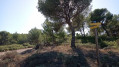
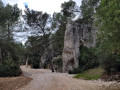
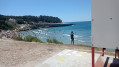
Between the Mediterranean and the Étang de Berre, on the western edge of the Nerthe massif, lies the region known as the ‘Venice of Provence’.
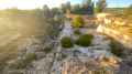
The vineyard covers nearly 200 hectares within the Saint-Pierre, Saint-Julien geological subsidence basin. A few plots are still cultivated in the communes of Châteauneuf-les-Martigues, Saint-Mitre-les-Remparts and Sausset-les-Pins. The majority of the plots fall within the Coteaux d’Aix-en-Provence AOP, with a small portion classified as IGP Méditerranée.

Details

3178575
Creation:
Last update:
Last review:
  • Walking
    Activity: Walking
  • ↔
    Distance: 11.41 mi
  • ◔
    Average duration: 6h 10 
  • ▲
    Difficulty: Moderate

  • ⚐
    Back to start: Yes
  • ↗
    Ascent: + 1,027 ft
  • ↘
    Descent: - 1,043 ft

  • ▲
    Highest point: 554 ft
  • ▼
    Lowest point: 102 ft
  • ⚐ Country: France
  • ⚐ City: Martigues (13500)
  • ⚑
    Start/End: N 43.367333° / E 5.08756°
  • ❏
    IGN map(s): Ref. 3144OT
  • Hour-by-hour weather

Photos

Description of the walk

Set off from the Saint-Julien-les-Martigues wine cellar.

(S/E) From the winery, turn left onto the D5 (Route de Sausset).

(1) At the traffic lights, turn right onto Chemin des Jardins. After a wide bend to the right, the path first turns right then left and joins Chemin des Jourdans at a right-hand bend.

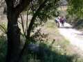
(2) At the street sign, take the stony track to the left between the vines. After the houses, head a few metres into the woods then turn right. Follow the path overlooking the vineyards until you reach a track and an old farmhouse on your left.

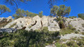
(3) Continue left along this wide track. Ignore the paths branching off to the right and left, pass to the right of the watchtower and stay on the plateau. Join the D49 at the Col de la Gatasse (power pylon).

(4) Cross the D49 with care! and head down to the right. At the right-hand bend, continue left along the old road. At the hairpin bend that follows (sign CB47), turn right. Pass La Gatasse on your left and reach the first path heading off to the right.

(5) Turn right and continue along this stony track. Pass a ruin on your right (a sheepfold) and, after a large wire-mesh gate (open), turn right. The track runs alongside the hamlet and joins the Chemin des Gides.

(6) At the junction, turn left onto Rue Abbé Villard, pass the car park on your right and reach a path starting on the left at number 10. Take this path and then climb the steps leading up to the church.

(7) Take the opportunity to see the Oppidum, then walk round the building and along the edge of the cemetery. At the junction, head down to the left along Rue des Tilleuls until you reach the roundabout. Follow the D49A straight ahead.

(8) Just as you come out of the wide right-hand bend in the road, turn left onto the track and carry on straight ahead at the junction immediately after. Follow this track, ignoring the turnings to the right and left, until you reach a four-way crossroads (elevation 64).
Turn right uphill and carry on straight ahead. Pass under a power line, walk along the left-hand side of some old mills and head downhill to the D5.

(9) Cross the road with care (signpost CB30) and take the track opposite, located behind the car park, which climbs up onto the plateau. After a few metres, turn right and rejoin theGR® de Pays 2013, which comes in from the left. Continue straight ahead to the next junction.

(10) Follow a hairpin bend to the right and head down into the valley. Walk alongside the vineyards until you reach a road.

(11) Turn left, pass under a power line and continue for about 500 m until you reach the start of a track on the right (Berrière).

(12) Follow this track – a round trip – uphill to the ridge, then turn left and head for a watchtower at the Ancien Moulin de Saint-Julien.

(13) After taking in the view, return to the road.

(12) Back on the road, carry on to the right through vineyards and olive groves until you reach the residential area at a place called Les Tourels.

(14) Head down to the right along the Chemin de Beaumenière and leavethe GR® route. The road passes through a pine forest and a hamlet, then continues between vineyards and residential areas.

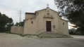
(15) In the copse, make a detour to and from Saint-Julien Church.
On your return, carry on to the left and join the D5. Continue to the right, pass through Saint-Julien-les-Martigues and head for the wine cellar (S/E).

Waypoints

  1. S/E : mi 0 - alt. 240 ft - Wine cellar
  2. 1 : mi 0.35 - alt. 190 ft - Traffic lights, on the right
  3. 2 : mi 0.88 - alt. 210 ft - Chemin des Jourdans, on the left
  4. 3 : mi 1.27 - alt. 299 ft - Path and old farmhouse, on the left
  5. 4 : mi 2.5 - alt. 404 ft - Col de la Gatasse
  6. 5 : mi 3.1 - alt. 217 ft - T-junction, turn right
  7. 6 : mi 3.82 - alt. 187 ft - Turn left onto Rue Abbé Villard
  8. 7 : mi 4.04 - alt. 230 ft - Oppidum and church
  9. 8 : mi 4.82 - alt. 167 ft - Wide right-hand bend, track on the left
  10. 9 : mi 5.78 - alt. 371 ft - D5
  11. 10 : mi 6.44 - alt. 459 ft - Hairpin bend
  12. 11 : mi 7.04 - alt. 322 ft - Road, on the left
  13. 12 : mi 7.62 - alt. 377 ft - Track on the right (Berrière)
  14. 13 : mi 8.04 - alt. 551 ft - Lookout post at the Ancien Moulin de Saint-Julien
  15. 14 : mi 9.16 - alt. 276 ft - Chemin de Beaumenière on the right
  16. 15 : mi 10.52 - alt. 184 ft - Saint-Julien Church junction
  17. S/E : mi 11.41 - alt. 240 ft - Wine cellar

Notes

Access conditions: Between1 June and 30 September, access to woodland areas is regulated by prefectural order and may also be regulated by local council order, for your safety and to protect sensitive sites. Before setting off on your walk, please call 0811 20 13 13. Every day, you can find out whether the site where you wish to walk is open all day, open only in the morning, or completely closed. Depending on weather conditions, the ‘forest fire’ danger level (orange-red-black) is announced by 6.00 pm at the latest for the following day.

Always be cautious and plan ahead when you're outdoors. Visorando and the author of this route cannot be held responsible for any accidents occurring on this route.

The GR® and PR® markings are the intellectual property of the Fédération Française de Randonnée Pédestre.

Reviews and comments

4.1 / 5
Based on 3 reviews

Reliability of the description
4.3 / 5
Ease of following the route
4 / 5
Route interest
4 / 5
OT Martigues
OT Martigues

Hello bs13, thank you for your feedback – what a lovely way to start the new year! We’re delighted to hear that you had a lovely time. We look forward to seeing you again soon.


Machine-translated

bs13
bs13

Overall rating : 5 / 5

Date of your route : Jan 10, 2025
Reliability of the description : ★★★★★ Very good
Ease of following the route : ★★★★★ Very good
Route interest : ★★★★★ Very good
Very busy route : No

Route taken on 5 January 2025: excellent for getting back into the swing of things after the festive season. 17.5 km, mind you, but it was good. A bit of a long run, but enjoyable. Not really suitable for a family run, but a good outing.

Machine-translated

miriel
miriel

Overall rating : 3.7 / 5

Date of your route : Oct 05, 2022
Reliability of the description : ★★★★☆ Good
Ease of following the route : ★★★★☆ Good
Route interest : ★★★☆☆ Average
Very busy route : No

This walk before the fires was lovely because I’d done it before.
Today we went on a recce to take our members along, but after 14 km we called it off because there’s no point in walking through the burnt-out area. What’s more, a section of the route has been diverted between points 5 and 6 as it’s private property. Kind regards.

Machine-translated

Randonneur du dimanche

Overall rating : 3.7 / 5

Date of your route : Apr 23, 2022
Reliability of the description : ★★★★☆ Good
Ease of following the route : ★★★☆☆ Average
Route interest : ★★★★☆ Good
Very busy route : No

Thanks to this walk, I discovered aspects of the Martigues area that I hadn’t known about before (vineyards, woodland, etc.).
The forest fires of recent years have left a desolate landscape in some places.
No difficulties, just a few minor errors in the route. A bit disappointed by the tarmac sections.
A pleasant walk overall.

Machine-translated

Other walks in the area

For more walks, use our search engine .

The GPS track and description are the property of this route's author. Please do not copy them without permission.