
Circular walk along the River Saale at the Burgkhammer Dam

The River Saale rises in the Fichtelgebirge and then winds its way along as the former inner-German border river between Bavaria and Thuringia. Once it reaches the Thuringian Slate Mountains, it flows through five cascades, one of which is the Bleiloch reservoir with the adjacent Burgkhammer dam. A truly enchanting landscape surrounds the Saale meanders here near the small village of Burgk, situated on a hill high above the river. Its history is closely linked to the famous Burgk Castle. 

Details

n°76136405
Creation:
Last update:
Last review:
  • Walking
    Activity: Walking
  • ↔
    Distance: 6.81 mi
  • ◔
    Average duration: 4h 05 
  • ▲
    Difficulty: Moderate

  • ⚐
    Back to start: Yes
  • ↗
    Ascent: + 1,125 ft
  • ↘
    Descent: - 1,135 ft

  • ▲
    Highest point: 1,532 ft
  • ▼
    Lowest point: 1,115 ft

Photos

Description of the walk

(S/E) The start and finish of this scenic circular walk is the car park at the Saaleturm, Burgk 3. 

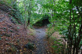
From the car park, we leave the road and head towards the motorhome site, keep to the left before reaching it, and turn left onto the road behind the site. After about 50 metres, we take the turn-off to the right, which soon leads us into the woodland, then along its edge and back into the woodland. 

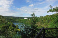
The path curves very widely to the left around the Saale loop. About 200 m past two junctions coming from the right, we come to a wooden hut (Marienhütte) with a good view over the Saale.

(1) Behind the hut, we turn right at the fork, walk a short distance along the edge of the woodland and, at the T-junction, turn left back into the woodland. 

At the next two forks, we keep to the right each time and eventually come to a three-way fork. Here, we continue straight ahead along the middle path. The route descends gently almost to the banks of the Saale; at the bottom, we turn left and walk round the two bends the Saale makes here, always staying above the riverbank.

After 2.3 km, we reach a charming old wooden bridge.

(2) There, we turn right and cross the Saale. On the other side, we turn left at the T-junction and, after 50 metres in the right-hand bend, come to a path leading to the left. Here, there is a truly breathtaking view of the castle high up on the ridge.

(3) We leave the wide path to continue walking along the banks of the Saale.

We continue to follow the path above the River Saale, keeping slightly to the left whenever there is a fork or junction. After crossing a small stream (at the southernmost point of the Saale loop), we take the left-hand turn after about 100 metres.

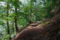
(4) We now continue along the so-called Jägersteig, walking along the hillside through the forest. After about 500 metres, the Jägersteig joins a forest track, where we turn left; after 300 metres, we come to a tarmac road, where we keep to the left again.

We follow the road as it takes a circular course to the left until we reach the Burgkhammer Dam on the right-hand side.

(5) After taking a look around, we head back and keep to the left behind the dam wall. There is a small car park on the right-hand side. At the end of this, a footpath branches off to the right, which we use as a shortcut, and at the top we continue to the right along the road. 

At the next fork, we take the left-hand path (straight ahead on the road). This leads us once again along the banks of the Saale to a junction, where we turn left. Behind a parking bay, we cross the ice bridge, which is painted a somewhat faded red (or has since bleached). 

(6) On the other side, we walk straight on along the road for a few more metres and, just past the right-hand bend where there is another small car park, turn left onto the unpaved path. This leads us directly to ameadow with scattered fruit trees, in front of which we turn right and walk up the slope.

(7) At the next junction, we turn left. From here, the so-calledVordere Röhrensteig winds its way high above the River Saale along the slope.

(8) There are two excellent vantage points here; the second (9) offers a superb view of the castle.

After we have almost completed the circular route around the Saale, we come to the first houses of Burgk. Here we continue straight on and reach thevillage road. We turn left onto this road and follow it past the Schlossterrasse restaurant.

Crossing the bridge, we reach Burgk Castle, which houses a museum.

(10) After our visit, we cross the bridge back, then continue straight on and turn right at the left-hand bend behind the Schlossterrasse. At the fork, we take the left-hand path, which leads us back tothe main village road. 

We cross the road and continue to the right as far as the Saale Tower. From the viewing platform, there is a fantastic view over the Saale loop. 

(11) In front of the Saaleturm is thecar park where we started. (S/E)

Waypoints

  1. S/E : mi 0 - alt. 1,483 ft - Car park at the Saaleturm
  2. 1 : mi 0.65 - alt. 1,437 ft - Marienhütte
  3. 2 : mi 2.77 - alt. 1,158 ft - Bridge over the Saale
  4. 3 : mi 2.92 - alt. 1,194 ft - View of Burgk Castle
  5. 4 : mi 3.68 - alt. 1,332 ft - Jägersteig
  6. 5 : mi 4.46 - alt. 1,138 ft - Burgkhammer Reservoir
  7. 6 : mi 5.05 - alt. 1,171 ft - Ice Bridge
  8. 7 : mi 5.36 - alt. 1,253 ft - Orchard meadow
  9. 8 : mi 5.52 - alt. 1,417 ft - Front Röhrensteig
  10. 9 : mi 5.82 - alt. 1,348 ft - Viewpoint
  11. 10 : mi 6.43 - alt. 1,299 ft - Burgk Castle
  12. 11 : mi 6.75 - alt. 1,480 ft - Saaleturm
  13. S/E : mi 6.81 - alt. 1,486 ft - Car park at the Saaleturm

Notes

Public transport

Bus route 610 of the ‘Natur- und Aktiv-Linien’ service stops at the Saaleturm, running from Schleiz via Burgk, Saalburg, Bad Lobenstein, Wurzbach and Lehesten to Brennersgrün and back, as does route 611 (Schleiz–Burg–Schleiz) (information available at https://www.kombus-online.eu/angebote/regionalverkehr/linienuebersicht/).

Equipment

  • Although the circular route follows well-maintained paths for the most part, there are sections (such as the Jägersteig and Röhrensteig) where sure-footedness and sturdy footwear are required.
  • The walk is also suitable for hot summer days, as there is plenty of shade in the many wooded sections.
  • Make sure to pack plenty of drinks. It’s also a good idea to bring a snack for along the way.
  • Not suitable for pushchairs, buggies, walking frames or wheelchairs.

Worth a visit

Burgk Castle

Since the Middle Ages, a castle has stood here in a prominent position above the Saale loop; it was converted into a palace around 1400. From its construction until 1945, the estate was owned by the House of Reuss. Shortly afterwards, the district of Schleiz took over the complex and, following extensive restoration, opened a museum. The palace chapel, with one of the best-preserved Silbermann organs, is also particularly worth seeing. (Information and opening times at https://www.schloss-burgk.de/) For your information: open all year round from Tuesday to Sunday.

Saale Tower

You have to climb almost 200 steps to reach the viewing platform of the 43-metre-high Saale Tower. The view over the Saale loop is breathtaking. (Usually open from 8 am to 9 pm), admission 2 euros.

Food and drink

  • Café at the Saale Tower
  • Burgk Castle Terrace

Reviews and comments

5 / 5
Based on 1 review

Reliability of the description
5 / 5
Ease of following the route
5 / 5
Route interest
5 / 5
mit-mama-nach.de
mit-mama-nach.de

Dear Tom,

thank you very much for your feedback. In my case, the breaks were quite short and actually easy to manage for normal hikers. I hope it hasn't gotten worse.

Best regards,

Michaela

Machine-translated

User 27790881

Overall rating : 5 / 5

Date of your route : Oct 05, 2025
Reliability of the description : ★★★★★ Very good
Ease of following the route : ★★★★★ Very good
Route interest : ★★★★★ Very good
Very busy route : No

Hello fellow hikers, the hike was really easy to follow based on the description!
It was a really beautiful tour, the paths are great, there were a couple of places where the ground was a little broken, but that didn't stop us from continuing the tour.

Very peaceful with beautiful nature and views!

In terms of the stated duration, it is possible to complete the hike in the time given, but with a few breaks to enjoy the views, it takes a little longer!

It was fun! I will repeat this hike again in a different season!

Best regards, Tom

Machine-translated

For more walks, use our search engine .

The GPS track and description are the property of this route's author. Please do not copy them without permission.


