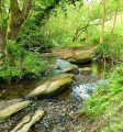
Rowarth Loop
Technical sheet
Creation:
Last update:
–
–
-
 Activity: Walking
 -
Distance: 7.36 km
-
Average duration: 2h 40
-
Difficulty: Not specified
-
-
Return to departure point: Yes
-
Vertical gain: + 195 m
-
Vertical drop: - 199 m
-
-
Highest point: 372 m
-
Lowest point: 197 m
-
Country: United Kingdom
-
Area: Peak District
-
District: New Mills
-
Start/End: N 53.399657° / W 1.983989°
Waypoints
- S/E : km 0 - alt. 218 m - Start on Goddard Lane
- 2 : km 0.02 - alt. 219 m - Turn right onto Goddard Lane
- 3 : km 0.23 - alt. 224 m - Turn right
- 4 : km 0.28 - alt. 218 m - Keep right
- 5 : km 0.34 - alt. 218 m - Turn left
- 6 : km 0.35 - alt. 220 m - Turn sharp right
- 7 : km 0.74 - alt. 231 m - Turn slight right
- 8 : km 1.32 - alt. 285 m - Turn sharp right
- 9 : km 2.16 - alt. 295 m - Turn slight right
- 10 : km 2.82 - alt. 287 m - Turn right
- 11 : km 2.83 - alt. 287 m - Turn left
- 12 : km 3.38 - alt. 331 m - Keep left
- 13 : km 3.48 - alt. 341 m - Turn right
- 14 : km 3.54 - alt. 350 m - Turn slight left
- 15 : km 3.94 - alt. 350 m - Keep right
- 16 : km 4 - alt. 341 m - Turn left
- 17 : km 4.1 - alt. 331 m - Turn slight right
- 18 : km 4.21 - alt. 312 m - Keep left
- 19 : km 4.65 - alt. 287 m - Turn sharp left
- 20 : km 5.63 - alt. 294 m - Turn sharp right
- 21 : km 6.85 - alt. 200 m - Keep right onto Brookside
- 22 : km 7.06 - alt. 210 m - Keep left onto Brookside
- 23 : km 7.15 - alt. 214 m - Turn left onto Chapel Street
- 24 : km 7.24 - alt. 221 m - Turn left onto Goddard Lane
- 25 : km 7.35 - alt. 219 m - Turn left
- S/E : km 7.36 - alt. 218 m
Other walks in the area
 Coombes Rocks and Cown Edge
A walk including three gritstone edges, all with fabulous views: Coombes Rocks overlook the village of Charlesworth; Cown Edge is a partly quarried edge with views to Kinder Scout, and Lantern Pike
is a well-known local summit.
 Rowarth Brook
An easy stroll along a pretty stream valley known locally as Little Switzerland.
 Robin Hood’s Picking Rods
A breezy walk to an ancient monument, with wide views over Manchester and the Cheshire Plain.
 Lantern Pike, Rowarth
A fairly gradual ascent to a heathery hilltop and viewpoint, with a steep descent and a return through farmland.
 Kinder Reservoir and Hayfield
A varied all-day hike with close-up views of Kinder Scout. Several moderate climbs and descents.
 Rowarth river & moorland loop

Start and finish at The Little Mill Inn, walk beside Rowarth Brook up the wooded valley (known as Little Switzerland to the locals) and then head uphill to the moors above Rowarth for amazing views of The Peak District, Kinder Scout and the Cheshire plain.
For more walks, use our search engine .
The GPS track and description are the property of the author. Do not copy them without permission.


