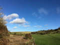
This walk explores the area around the village in the heart of the Lincolnshire Wolds. The walk starts in the old Market Place, and although markets are no longer held here, it is still an important trading area of the village with many local shops.
(S/E) Starting the walk in Market Place, walk towards the Plough Inn on the Louth Road. Go past the church on your left.
(1) Take the bridleway on the right up the hill. At the top of the hill, turn right on a footpath and walk down the hill, cross over a small stream and enter the southern end of St Mary’s Lane.
Turn left along the narrow part of St Mary’s Lane, cross the stile and bear right across the grass field to a stile next to the last bungalow on Ludford Road.
(2) Turn right and follow the road ahead through Market Place, turn left at the T junction (by the old ‘Marquis of Granby’ pub). Cross the road with care and continue to the school.
Garlic Mustard - Look out for the white flowers of garlic mustard in the spring. Crush the leaves for its distinctive smell! Orange tip and green-veined white caterpillars feed on this plant which is also known as Jack-by-the-hedge.
Turn right on the footpath across the school playground and continue along School Lane. On entering North Halls, continue straight ahead until it joins the Grimsby Road, opposite the pump. Cross Grimsby Road and turn left.
(3) At the bottom of the hill turn right into Meadow Drive and continue along until it joins Louth Road. Turn right and return to Market Place.(S/E)
Waypoints
S/E : mi 0 - alt. 249 ft - Market Place
1 : mi 0.23 - alt. 217 ft - Bridleway
2 : mi 0.73 - alt. 253 ft
3 : mi 1.53 - alt. 207 ft - Meadow Drive
S/E : mi 1.88 - alt. 249 ft - Market Place
Notes
Maps: OS Explorer Map 282
Parking: Considerate parking in the village.
Terrain: A mixture of footpaths, tracks and roadside walking - may be muddy in places.
Stiles: A few.
Refreshments & Toilets: Pub and shop in the village, (ask for toilet key in the village shop).
The Lincolnshire Wolds is a National Landscape, designated an Area of Outstanding Natural Beauty (AONB) in 1973. Covering an area of 558 square kilometres or 216 square miles, the AONB contains the highest ground in eastern England between Yorkshire and Kent, rising to over 150m along its western edge. Rolling chalk hills and areas of sandstone and clay underlie this attractive landscape.
The Lincolnshire Wolds has been inhabited since prehistoric times and the appearance of the countryside today has been greatly influenced by past and present agricultural practices.
A Countryside Service helps to protect and enhance the landscape through partnership projects with local landowners, farmers, parish councils, businesses and residents of the Wolds.
Date of your route : Sep 13, 2022 Reliability of the description : ★★★★★ Very good Ease of following the route : ★★★★★ Very good Route interest : ★★★★☆ Good
Good walk, just watch for the turning off the bridle path soon after starting the walk. The turn to go downhill is easily missed! Otherwise, a lovely walk with beautiful views in and around Binbrook
To open this route on your smartphone, you must have the Visorando app installed. If not, got to the Apple Store (iPhone) or Google Play Store (Android) to download the app.



 Country:
 City:



 Visorando Member


 Moderate