Park on the road to the departmental base, 800 m from the exit of the village at a place called “Le Chambon".
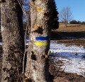
From the car park, retrace your steps for 100 m and take the yellow and white marked trail on the left.
At the fork (1) turn left and follow the signs to the top (2). Once at the top, walk along the ridge to get down to the Rieussec stream (3). This is where you leave the markings to head into the stream bed.
Depending on your mood, you can walk alongside or in the bed Take care if the weather is stormy, and beware of the depth of some potholes. Once past the stone bridge, continue alongside the stream. Faced with difficulties, do not hesitate to follow the green dots and traces of yellow paint, which indicate the recommended routes. Recommended does not necessarily mean safe. You end up returning to the banks of the Ardèche, in the Blachas camping site. You are allowed to cross it to get back to the road (4). Follow it passing three successive roads to the right and reach the car park at the starting point.


