Ponta de Sao Lourenco

A walk at the eastern end of Madeira in the only semi-desert environment of the island. Beautiful scenery on top of colourful cliffs, beautiful views of the sea and a way to escape.

Technical sheet

118174
Creation:
Last update:
Last review:
  • Walking
    Activity: Walking
  • ↔
    Distance: 6.40 km
  • ◔
    Average duration: 3h 00 
  • ▲
    Difficulty: Moderate

  • ⚐
    Return to departure point: Yes
  • ↗
    Vertical gain: + 410 m
  • ↘
    Vertical drop: - 408 m

  • ▲
    Highest point: 105 m
  • ▼
    Lowest point: 25 m

Photos

Description of the walk

Start & Parking: Park in Baia Abra, east of Caniçal, at the end of the road.

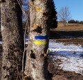
Yellow and Red markings (trail No. 8).

(S/E) Follow the path that goes to the North-East. Walk along the top of the cliff to the left and reach the heights of the cliffs to the north.

(1) Turn south-west to head past Ponta do Castelo on the right. Continue through a sort of spit: the narrowest passage of the route. Approximately 250 m after crossing this isthmus, arrive at a split in the route.

(2) The trail goes around the tip of Ponta de São Lourenço and can be walked in either direction. This route guide takes a clockwise direction starting on the left. After about 500 m, turn right towards the Casa do Sardinha (Natural Parks building).

(3) Head past the building on the left, then head to the North-West.

(4) Turn left onto a small that leads down to the sea. Then back onto the path to the North-West to the start of the loop.

(2) Continue North-West, head back across the narrow isthmus and back to the north cliff.

(1) Turn South-West to reach the starting point.(S/E)

Waypoints

  1. S/E : km 0 - alt. 77 m - Baia d'Abra
  2. 1 : km 1.22 - alt. 87 m - North cliff
  3. 2 : km 2.49 - alt. 74 m - Start of the loop from the end of the tip
  4. 3 : km 3.06 - alt. 51 m - Casa do Sardinha
  5. 4 : km 3.51 - alt. 25 m - Access to Cais do Sardinha
  6. S/E : km 6.4 - alt. 77 m - Baia d'Abra

Practical information

Start & Parking: Park in Baia Abra, east of Caniçal, at the end of the road.

Waymarkers: Yellow and Red markings (trail No. 8).

Terrain: The itinerary includes high passages along cliff edges around (1), a narrow isthmus between (1) and (2). Although the route is secured in some places (cables, barriers), ‘’these sections require greater care''. Similarly, the path to Cais do Sardinha (4) requires surefooted hikers. People prone to fear of heights should avoid this hike.

The environment is fragile and is in a nature reserve. Always read and respect the recommendations on the panels at the start. In particular, do not stray off the paths and not to litter, including cigarette butts.

Gears: The terrain is rocky, good hiking shoes are essential. A map is essential (at a minimum the one that is provided with this description).

There is no shade or water on the course: bring sun screen and water supplies. Do not hesitate to start early in the morning so as to avoid too much direct sun.

In the nearby area

Stunning views of the sea and the cliffs of volcanic rocks in red hues.

Ponta de Sao Lourenco is the only non-wooded and semi-desert area of the island of Madeira. There is a sparse vegetation adapted to the conditions (drought, wind).

Reviews and comments

4.8 / 5
Based on 73 reviews

Reliability of the description
4.9 / 5
Clarity of route map
4.8 / 5
Route interest
4.9 / 5
PierrickBZH
PierrickBZH

Overall rating : 5 / 5

Date of walk : Jun 05, 2025
Reliability of the description : ★★★★★ Very good
Clarity of route map : ★★★★★ Very good
Route interest : ★★★★★ Very good
Busy trail : Yes

This is a very fine walk and one of the best known, so there are a lot of people even if you start early. The scenery is arid with little vegetation, so it stands out from the rest of the island.

Automatically translated

User 12052167

Overall rating : 5 / 5

Date of walk : May 10, 2025
Reliability of the description : ★★★★★ Very good
Clarity of route map : ★★★★★ Very good
Route interest : ★★★★★ Very good
Busy trail : Yes

A fine walk with beautiful views. The route is not technically difficult. However, beware of rusty cables, as there is a risk of being pricked or cut. Avoid this hike if it is raining or the ground is very wet.
Car park often overbooked.

Automatically translated

Chaden
Chaden

Overall rating : 5 / 5

Date of walk : Apr 24, 2025
Reliability of the description : ★★★★★ Very good
Clarity of route map : ★★★★★ Very good
Route interest : ★★★★★ Very good
Busy trail : Yes

We arrived a little late and the police forbade us to go to the Baia d'Abra car park as it was full. We had to go and park near the Miradouro do Rosto, then walk along the fenced-in camp and find the route of the hike further below.
A magnificent hike that takes you to the very tip of Madeira.
Be careful, the last climb after the Casa do Sardinha is more difficult and the caves along the way are not well maintained. Otherwise, the narrow passages are well secured with cables.
Thanks to the author for this hike!

Automatically translated

RPodor
RPodor

Overall rating : 5 / 5

Date of walk : Apr 15, 2025
Reliability of the description : ★★★★★ Very good
Clarity of route map : ★★★★★ Very good
Route interest : ★★★★★ Very good
Busy trail : Yes

Magnificent walk with sea views and superb scenery. Popular but not overly so at this time of year.

Automatically translated

spirou56
spirou56

Overall rating : 5 / 5

Date of walk : May 04, 2025
Reliability of the description : ★★★★★ Very good
Clarity of route map : ★★★★★ Very good
Route interest : ★★★★★ Very good
Busy trail : Yes

Very good, but be careful when it's windy - the gusts are really dangerous.

Automatically translated

Ang76
Ang76

Overall rating : 5 / 5

Date of walk : Oct 19, 2024
Reliability of the description : ★★★★★ Very good
Clarity of route map : ★★★★★ Very good
Route interest : ★★★★★ Very good
Busy trail : Yes

Well signposted all the way, with no difficulties, magnificent views and superb panoramas. Very popular. The final climb after the restaurant is complicated because the ground is very slippery, the track is in poor condition and the gradient is steep, so you need parish specific to Brittany shoes.
No shade, so bring water and a cap.
Total change of scenery

Automatically translated

david_45000
david_45000

Overall rating : 4.3 / 5

Date of walk : Aug 04, 2024
Reliability of the description : ★★★★☆ Good
Clarity of route map : ★★★★☆ Good
Route interest : ★★★★★ Very good
Busy trail : Yes

very nice hike, the last viewpoint at the tip is a bit more difficult, but otherwise magnificent scenery and a very accessible hike!

Automatically translated

PhilFilou33
PhilFilou33
• Last modified:

Overall rating : 4.7 / 5

Date of walk : Jul 25, 2024
Reliability of the description : ★★★★★ Very good
Clarity of route map : ★★★★★ Very good
Route interest : ★★★★☆ Good
Busy trail : Yes

Visit at the end of July, pleasant overcast weather for hiking.
This route is a motorway. Parking is hell.
The viewpoints are very beautiful.
The last climb is closed (signs) but everyone climbs up, it's a fair.
I recommend doing the outward journey and returning by boat from Maison Sardine, as the return journey on foot is the same as the outward journey, with the added bonus of a herd effect.

Take plenty of water as there is no shade.
There is a proposal to pay one euro to help maintain the site, but it's a QR code that's slow because there's no network and even the dedicated wifi is down. It's a pity, as the final section of the hike deserves to have its steps maintained.
Beware also of some of the cable railings, rusty or not, with metal wires sticking out which are dangerous (I pricked my finger and with the pressure of the step, it bled).

Automatically translated

Fred 50
Fred 50

Overall rating : 5 / 5

Date of walk : Jul 06, 2024
Reliability of the description : ★★★★★ Very good
Clarity of route map : ★★★★★ Very good
Route interest : ★★★★★ Very good
Busy trail : Yes

Super hike, the site is very busy but it goes very well.
No shade, so bring sun cream.
No need to go to the last car park by car if you're not early, park at the bottom to save time.

Automatically translated

paten33
paten33

Overall rating : 4.3 / 5

Date of walk : Jun 04, 2024
Reliability of the description : ★★★★☆ Good
Clarity of route map : ★★★★★ Very good
Route interest : ★★★★☆ Good
Busy trail : Yes

Hello
There are a lot of people on this walk and it's difficult to park unless you arrive early or in the middle of the afternoon.
There are no major problems with the walk itself. The last section (after the restaurant) is in very poor condition and the steel cable is rusty, broken and frayed. You should avoid touching it or rubbing against it. Some people, who were probably used to it or had been warned, wore gloves for this last section.

Automatically translated

Netra
Netra ★

Hello PasBouc, thank you for your feedback.

However, I think you've made a mistake when making your comment: you're referring to a forest and undergrowth with no viewpoints, whereas this walk is essentially on cliffs by the sea, with virtually no vegetation.

Automatically translated

PasBouc
PasBouc

Overall rating : 4 / 5

Date of walk : Jun 23, 2024
Reliability of the description : ★★★★☆ Good
Clarity of route map : ★★★★★ Very good
Route interest : ★★★☆☆ Average
Busy trail : No

Very easy and great classified forest but we have little external view and we stay in the undergrowth with great scenery.

Automatically translated

CoachDosh42
CoachDosh42

Overall rating : 5 / 5

Date of walk : Jun 01, 2024
Reliability of the description : ★★★★★ Very good
Clarity of route map : ★★★★★ Very good
Route interest : ★★★★★ Very good
Busy trail : Yes

Breathtaking scenery!
Not a difficult walk, just a bit of a climb and lots of people.
A word of advice: come early to enjoy the view without being in the clouds, but above all to avoid the throngs of tourists!
cost of hike: €1 per person

Automatically translated

faustinebrun
faustinebrun

Overall rating : 4.7 / 5

Date of walk : May 16, 2024
Reliability of the description : ★★★★★ Very good
Clarity of route map : ★★★★★ Very good
Route interest : ★★★★☆ Good
Busy trail : Yes

Come before 9am to get started and avoid the buses.

Automatically translated

Nath001
Nath001

Overall rating : 4.3 / 5

Date of walk : May 05, 2024
Reliability of the description : ★★★★☆ Good
Clarity of route map : ★★★★☆ Good
Route interest : ★★★★★ Very good
Busy trail : Yes

Great hike! Can be done with the whole family.
Beware though, there are a lot of people on the trail and it's hard to keep your own pace as it's really busy.
A word of advice: arrive in the morning, otherwise there's no place to park.

Automatically translated

For more walks, use our search engine .

The GPS track and description are the property of the author. Do not copy them without permission.