Parks and gardens along the Yerres

This walk starts in Crosne, goes through the Grange Forest and then through the town of Yerres before reaching Park Caillebotte where the painter lived. The walk goes along the Yerres River and finishes by going alongside the communal gardens in Villeneuve-Saint-Georges.

Technical sheet

217705
Creation:
Last update:
Last review:
  • Walking
    Activity: Walking
  • ↔
    Distance: 15.43 km
  • ◔
    Average duration: 4h 40 
  • ▲
    Difficulty: Moderate

  • ⚐
    Return to departure point: Yes
  • ↗
    Vertical gain: + 93 m
  • ↘
    Vertical drop: - 93 m

  • ▲
    Highest point: 119 m
  • ▼
    Lowest point: 32 m

Photos

Description of the walk

Park at 12 Avenue Léon Jouhaux in Crosne. The car park is quite big.

(S/E) On leaving the car park, follow l'Avenue Léon Jouhaux to the right and then take Chemin du Grand Hâ-Hâ on the right.

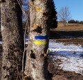
(1) After entering the forest, take the first path on the right waymarked in Yellow and Red. Continue on this path and cross Allée du Général Lejeune. Ignore the two paths heading off to the sides and then turn right towards the reservoir.

(2) Just before the reservoir, take the path on the left waymarked in Yellow and Red which goes downhill. At the next crossroads, turn left and climb back up until you reach Allée Royale. Follow this road to the right for about 200m.

(3) Turn left at a 90-degree turn, continue to follow the Yellow and Red waymarking, ignoring the two paths heading off to the left. You will re-join allée du Général Lejeune. Follow it to the right.

(4) On arriving in front of the Château Park, turn left and go along the moats. At the park corner, turn right and continue to go along the wall for about 300m.

(5) Veer to the left and keep following the waymarked path. Continue on this waymarked route by taking the first path on the right. At the end, turn left and then right and follow the railway line.

(6) Go under a bridge and then turn right and go along the road. At the passage, admire the château (former residency of the Count of Saxony). Cross the road and then take the path waymarked in Yellow which heads off to the left just after the roundabout. Continue up to the next crossroads (high voltage electricity line).

(7) Follow the path to the right (due south). Continue on this path and then turn right in order to re-join the road which passes in front of the château. Continue on this road up to the car park situated just before the next roundabout.

(8) Cut across the car park and then turn right onto Avenue de la Grange. Continue along this avenue for about 600m and then take the small Sentier de la Folie on the right located between the lodges.
At the end, turn left onto Rue du Mont Griffon and then, at the end, turn right onto Rue René Coty. Continue down this road, veering to the left as it goes, and go downhill to the foot of Yerres Town Hall.

(9) Go past the front of the town hall and continue on Rue Charles de Gaulle. Turn right onto Rue Marc Sangnier. Admire the château situated at the start of the road. Go down the road to the River Yerres. A washhouse is situated just before the bridge on the right.

(10) Cross the bridge while staying on the right-hand side. You will reach the entrance to Park Caillebotte which is a very lovely place to walk. Once you've visited the park, return to the banks of the Yerres. Go along the river on the right-hand side for about 2.1km, crossing a road just before going past the front of a swimming pool, still staying on the same side of the river. 750m further on (around 10 mins), cross over a small bridge over the Yerres. After going past a horse riding centre, cross over the small bridge (in order to go over the Yerres again) so that you end up on the right-hand side.

(11) Leave the path and return to the road situated on the left when you see a second small bridge and the number '9' on the Moulin de Senlis road on the left. Turn right onto Route du Moulin de Senlis. Just before the windmill, go alongside an Orthodox church on the right. Continue straight ahead up to the windmill (which looks like a church).

(12) At the windmill, take the path on the right which spans across the Yerres over two small bridges. Continue on up to the entrance to Park Moulin on the left. In the distance you can see the cross-district hospital.

(13) Go into the park and then cross through the park through an uncultivated area (the exit is located opposite the entrance). Go alongside a mound of earth on the right. The pre-existing road is completely ruined. Be careful as there are holes everywhere. Exit into Rue de Pampelune and turn right. At the roundabout, turn left and take Rue de Crosne. Stay on the left to go alongside the Yerres.

(14) At the end of the road, continue going straight ahead in order to enter Crosne town centre. Next, take the first road on the right, Rue de l’Église, with a bakery on the corner, climbing uphill. Continue on and take the road on the right called Rue de la Grande Montagne (still going uphill).

(15) Go along the wall of the cemetery along Rue des Sapeurs-Pompiers de Paris. After about 250m, take Chemin de la Grange, which heads off to the left after the car park. This path goes alongside allotment gardens on the left. It is waymarked in Yellow and Red.

(16) On arriving in the forest, at the first intersection, turn onto the small path on the right. Continue straight ahead on this path up to the D324 road. Follow this road to the right in order to return to the car park (S/E).

Waypoints

  1. S/E : km 0 - alt. 88 m - Car park, Avenue Léon Jouhaux
  2. 1 : km 0.44 - alt. 87 m - After entering the forest, turn right
  3. 2 : km 1.13 - alt. 119 m - Tank
  4. 3 : km 1.58 - alt. 95 m - Follow the yellow and red signs on the left
  5. 4 : km 2.28 - alt. 88 m - To the left, along the moat
  6. 5 : km 2.89 - alt. 90 m - Left fork
  7. 6 : km 4.02 - alt. 91 m - Avenue Descartes
  8. 7 : km 4.91 - alt. 93 m - Crossing - High-voltage line
  9. 8 : km 5.83 - alt. 93 m - Cut through the car park
  10. 9 : km 7.25 - alt. 50 m - Yerres town centre
  11. 10 : km 7.7 - alt. 38 m - Bridge - Yerres (l')
  12. 11 : km 10.55 - alt. 34 m - Take the Moulin de Senlis road
  13. 12 : km 11.08 - alt. 35 m - Senlis Mill
  14. 13 : km 11.49 - alt. 33 m - Mill park
  15. 14 : km 12.69 - alt. 34 m - Intersection with Rue de Paris
  16. 15 : km 13.13 - alt. 81 m - Cemetery
  17. 16 : km 14.25 - alt. 88 m - Path to the right in the forest
  18. S/E : km 15.43 - alt. 89 m - Car park, Avenue Léon Jouhaux

Practical information

WC: Park Caillebotte; swimming pool between and (11).

Picnic area: Yerres town centre (9), in the washhouse if its open, if it rains there is shelter in the theatre; Park Caillebotte is very lovely with seats; Park Moulin (13).

In the nearby area

(6) Château du Maréchal de Saxe
The Grange estate, first mentioned in 1389, was then a large wood, cleared for a religious Parisian community. Around 1581, a fortified farm was built.
Construction of the château was undertaken in 1617 by Charles Duret, Comptroller General of Finance and son of the chief physician to Charles IX. As was the fashion at the time, the landscaped gardens were landscaped along with the château.
In 1748, Maurice de Saxe, Marshal General of France, acquired the château, which he kept until his death two years later. He had the large gallery built.
Landowners related to royal power lived there until the French Revolution. In the 19th century, the estate belonged to Boscary de Villeplaine stockbrokers and passed to the families of Du Taillis and Gourgaud, whose name is linked to Napoleonic history.
Between 1914 and 1918, it welcomed war causalities (hospital No 223).
The Americans turned it into an airplane engine repair workshop during the second world war.
In 2000, the château was bought by the Savry Group which turned it into a prestigious hotel called "Château du Maréchal de Saxe".

(9) Yerres town centre
Yerres is situated on an old Roman road connecting Paris to Montereau. The known history of the area begins with the construction, starting in 1120, of the Notre-Dame d'Yerres Abbey undertaken by the Benedictines. In 1130, Lord Guillaume de Hierres built a château, a small castle still remains today in the town centre. The feudal castle was built in the 15th century by Dreux Budé in a defensive architectural style. The Budé family produced the lords of Yerres from 1452 to 1628.

Caillebotte Park
Entry to the park is free. In 1860, Father Gustave Caillebotte, the painter, acquired his property in Yerres, situated close to the old ford and bridge over the river. The main building, called "Casin", inspired the 'Casina de Raphaël', located in the gardens of Borghèse Villa in Rome. The artist produced more than eighty paintings in this property, as well as in the surrounding countryside.

Reviews and comments

4.2 / 5
Based on 32 reviews

Reliability of the description
4.2 / 5
Clarity of route map
4.3 / 5
Route interest
4.1 / 5
joselyne
joselyne

Overall rating : 4.7 / 5

Date of walk : May 14, 2025
Reliability of the description : ★★★★★ Very good
Clarity of route map : ★★★★☆ Good
Route interest : ★★★★★ Very good
Busy trail : No

This was a lovely walk, starting at Villeneuve Saint-Georges station and finishing in a loop, with a stop at the Caillebotte house/museum. There were around twenty of us in the group, with some stopping off at Yerres, others at Montgeron, and the most energetic going all the way to Villeneuve, a 16km walk.

Automatically translated

PierreduNord
PierreduNord

Overall rating : 4.7 / 5

Date of walk : Nov 09, 2024
Reliability of the description : ★★★★☆ Good
Clarity of route map : ★★★★★ Very good
Route interest : ★★★★★ Very good
Busy trail : Yes

Lovely autumn route. The forest was very beautiful. All the parks were open. In Yerres, the Parc de l'Hôtel de Ville and the Parc Budé were also worth a visit. The passage from one to the other was also quieter than on the shopping street. In Villeneuve St Georges, the Parc de la Chevrette was also worth a walk down and back up again!
The passage de l'orangerie (Villeneuve St Georges), recommended by a review here dating from 2017, was well worth the diversions.
Just north of point "7", off the route, there is no picnic table as indicated on the IGN map.
I would have liked to cross the Villeneuve St Georges cemetery but it was closed.
With these few easy detours, the parts in town were reduced and were not considered uninteresting or long.
In the end, there were 11 of us and everyone enjoyed the walk. Thank you for this route and its possible variations. We met hikers and cyclists in the forest and walkers in the parks. There was also plenty of activity around the gardens.

Automatically translated

AJMK
AJMK

Overall rating : 4.3 / 5

Date of walk : Aug 04, 2024
Reliability of the description : ★★★★★ Very good
Clarity of route map : ★★★★☆ Good
Route interest : ★★★★☆ Good
Busy trail : No

The Parc Caillebote is well worth a visit in its own right, as are the surrounding châteaux.
The communal gardens are the second focus of the walk. I was impressed by the size of the grounds and moved by the peace and conviviality that reign there.
Some may regret that, to get from the Park to the Gardens, you have to walk past industrial sites that break up the atmosphere a little, but I don't imagine there were many other solutions.

Automatically translated

SergeDel
SergeDel

Overall rating : 4 / 5

Date of walk : May 25, 2023
Reliability of the description : ★★★★★ Very good
Clarity of route map : ★★★☆☆ Average
Route interest : ★★★★☆ Good
Busy trail : No

You can do this walk from Villeneuve St Georges station, starting at point 15 and finishing at point 14.

Automatically translated

Rct92
Rct92

Overall rating : 4.7 / 5

Date of walk : Sep 02, 2022
Reliability of the description : ★★★★★ Very good
Clarity of route map : ★★★★★ Very good
Route interest : ★★★★☆ Good
Busy trail : No

A pleasant walk with no major difficulties. The first part of the walk in the woods is along the axis of an Orly runway. The noise is omnipresent. The Parc Caillebotte is very pleasant. The climb back up through the Villeneuve cemetery leads to the allotments. I often drive past them. I had never imagined the scale of them. A walk that took 3 hours 30 minutes.

Automatically translated

mdre
mdre

Overall rating : 3.3 / 5

Date of walk : Apr 24, 2021
Reliability of the description : ★★★☆☆ Average
Clarity of route map : ★★★☆☆ Average
Route interest : ★★★★☆ Good
Busy trail : No

Thank you for this tour; there are a few points that need to be clarified in the description, but the hikers have included them in their comments.
On the other hand, the end is quite difficult because the return to the forest is on a totally impassable path (mud and stagnant water). This walk is not far from Paris, with some interesting points such as the park, the forest and the crossing of Yerres, a pretty little suburban town that I didn't know. It's true that arriving in Villeneuve Saint Georges in a street undergoing roadworks isn't very pleasant and the climb to the cemetery isn't very interesting, but it's a good idea to get back !!!!

Automatically translated

jpb93
jpb93

Overall rating : 4.3 / 5

Date of walk : Oct 24, 2020
Reliability of the description : ★★★★☆ Good
Clarity of route map : ★★★★★ Very good
Route interest : ★★★★☆ Good
Busy trail : No

A pleasant and interesting route, especially the Grange forest, the Caillebotte park, the banks of the Yerres and the shared gardens. Following comments from a number of visitors, we skipped the section through Villeneuve-Saint-Georges and went through the centre of Crosne (not very exciting either). The forest sections were quite muddy after the rain. The reservoir is easy to find, just follow the yellow markings (there are steps up to the top). In the Caillebotte park, you can visit the ice house at certain times and the vegetable garden until the end of October. An important detail: the signposting between 1 and 4 is no longer yellow and red, but only yellow (the red has been removed), and the GRP can be found between 4 and 5. Enjoy your walks!

Automatically translated

Jacques93
Jacques93

Overall rating : 5 / 5

Date of walk : Aug 09, 2020
Reliability of the description : ★★★★★ Very good
Clarity of route map : ★★★★★ Very good
Route interest : ★★★★★ Very good
Busy trail : Yes

Very pleasant

Automatically translated

94drg12
94drg12

Overall rating : 4 / 5

Date of walk : Jul 12, 2020
Reliability of the description : ★★★★☆ Good
Clarity of route map : ★★★★☆ Good
Route interest : ★★★★☆ Good
Busy trail : No

A pleasant walk. In the forest, we made a few variations and detours via the Bois des Glands and the allée royale, following PR and GRP trails (which are numerous in the area) to lengthen the route and, above all, to avoid the section along the D94 to the east of the Château de la Grange, which is not very pleasant.

Automatically translated

troglodux
troglodux

Overall rating : 3.3 / 5

Date of walk : Jul 09, 2020
Reliability of the description : ★★★★☆ Good
Clarity of route map : ★★★☆☆ Average
Route interest : ★★★☆☆ Average
Busy trail : No

Correct walk, random marking at the start in the forest, "visit" to the centre of Villeneuve Saint-Georges Saint-Interest, better to go directly to the right of the hospital then to the allotments.

Automatically translated

Jacky94
Jacky94

Overall rating : 3.7 / 5

Date of walk : Jun 09, 2020
Reliability of the description : ★★★★☆ Good
Clarity of route map : ★★★★☆ Good
Route interest : ★★★☆☆ Average
Busy trail : No

We got off to a good start in the forest, lacking a bit of precision on the circuit, but we found each other.

Not an interesting route through the town, but a short climb that's good for the legs and then you're off to discover the many allotments in Villeneuve Saint Georges, just outside the town.

Automatically translated

portaclem
portaclem

Overall rating : 4 / 5

Date of walk : Jun 07, 2020
Reliability of the description : ★★★★☆ Good
Clarity of route map : ★★★★☆ Good
Route interest : ★★★★☆ Good
Busy trail : No

the hike took place on 22 May 22020 during the confinement period
the route on the map is well done but the markings in the forest are insufficient without GPS it is difficult to find the right path and the end of the route in Villeneuge St georges is of no interest
it's a shame that Parc Caillebote has been closed due to the confinement.

Automatically translated

LLP
LLP

It seemed to be a one-off event, but the banks were repaired and then the park was closed for no reason given (industrial action?).
Thank you for your work in making the routes available.
Happy holidays

Automatically translated

Netra
Netra ★

Hello LLP, and thank you for your feedback.

Do you know why the Crosne park is closed? Is it temporary, for example because of flooding or bad weather? Is it for a long period, or even permanently?

Thank you in advance for your clarification.

Automatically translated

LLP
LLP

Overall rating : 3.3 / 5

Date of walk : Dec 22, 2019
Reliability of the description : ★★★☆☆ Average
Clarity of route map : ★★★★☆ Good
Route interest : ★★★☆☆ Average

Original route: forest, banks of the Yerre, allotments. Mixed impression because the description was sometimes inadequate (very beginning (forest) and end of walk (allotments), park closed at Crosne, long town crossings.
In short, revise the description a little and hope that the banks of the Yerre and the park at Crosnes are not closed.

Automatically translated

For more walks, use our search engine .

The GPS track and description are the property of the author. Do not copy them without permission.