


 Country:
 City:




Access by car: park in the free car park at the foot of Torrechiara Castle.
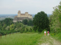
(S/E) Follow the small tarmac road, Strada del Molino, turning left from the Mulino di Torrechiara restaurant. Don’t forget to look back to admire the castle behind you. To your right, you’ll see the village of Torrechiara below the first vineyards. At the first junction, turn left onto Strada per Goiano and follow it for a few hundred metres.
(1) Take the dirt track branching off to the right towards the village of Tiorre. After 400 metres, the track turns to the right. The tree-lined path offers a bit of shade. Ignore two private tracks on the right and stay on the path which turns to the left. Continue uphill to the entrance to the hamlet of Tiorre.
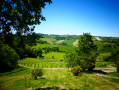
(2) Turn left to walk through the hamlet. As you leave, you can admire the cultivated valleys and hills. There is no shade on this stretch, which climbs up to a small hamlet of farmhouses.
(3) Continue along the tarmac road through the woodland. Ignore a road on the left opposite the cemetery, where you’ll find a water point. The road then descends towards the village of Casatico. Turn right at the next Y-junction onto Strada Casatico to enter the village.
(4) The church offers a lovely view over the vineyards, the castle and the river below. Best of all, you can stop for a break in the shade on a bench or in the sun on a low wall to take in the scenery. It’s the perfect spot for a snack. After this break, take the shaded road leading down to the left, the Strada della Chiesa. After a few houses, you’ll catch sight of the mountain peaks in the distance, which may still be snow-capped depending on the season.
(5) At the end of the street, turn left onto the Strada della Nave, which leads down towards the vineyards. As you round a bend, the castle will come into view from a different angle.
(6) Leave the road as it bends to the right and head straight on along the shaded, unpaved Strada del Castello. It will take you through the vineyards towards the castle. The path may be muddy in places.
(7) Ignore the path branching off to the right and continue towards the castle. After a few metres, you’ll have two options:
- take a pleasant path through the woodland on the left, which will take you round the fortress to the car park (our route),
- continue along the path which will take you to the entrance of the imposing castle, from where you can also walk back down to the car park (S/E).

 Visorando Member
 Moderate


