


Or This
Details
Creation:
Last update:
–
–
-
 Activity: Walking
 -
 Distance: 3.30 mi
 -
 Average duration: 1h 35
 -
 Difficulty: Not specified
 -
-
 Back to start: Yes
 -
 Ascent: + 39 ft
 -
 Descent: - 39 ft
 -
-
 Highest point: 243 ft
 -
 Lowest point: 190 ft
-
 Country:
United Kingdom
Country:
United Kingdom
-
 City:
North Lanarkshire
City:
North Lanarkshire -
 Start/End: N 55.826363° / W 4.052327°
 -


 Hour-by-hour weather


Waypoints
- S/E : mi 0 - alt. 230 ft - Start on Laburnum Road
- 1 : mi 0.06 - alt. 217 ft - Keep left
- 2 : mi 0.18 - alt. 200 ft - Turn right
- 3 : mi 0.2 - alt. 200 ft - Turn left onto Chestnut Crescent
- 4 : mi 0.21 - alt. 200 ft - Turn right onto Burnhead Street
- 5 : mi 0.79 - alt. 230 ft - Turn right onto Douglas Crescent
- 6 : mi 0.88 - alt. 230 ft - Turn left onto Myrtle Road
- 7 : mi 1.24 - alt. 200 ft - Turn left
- 8 : mi 1.26 - alt. 203 ft - Keep left
- 9 : mi 1.31 - alt. 210 ft - Turn left
- 10 : mi 1.37 - alt. 197 ft - At roundabout, take exit 1 onto Tannochside Drive
- 11 : mi 1.6 - alt. 194 ft - At roundabout, take exit 2 onto Tannochside Drive
- 12 : mi 1.84 - alt. 213 ft - At roundabout, take exit 2 onto Aitkenhead Road, A752
- 13 : mi 2.12 - alt. 213 ft - Keep left
- 14 : mi 2.14 - alt. 213 ft - Enter roundabout
- 15 : mi 2.24 - alt. 217 ft - At roundabout, take exit 2 onto Old Edinburgh Road, B7001
- 16 : mi 3.15 - alt. 243 ft - Turn left onto Laburnum Road
- 17 : mi 3.28 - alt. 233 ft - At roundabout, take exit 1 onto Laburnum Road
- S/E : mi 3.3 - alt. 230 ft
Other walks in the area
Greggs, Parade, Drygate circuit
 Visorando Member2.38 mi
+79 ft
-85 ft
1h 10
Visorando Member2.38 mi
+79 ft
-85 ft
1h 10
 Easy
Easy
 Departure from Glasgow
An easy urban circuit around Dennistoun starting from Greggs on Duke Street. Along Alexandra Parade to the Royal then down towards Drygate. Back on to Duke street past the brewery to complete the circuit.
River Clyde walkway from Cardies Bridge
 9.73 mi
+738 ft
-732 ft
5h 05
9.73 mi
+738 ft
-732 ft
5h 05
 Moderate
Departure from South Lanarkshire
Moderate
Departure from South Lanarkshire
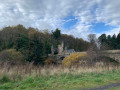
Walk part of River Clyde walkway from Cardies Bridge.
Shotts to Redmill Cottages - Blackburn, River Almond
10.53 mi
+361 ft
-538 ft
5h 10
Moderate
Departure from North Lanarkshire
First leg of a 4-part walk down the full length of the valley of the River Almond. This walks is part of the Edinburgh’s five rivers: Source to Sea collection.
River Almond, source to Sea
36.53 mi
+869 ft
-1,470 ft
4 days
Moderate
Departure from North Lanarkshire
This walk is composed of 4 stages from Scotts to Cramond and is part of the Edinburgh’s five rivers: Source to Sea project.
Cleughearn Forestry, Whitelee Windfarm
 Tourism professional
 2.89 mi
+121 ft
-102 ft
1h 25
Easy
Departure from South Lanarkshire
2.89 mi
+121 ft
-102 ft
1h 25
Easy
Departure from South Lanarkshire
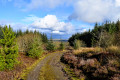
A pleasant walk around one of the quieter areas of forestry within the UK’s largest onshore windfarm. Starting at the parking area just off Ardochrig Road (near Strathaven), you soon find yourself on a mossy track through the trees. In this area it is possible to spot jay, bullfinch, merlin, peregrine, roe deer, and occasionally goldeneye ducks on the ponds.
Lothian-90
71.08 mi
+2,165 ft
-2,687 ft
9 days
Moderate
Departure from North Lanarkshire
A 90 mile walk (in nine sections) across West, Mid and East Lothian. The full traverse has been designed as a quiet, scenic route along quiet footpaths and lanes, with a minimal amount of roadside walking. All sections are easily reached by public transport.
Harthill to Addiewell, Lothian
11.63 mi
+338 ft
-312 ft
5h 40
Easy
Departure from North Lanarkshire
First leg of a 90-mile walk (in 9 stages) across the whole of the Lothians, using quiet footpaths, country parks, disused railway lines, river banks, tracks and the occasional minor road.
Kelvin Walkway: Milngavie to Partick
 10.58 mi
+10 ft
-151 ft
4h 50
Moderate
Departure from East Dunbartonshire
10.58 mi
+10 ft
-151 ft
4h 50
Moderate
Departure from East Dunbartonshire
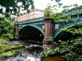
This 10 mile route along the River Kelvin feels surprisingly rural when walked from North to South, with the hustle and bustle of the city becoming more apparent the further along you go. Rather poorly way-marked for the first half, signage is then very easy to follow for the remainder of the route down to the Riverside Museum, where the Kelvin meets the Clyde.
For more walks, use our search engine .
The GPS track and description are the property of this route's author. Please do not copy them without permission.

