
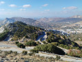
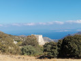
A circular walk up Mount Zeus from Filoti on the island of Naxos

A circular walk involving the ascent of the highest peak on the island of Naxos in the Cyclades, offering a 360° view.

Details

66283028
Creation:
Last update:
Last review:
  • Walking
    Activity: Walking
  • ↔
    Distance: 6.78 mi
  • ◔
    Average duration: 5h 05 
  • ▲
    Difficulty: Moderate

  • ⚐
    Back to start: Yes
  • ↗
    Ascent: + 2,293 ft
  • ↘
    Descent: - 2,293 ft

  • ▲
    Highest point: 3,248 ft
  • ▼
    Lowest point: 1,079 ft

Photos

Description of the walk

Start from the bus stop in Filoti.

(S/E) Walk up the main shopping street. Ignore signpost 2 for the summit, which branches off to the left. Further on, a sign on the right – which is hard to spot – points to a steeply sloping road leading to a large free car park (an alternative starting point if you’re travelling by car).
From the car park, take the tarmac road which initially heads due north, then turns west and finally south. Follow this road for a good while until you reach a fork.

(1) Turn left. After 500 m, you’ll reach a road; follow it to the right, heading west.

(2) Follow the path that branches off to the left towards the mill ruins. Continue along this path due south, then south-east.

(3) You’ll come across a lovely fountain, with a terrace and some shade. The path then climbs over the rocks, continuing eastwards. You’ll reach the Grotte de Zeus (closed).

(4) Continue climbing up a gully below the summit.

(5) Leave this gully heading south-east to climb up along the ridge, following the cairns. Continue a little further to the right to reach the summit.

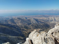
(6) Stunning views. Retrace your steps.

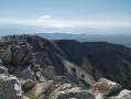
(5) Continue to follow the cairns north-west along a clearly visible track. The path follows the ridge and descends gradually. It is easier going than on the ascent.

(7) When you reach a large cairn, the path branches off to the north and continues to descend gradually.

(8) Pass Levgassa Spring (dry).

(9) Go through a gate, then you’ll soon reach a small road with a car park and a chapel.
Take the road to the left and follow it down through a few bends. Join another road and follow it to the left.

(10) Just before a wide bend, the path branches off to the right. There is some litter. The path is less clearly marked.
It comes out onto a concrete road, which you should take to cross the village. This narrow lane leads to the main road to Filoti and the bus stop (S/E).

Waypoints

  1. S/E : mi 0 - alt. 1,194 ft - Bus stop
  2. 1 : mi 0.84 - alt. 1,165 ft - Junction
  3. 2 : mi 1.4 - alt. 1,302 ft - Mill
  4. 3 : mi 2.25 - alt. 1,657 ft - Fountain
  5. 4 : mi 2.62 - alt. 2,103 ft - Caves
  6. 5 : mi 3.35 - alt. 3,127 ft - Crete
  7. 6 : mi 3.48 - alt. 3,232 ft - Summit
  8. 7 : mi 4.41 - alt. 2,487 ft - Junction marked by a large cairn
  9. 8 : mi 4.72 - alt. 2,185 ft - The drinking trough is dry.
  10. 9 : mi 5.18 - alt. 1,939 ft - Barrier
  11. 10 : mi 5.96 - alt. 1,686 ft - Fork in the path
  12. S/E : mi 6.78 - alt. 1,194 ft - Bus stop

Notes

You can get to Filoti by public bus from Naxos. Check at the port for timetables. Services are frequent in high season but less so in low season

Very little water and shade.

The climb over the rocks can be gruelling, especially in hot weather.

It is possible to walk directly to the summit and back along a pleasant path from the chapel.

Worth a visit

A fortified monastery, accessible 1.5 km from the chapel. It is not always open but is also interesting to view from the outside and offers a beautiful view of the coast.

The village of Filoti is well worth a visit.

Reviews and comments

4.8 / 5
Based on 2 reviews

Reliability of the description
5 / 5
Ease of following the route
4.5 / 5
Route interest
5 / 5
User 16805807

Overall rating : 5 / 5

Date of your route : May 29, 2026
Reliability of the description : ★★★★★ Very good
Ease of following the route : ★★★★★ Very good
Route interest : ★★★★★ Very good
Very busy route : No

A fantastic hike with a magical view at the top – a must-do if you’re in the area!!
The route is the right way round (unlike the routes I’ve seen on other websites); it goes uphill on the steep section (near Zeus’s cave) and downhill on the gentler part.
I set off at 6.45 am (late May) to avoid the sun and the heat, and a good part of the climb was in the shade, which was lovely!
As I’ve seen in other comments, I’d also recommend wearing trousers as there are lots of sections through bushes and plants.
A hat and sun cream are essential, as is plenty of water!

Machine-translated

User 24440693

Overall rating : 4.7 / 5

Date of your route : Aug 11, 2025
Reliability of the description : ★★★★★ Very good
Ease of following the route : ★★★★☆ Good
Route interest : ★★★★★ Very good
Very busy route : No

A superb route starting from Filoti, which takes you on a loop via Mount Zeus, the highest point on the island.
You pass through different sections of mountains with varying degrees of vertigo. But it's accessible if you take your time. We really enjoyed this circuit early in the morning as there isn't much shade

Machine-translated

For more walks, use our search engine .

The GPS track and description are the property of this route's author. Please do not copy them without permission.

