


There are several paid parking places. We parked in Mixnitz, where the walk starts.
Mixnitz Bärenschützklam, Canyon walk


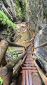
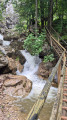
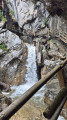
You follow the rock path up, along the river. Halfway up, you arrive at the entrance of the canyon, where you buy your ticket for € 10,-. From there you walk over wooden bridges and steep wooden stairs. It can be slippery at points where it is wet.
Altogether you have to climb 724 meters over a distance of ± 5 km. There you can find a small restaurant and toilets.
The way back goes down through the woods. Back at the ticket booth, we decided not to follow the river again, but to find our own way through the forest. Starting on a wide dirt road, but at a certain point you have to find a very small path that leads you back to the river and parking place. Altogether it was a spectacular walk.
Details
Creation:
Last update:
Last review:
–
–
-
 Activity: Walking
 -
 Distance: 6.16 mi
 -
 Average duration: 5h 00
 -
 Difficulty: Difficult
 -
-
 Back to start: Yes
 -
 Ascent: + 2,444 ft
 -
 Descent: - 2,454 ft
 -
-
 Highest point: 4,022 ft
 -
 Lowest point: 1,624 ft
-
 Country:
Austria
Country:
Austria
-
 Area: Alps
 -
 City:
Pernegg an der Mur
City:
Pernegg an der Mur -
 Start/End: N 47.335883° / E 15.373305°
 -


 Hour-by-hour weather
Photos
Waypoints
- S/E : mi 0 - alt. 1,634 ft - Mixnitz car park
- 1 : mi 1.28 - alt. 2,520 ft - Picnic area
- 2 : mi 2.65 - alt. 3,983 ft - Zum Guten Hirten
- 3 : mi 4.1 - alt. 2,894 ft - Schwaigeralm
- 4 : mi 4.52 - alt. 2,618 ft - Left to Schwaigerhöhle
- S/E : mi 6.16 - alt. 1,634 ft - Mixnitz car park
Notes
Other walks in the area
From Rettenbachklamm to Mariatrost
 Visorando Member
 3.87 mi
+925 ft
-866 ft
2h 25
3.87 mi
+925 ft
-866 ft
2h 25
 Moderate
 Departure from Bezirk Graz-Umgebung
The start and finish are on tram line 1 in Graz.
The Rettenbach Gorge has some very slippery sections, especially in wet weather. Sturdy footwear is essential.
The walk is marked #6 in the Graz Tourist Office walking guide.
For more walks, use our search engine .
The GPS track and description are the property of this route's author. Please do not copy them without permission.

