


ADEPS walk from Tubize via Renarmont


A 15 km walk through the countryside of Tubize and Saintes, passing through the Quenast woods and along several footpaths. You’ll be surrounded by nature and peaceful spots amidst the fields.
Details
Creation:
Last update:
Last review:
–
–
-
 Activity: Walking
-
 Distance: 9.74 mi
-
 Average duration: 4h 55
-
 Difficulty: Moderate
-
-
 Back to start: Yes
-
 Ascent: + 495 ft
-
 Descent: - 472 ft
-
-
 Highest point: 276 ft
-
 Lowest point: 115 ft
 Country:
 City:


Waypoints
- S/E : mi 0 - alt. 174 ft - Tubize
- 1 : mi 0.41 - alt. 125 ft - Renarmont
- 2 : mi 1.26 - alt. 144 ft - Le Coeurq
- 3 : mi 2.37 - alt. 256 ft - N6
- 4 : mi 2.91 - alt. 125 ft - The Senne
- 5 : mi 4.05 - alt. 266 ft - Cemetery
- 6 : mi 5.28 - alt. 157 ft - Quenast
- 7 : mi 5.89 - alt. 269 ft - Little Brussels
- 8 : mi 6.46 - alt. 226 ft - Bridge over the A8
- 9 : mi 7.47 - alt. 135 ft - The Laubecq
- 10 : mi 8.51 - alt. 154 ft - Try Bas
- 11 : mi 8.85 - alt. 230 ft - Try Top
- S/E : mi 9.74 - alt. 174 ft - Tubize
Other walks in the area
ADEPS walk in Tubize via the Ferme de Froye
 Visorando Member3.48 mi
+89 ft
-66 ft
1h 40
 Easy
 Departure from Tubize (Brabant Wallon)
A 5 km walk through the countryside of Tubize - Saintes, passing through the W estate. You’ll be surrounded by nature and peaceful spots amidst the fields. Come and walk for a good cause
ADEPS walk from Tubize via Ophain
6.60 mi
+331 ft
-302 ft
3h 20
Moderate
Departure from Tubize (Brabant Wallon)
A 10 km walk through the countryside of Tubize and Saintes, passing through the Quenast woods and along several footpaths. You’ll find yourself surrounded by nature and peaceful spots amidst the fields.
ADEPS circular in Tubize
3.00 mi
+108 ft
-108 ft
1h 30
Easy
Departure from Tubize (Brabant Wallon)
Welcome to this new walking route, located in the surroundings of Tubize.
This route is located in the heart of the countryside between Saintes, Tubize and Quenast.
A beautiful walk to enjoy with friends and family... surrounded by fields, horses and farms... The walk is easy and pleasant, offering plenty of opportunities to enjoy the fresh air in the heart of the town of Betchards.
ADEPS walk in Tubize
12.79 mi
+509 ft
-479 ft
6h 20
 Difficult
Departure from Tubize (Brabant Wallon)
A 20 km walk through the countryside of Tubize and Saintes, passing through the Quenast woods, the Coeurq ponds and along several footpaths. You will be surrounded by nature and peaceful surroundings.
Nature getaway in Lembeek
9.36 mi
+509 ft
-531 ft
4h 45
Moderate
Departure from Belgium
Welcome to Lembeek, where nature and history intertwine at every turn. The Kasteelpark, the former castle grounds, offers a romantic19th-century atmosphere. Nearby, the Malakoff Tower (1854), built as a folly, served as a viewpoint over the valley. The Zenne and its tributaries (Vijverbeek, Maasdalbeek, Mollebeek) shape a wetland landscape that was once ideal for mills. It is a varied walk through water, woods, history and legends.
The Ermitage Nature Reserve
 2.20 mi
+669 ft
-679 ft
1h 35
Easy
Departure from Braine-le-Château (Brabant Wallon)
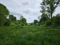
A circular walk in and around the lovely little Ermitage nature reserve (managed by Natagora), a haven of nature and tranquillity between Braine-le-Château and Ittre. The walk features several information boards.
Along the Brussels-Charleroi Canal and the Ittre lock
 6.58 mi
+108 ft
-112 ft
3h 05
Moderate
Departure from Ittre (Brabant Wallon)
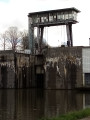
On this easy walk, which is mainly on hard-surfaced paths, you will discover a fine feat of engineering, one of many in the region, symbolising both the economic vitality of this area and human ingenuity in overcoming natural obstacles.
Ittre and the Brussels-Charleroi Canal
 6.25 mi
+472 ft
-453 ft
3h 15
Moderate
Departure from Ittre (Brabant Wallon)
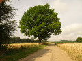
Starting from the pleasant little square in Ittre, a small path quickly leads to unusual places so close to the town. Then there are vast landscapes stretching as far as the eye can see, followed by a pleasant walk through the Bois du Chapitre forest as you continue on your way. This is how this circular route is constructed, with a few streets here and there connecting the paths that take precedence here. And, as the icing on the cake, you pass by the Brussels-Charleroi Canal, discover lock no. 5 and the Ittre marina, and, before setting off again, stroll through the narrow streets of Ittre.
For more walks, use our search engine .
The GPS track and description are the property of this route's author. Please do not copy them without permission.

