


Marathon Training 14 Miles NSEW
Details
Creation:
Last update:
–
–
-
 Activity: Walking
 -
 Distance: 14.16 mi
 -
 Average duration: 7h 00
 -
 Difficulty: Not specified
 -
-
 Back to start: Yes
 -
 Ascent: + 531 ft
 -
 Descent: - 515 ft
 -
-
 Highest point: 627 ft
 -
 Lowest point: 331 ft
-
 Country:
United Kingdom
Country:
United Kingdom
-
 City:
North Lanarkshire
City:
North Lanarkshire -
 Start/End: N 55.872024° / W 3.962289°
 -


 Hour-by-hour weather


Waypoints
- S/E : mi 0 - alt. 502 ft - Start on
- 1 : mi 0.01 - alt. 502 ft - Turn left onto Motherwell Street, A73
- 2 : mi 0.34 - alt. 574 ft - At roundabout, take exit 2 onto Stirling Road, A73
- 3 : mi 0.74 - alt. 594 ft - Turn right onto Dykehead Road
- 4 : mi 0.76 - alt. 594 ft - Turn sharp right onto Stirling Road, A73
- 5 : mi 2.69 - alt. 577 ft - At roundabout, take exit 2 onto Motherwell Street, A73
- 6 : mi 3.09 - alt. 505 ft - Keep right onto A73
- 7 : mi 3.11 - alt. 505 ft - At roundabout, take exit 1 onto A73
- 8 : mi 3.42 - alt. 479 ft - At roundabout, take exit 1 onto Forrest Street, A89
- 9 : mi 4.13 - alt. 528 ft - Keep left onto Forrest Street, A89
- 10 : mi 6.78 - alt. 528 ft - Keep right onto Forrest Street, A89
- 11 : mi 7.52 - alt. 476 ft - At roundabout, take exit 1 onto Carlisle Road, A73
- 12 : mi 10.94 - alt. 476 ft - At roundabout, take exit 1 onto Clark Street, A89
- 13 : mi 11.48 - alt. 440 ft - At roundabout, take exit 2 onto Graham Street
- 14 : mi 11.56 - alt. 427 ft - Turn slight left onto Graham Street
- 15 : mi 11.78 - alt. 404 ft - At roundabout, take exit 1 onto Alexander Street, A89
- 16 : mi 12.47 - alt. 354 ft - Keep right onto Alexander Street, A89
- 17 : mi 12.92 - alt. 404 ft - Keep left onto Alexander Street, A89
- 18 : mi 12.93 - alt. 404 ft - At roundabout, take exit 1 onto Stirling Street
- 19 : mi 13.16 - alt. 427 ft - Turn slight right onto Graham Street
- 20 : mi 13.23 - alt. 440 ft - At roundabout, take exit 2 onto Graham Street, A89
- 21 : mi 13.3 - alt. 453 ft - Turn right
- 22 : mi 13.31 - alt. 453 ft - Turn right onto Graham Street, A89
- 23 : mi 13.78 - alt. 479 ft - At roundabout, take exit 1 onto A73
- 24 : mi 14.09 - alt. 505 ft - At roundabout, take exit 1 onto A73
- 25 : mi 14.12 - alt. 505 ft - Turn slight left onto Motherwell Street, A73
- 26 : mi 14.16 - alt. 502 ft - Turn left
- S/E : mi 14.16 - alt. 502 ft
Other walks in the area
Shotts to Redmill Cottages - Blackburn, River Almond
 Visorando Member10.53 mi
+361 ft
-538 ft
5h 10
Visorando Member10.53 mi
+361 ft
-538 ft
5h 10
 Average
 Departure from North Lanarkshire
First leg of a 4-part walk down the full length of the valley of the River Almond. This walks is part of the Edinburgh’s five rivers: Source to Sea collection.
River Almond, source to Sea
36.53 mi
+869 ft
-1,470 ft
4 days
Average
Departure from North Lanarkshire
This walk is composed of 4 stages from Scotts to Cramond and is part of the Edinburgh’s five rivers: Source to Sea project.
Lothian-90
71.08 mi
+2,165 ft
-2,687 ft
9 days
Average
Departure from North Lanarkshire
A 90 mile walk (in nine sections) across West, Mid and East Lothian. The full traverse has been designed as a quiet, scenic route along quiet footpaths and lanes, with a minimal amount of roadside walking. All sections are easily reached by public transport.
Harthill to Addiewell, Lothian
11.63 mi
+338 ft
-312 ft
5h 40
 Easy
Departure from North Lanarkshire
Easy
Departure from North Lanarkshire
First leg of a 90-mile walk (in 9 stages) across the whole of the Lothians, using quiet footpaths, country parks, disused railway lines, river banks, tracks and the occasional minor road.
River Clyde walkway from Cardies Bridge
 9.73 mi
+738 ft
-732 ft
5h 05
Average
Departure from South Lanarkshire
9.73 mi
+738 ft
-732 ft
5h 05
Average
Departure from South Lanarkshire
Walk part of River Clyde walkway from Cardies Bridge.
Greggs, Parade, Drygate circuit
2.38 mi
+79 ft
-85 ft
1h 10
Easy
Departure from Glasgow
An easy urban circuit around Dennistoun starting from Greggs on Duke Street. Along Alexandra Parade to the Royal then down towards Drygate. Back on to Duke street past the brewery to complete the circuit.
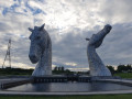
The Kelpies and locks
 Association / Club / Walk leader
 1.09 mi
+7 ft
-10 ft
0h 30
Easy
Departure from Falkirk
1.09 mi
+7 ft
-10 ft
0h 30
Easy
Departure from Falkirk
This short wonder starts from The Helix car park and goes along the Forth and Clyde Canal Towpath to reach the impressive Kelpies horses statues! This is a family and push chairs friendly route.
Blackburn to Mid Calder, River Almond
9.50 mi
+187 ft
-351 ft
4h 30
Average
Departure from West Lothian
This walks is part of the Edinburgh’s five rivers: Source to Sea collection. This is the second leg of a 4-part route down the full length of the valley of the River Almond. It is a varied walk visiting former mill-site, reshaped shale-bing, miners’ rows, river-side woodlands, two huge shopping malls, eight public works of art.
For more walks, use our search engine .
The GPS track and description are the property of this route's author. Please do not copy them without permission.

