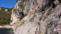
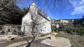
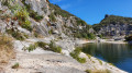
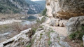
The Pioneers head to the beach from Saint-Remèze

This path was used almost every day by the Scouts working on the Marzal 2 project to clear a karstic cave, right up until 1991. They would then walk on to cool off in the waters of the Ardèche.
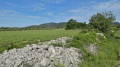
There are no difficulties on this walk; the paths are wide, well-marked and almost suitable for vehicles. The terrain is fairly flat, except towards the end during the descent towards the Ardèche.
Beware of the sun: there is little shade.

Details

3310309
Creation:
Last update:
Last review:
  • Walking
    Activity: Walking
  • ↔
    Distance: 7.26 mi
  • ◔
    Average duration: 4h 10 
  • ▲
    Difficulty: Moderate

  • ⚐
    Back to start: Yes
  • ↗
    Ascent: + 958 ft
  • ↘
    Descent: - 958 ft

  • ▲
    Highest point: 1,161 ft
  • ▼
    Lowest point: 203 ft

Description of the walk

Start from the Aven Marzal car park (check opening times) located a few kilometres from Remèze on the D201.

(S/E) Follow the path, keeping to the right at the entrance to the Marzal site, along the fence until you reach the old Marzal 2 building site. Stay on this wide path alongside the fence until you reach the junction withthe GR®4F.

(1) Turn right onto it, following the red and white markings. Turn immediately left onto the wide, straight track. You’ll reach a junction with a road.

(2) Cross it, continue straight ahead along another straight path, and rejoin a wide track at the junction with the Aven du Cadet. Turn left onto this wide path, marked with yellow and white signs, and head towards the forester’s cottage.

(3) Turn right, staying on the path marked in yellow and white. You’ll soon reach the D 290 road.

(4) Pass under the tourist road through the tunnel. Continue along the concrete road, which is closed to traffic. Begin the steep descent towards the Ardèche to reach the Gournier campsite. Then head to the Ardèche for a refreshing swim.

(5) Follow the route back in the opposite direction to return to the Marzal car park (S/E).

Waypoints

  1. S/E : mi 0 - alt. 1,161 ft - Aven Marzal 2 car park
  2. 1 : mi 0.63 - alt. 1,066 ft - GR junction
  3. 2 : mi 1.47 - alt. 1,004 ft - Road junction
  4. 3 : mi 2.38 - alt. 1,017 ft - Former forest ranger’s house
  5. 4 : mi 2.75 - alt. 909 ft - Tourist route
  6. 5 : mi 3.63 - alt. 203 ft - Ardèche
  7. S/E : mi 7.26 - alt. 1,161 ft - Aven Marzal 2 car park

Notes

(S/E) The Aven Marzal is a private site with set closing times; please check the details carefully so as not to disrupt the site’s operations. The Aven Marzal
(3) Shaded picnic tables are available at the forest ranger’s house. Parking is possible if you wish to arrange a meet-up with a car to avoid a full round trip.
(5) Tables are also available at the Gournier campsite. However, there isn’t really any parking, not even along the tourist road. There are a few places to park your car along the tourist road, but these fill up quickly in high season.
(5) Swimming is possible at the Gournier campsite, but watch out for canoes and the current, which can be very strong following recent rain or storms and may sweep weaker swimmers into the rapids (risk of drowning).
(5) Toilets and water available at Gournier.

Worth a visit

(S/E) At Aven Marzal: karstic cave tour, prehistoric zoo, adventure trail. Car park and picnic tables, as well as a refreshment bar with a terrace.
(5) At Gournier: swimming, picnicking and camping are possible.

Always be cautious and plan ahead when you're outdoors. Visorando and the author of this route cannot be held responsible for any accidents occurring on this route.

The GR® and PR® markings are the intellectual property of the Fédération Française de Randonnée Pédestre.

Reviews and comments

3.5 / 5
Based on 4 reviews

Reliability of the description
3.8 / 5
Ease of following the route
3.8 / 5
Route interest
3 / 5
ThB
ThB

Overall rating : 4 / 5

Date of your route : Apr 20, 2026
Reliability of the description : ★★★★★ Very good
Ease of following the route : ★★★★☆ Good
Route interest : ★★★☆☆ Average
Very busy route : No

Not particularly interesting.
Very long straight stretches (around 7 km in total along the route).
Descent and climb towards the Ardèche, well shaded. Beautiful beaches

Machine-translated

MINOMICHEL
MINOMICHEL

Overall rating : 3 / 5

Date of your route : May 26, 2021
Reliability of the description : ★★★☆☆ Average
Ease of following the route : ★★★☆☆ Average
Route interest : ★★★☆☆ Average
Very busy route : No

A monotonous route due to these long, uninteresting tracks. Furthermore, you need to be an experienced walker and have an IGN map; otherwise, it’s difficult to find your way as the yellow and white markings are invisible, particularly at the uninteresting junctions.

Machine-translated

Evemi
Evemi

Overall rating : 2.7 / 5

Date of your route : Mar 22, 2021
Reliability of the description : ★★★☆☆ Average
Ease of following the route : ★★★☆☆ Average
Route interest : ★★☆☆☆ Disappointing
Very busy route : No

Hello, I didn’t really enjoy this rather uninteresting ‘walk’ – stony, wide, flat paths, apart from the final steep descent towards the Ardèche (that’s where all the elevation gain is); perhaps something to do with the family, finishing off with a swim.

Machine-translated

Dtres
Dtres

Overall rating : 4.3 / 5

Date of your route : Oct 24, 2020
Reliability of the description : ★★★★☆ Good
Ease of following the route : ★★★★★ Very good
Route interest : ★★★★☆ Good
Very busy route : No

A family hike with our dog and children (aged 14 and 8) – a lovely outing on this beautiful early autumn’s day. We were completely on our own at the campsite. A very easy route which allowed the children to get to grips with navigation and map-reading. The concrete descent (and the climb back up) were the only challenging parts of the route; it was slightly slippery on the way down (it had rained the day before) but nothing insurmountable, even after our picnic at the campsite.

Machine-translated

Other walks in the area

For more walks, use our search engine .

The GPS track and description are the property of this route's author. Please do not copy them without permission.