The landscapes of Vinsobres

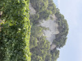
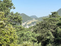
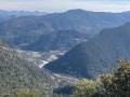
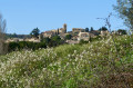
This short circular loop starting from the village of Vinsobres follows small tarmac roads (not recommended for keen sports enthusiasts – except perhaps joggers – or those with tarmac allergies) and offers the chance to discover beautiful scenery (Mont Ventoux in fine weather, the Provençal hills) and the region’s traditional agricultural landscapes (vineyards, olive groves; lavender fields are becoming increasingly rare).

Details

n°111773612
Creation:
Last update:
Last review:
–
  • Walking
    Activity: Walking
  • ↔
    Distance: 4.36 mi
  • ◔
    Average duration: 2h 25 
  • ▲
    Difficulty: Easy

  • ⚐
    Back to start: Yes
  • ↗
    Ascent: + 443 ft
  • ↘
    Descent: - 446 ft

  • ▲
    Highest point: 1,211 ft
  • ▼
    Lowest point: 797 ft

Photos

Description of the walk

Park at Place de la Mairie (alternatively, there are several municipal car parks nearby).

(S/E) From the car park, walk up to Rue Gironde, follow it up to the left, turn right between the church and the bistro, and follow the signs for ‘12th-century temple’ until you come to the Passage des Templiers on the right, accessed via a flight of steps.

(1) Climb the steps, cross Place de la Clastre, and keep to the left on Rue du Temple (on your left). At the Fork in the road at the top of the temple, keep left onto Rue de La Tour de Paris, and follow a wide bend to the right. When you reach Grande Rue on your right, continue down a few more metres to the left until you reach the junction with the D619.

(2) Cross carefully and carry on, almost directly opposite, slightly to the left (Chemin des Cornuds), heading east, until you reach a four-way junction.

(3) Head straight on along Chemin de la Combe, towards Les Cornuds. Follow this small road, ignoring all junctions to the left or right. The road takes a series of wide bends; after a final, slightly sharper bend to the right, take a sharp hairpin bend to the left to climb up to the hamlet of Les Cornuds.

(4) At the entrance to the hamlet, take the Chemin du Hameau immediately on the right. Pass the Col des Cornuds (sign on the left) and continue downhill. After a right-angle turn to the right, you’ll reach the access road to the small hamlet of Colombier.

(5) Leave the hamlet on your right and continue left until you reach a T-junction with hiking signposts.

(6) Ignore the signposts, take the road to the left for just under 100 metres and take the first path on the right, just before the small bridge. Continue downhill to a junction just before a house.

(7) Take the Chemin de la Conche, which climbs to the right, leaving the house on your left, followed by the vineyards. Carry on along the footpath, then a field track, and head downhill to the Moye stream. Ford the stream (this may be tricky if it has rained; see the alternative route below), then head back uphill until you reach the tarmac road (Chemin de Sournure).

(8) Follow it to the right, then turn right again onto Rue Gironde, which leads back to the village (S/E).

Waypoints

  1. S/E : mi 0 - alt. 958 ft - Town Hall Square
  2. 1 : mi 0.16 - alt. 1,014 ft - Passage des Templiers
  3. 2 : mi 0.32 - alt. 1,066 ft - Junction of Rue Saint-Botin and Rue de Barriou
  4. 3 : mi 0.62 - alt. 1,040 ft - Chemin de la Combe, towards Les Cornuds
  5. 4 : mi 1.84 - alt. 1,148 ft - Les Cornuds
  6. 5 : mi 2.66 - alt. 1,004 ft - Junction
  7. 6 : mi 2.9 - alt. 951 ft - Chemin de Barbesier
  8. 7 : mi 3.35 - alt. 814 ft - Chemin de la Conche
  9. 8 : mi 3.7 - alt. 896 ft - Route
  10. S/E : mi 4.36 - alt. 958 ft - Town Hall Square

Notes

Sturdy footwear may be required for the stream crossing.

Alternative route:
(6) After rain, if you wish to stay on the tarmac, avoid the dirt track and the stream crossing; take the Chemin de Berbesier on the right, which leads back to the village.

Worth a visit

If you’re coming from Valréas, the route via the D46 then the D190 offers a lovely opportunity to explore the Provençal countryside. You’ll need to pay attention at the start so as not to miss it.

A thorough exploration of the old village is a must, either at the start of or as an extension to the walk. The bistro is a discovery in itself.

Vinsobres lies at the heart of a renowned wine-growing region. Several wine cellars are nearby. To be enjoyed in moderation, etc.

To see the lavender fields – the area of which has shrunk in recent years – you need to choose the right time of year. Check with the Tourist Office, for example.

Other walks in the area

For more walks, use our search engine .

The GPS track and description are the property of this route's author. Please do not copy them without permission.