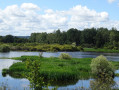
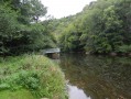
The Voueize Gorges

This short hike also gives you the opportunity to discover the charming village of Chambon-sur-Voueize.
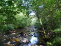
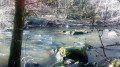
The walk can be done as a circular route, but only the first half runs along the Voueize gorges. For once, I vote for a return trip to enjoy the scenery along the banks twice.

Details

1787013
Creation:
Last update:
Last review:
  • Walking
    Activity: Walking
  • ↔
    Distance: 5.18 mi
  • ◔
    Average duration: 2h 45 
  • ▲
    Difficulty: Easy

  • ⚐
    Back to start: Yes
  • ↗
    Ascent: + 400 ft
  • ↘
    Descent: - 381 ft

  • ▲
    Highest point: 1,467 ft
  • ▼
    Lowest point: 1,083 ft

Photos

Description of the walk

Departure from the car park in front of the town hall in Chambon-sur-Voueize.

Yellow markings then yellow C4 markings.

(S/E) From the Tourist Office, just behind the town hall (Place Aubergier), take Rue de la Place Aubergier, then turn left onto Rue des Forts. At the end of this street, turn right onto Route de Lépaud. Follow this road for about 200 metres. The river is on your left.

(1) Leave the D917, taking the small road that descends to the left. Follow this road, which first passes in front of an old electricity-producing mill, "le Moulin Girardy", then through abandoned industrial buildings.

(2) The road turns into a path that varies in width depending on the location. This path, which runs through the woods, follows the river and only deviates from it once before quickly rejoining it. Then follow a left-hand bend; continue for about 150 metres and you will find a discreet path starting on the right.

(3) Take this path, which climbs steeply (very steeply). It widens between two meadows.

(4) Leave the farm on your right and continue along the road slightly to the left until you reach the stop sign. Be careful, the D917 is quite busy. Turn right and follow the road for about 600 metres.

(5) Turn onto the first path on the left, which leads to a very small road. Head towards the hamlet of Longeville, whose houses can be seen on the left.

(6) At the first house, continue to the right, following the PR® sign. The path leads to a crossroads with the D41, which you cross towards La Budelière via the D41A2. Stay on this road for 200 metres.

(7) Turn right onto the first path (marked white-red and yellow) and follow it straight ahead to the end.

(8) At the end of the path, cross the road, enter the housing estate and continue straight ahead downhill. The small road turns into a path in a left-hand bend.

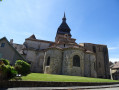
(9) Cross the road again and take Grand Rue du Puy. This road turns right and overlooks the abbey church and the roofs of the village. Then take the first left, which will bring you back to Route de Lépaud. Take Rue des Forts to return to the starting point (S/E).

Waypoints

  1. S/E : mi 0 - alt. 1,086 ft - Parking available at the Town Hall and Tourist Office - Abbatiale Sainte Valérie
  2. 1 : mi 0.36 - alt. 1,119 ft - Small road on the left - Voueize (rivière)
  3. 2 : mi 0.77 - alt. 1,102 ft - Path continuing on from the road
  4. 3 : mi 1.71 - alt. 1,135 ft - Steep slope on the right
  5. 4 : mi 2.19 - alt. 1,345 ft - Road continuing on from the footpath
  6. 5 : mi 2.77 - alt. 1,365 ft - Path on the left
  7. 6 : mi 3.23 - alt. 1,424 ft - On the right in the hamlet of Longeville
  8. 7 : mi 3.52 - alt. 1,447 ft - On the right, follow the white-red and yellow marked trail
  9. 8 : mi 4.29 - alt. 1,385 ft - Opposite, towards the housing estate
  10. 9 : mi 4.52 - alt. 1,293 ft - Grande Rue du Puy
  11. S/E : mi 5.18 - alt. 1,086 ft - Car park - Tardes (rivière)

Notes

Shops and restaurants in the village

Worth a visit

Always be cautious and plan ahead when you're outdoors. Visorando and the author of this route cannot be held responsible for any accidents occurring on this route.

The GR® and PR® markings are the intellectual property of the Fédération Française de Randonnée Pédestre.

Reviews and comments

4.6 / 5
Based on 17 reviews

Reliability of the description
4.7 / 5
Ease of following the route
4.7 / 5
Route interest
4.3 / 5
User 25473431

Overall rating : 4 / 5

Date of your route : Aug 05, 2026
Reliability of the description : ★★★★★ Very good
Ease of following the route : ★★★★☆ Good
Route interest : ★★★☆☆ Average
Very busy route : No

The highlight of this walk in such hot weather is the stretch through the woodland along the Voueize – which, unfortunately, is dry!
We’ll do this walk again in the autumn

Machine-translated

mame kiki
mame kiki

Yes, it’s a walk best done in spring. The Voueize is ‘bouncy’ at that time of year. But in summer, the ‘Voueize’ section is nicely shaded. I’m happy just to walk the whole length there and back.

Machine-translated

Vador61
Vador61

Overall rating : 4 / 5

Date of your route : Jul 24, 2026
Reliability of the description : ★★★★☆ Good
Ease of following the route : ★★★★☆ Good
Route interest : ★★★★☆ Good
Very busy route : No

A really lovely walk – it’s a shame the Voueize was completely dry when we were there.
A small correction: at point 6, you cross a junction heading towards La Budelière via the D41A1, not the D41A2 as indicated.

Machine-translated

Visiorandonneur 79
Visiorandonneur 79

Overall rating : 5 / 5

Date of your route : May 03, 2026
Reliability of the description : ★★★★★ Very good
Ease of following the route : ★★★★★ Very good
Route interest : ★★★★★ Very good
Very busy route : No

A lovely walk that’s best done in its entirety to appreciate the varied scenery.

Machine-translated

mamekiki
mamekiki

thank you!

Machine-translated

Mimosadu23
Mimosadu23

Overall rating : 4.7 / 5

Date of your route : Feb 21, 2025
Reliability of the description : ★★★★☆ Good
Ease of following the route : ★★★★★ Very good
Route interest : ★★★★★ Very good
Very busy route : No

On a beautiful sunny day in February, we are alone on the entire route.
The wild and authentic Voueize Valley with its peaceful, mysterious and unspoilt landscapes...
We set off on the departmental road, which was less pleasant as it was very busy (about fifteen vehicles...).
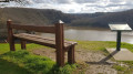
We enjoyed the bench where we could take a break facing the sun, and the descent towards Chambon with its beautiful panoramic views.
We recommend it...

Machine-translated

Gadaud Jean-Pierre
Gadaud Jean-Pierre

Overall rating : 3.7 / 5

Date of your route : Aug 20, 2024
Reliability of the description : ★★★★☆ Good
Ease of following the route : ★★★★☆ Good
Route interest : ★★★☆☆ Average
Very busy route : No

Great route along the Voueize. Unfortunately, the second part of the route is quite ordinary, with some dangerous spots on busy asphalt roads.

Machine-translated

TVdbk
TVdbk

Overall rating : 4.7 / 5

Date of your route : Aug 28, 2023
Reliability of the description : ★★★★★ Very good
Ease of following the route : ★★★★★ Very good
Route interest : ★★★★☆ Good
Very busy route : Yes

A pleasant route, especially the first part through the woods, with some sections more challenging than others. Then there is a section through the countryside on tarmac paths offering a different but equally interesting setting.
I recommend it!

Machine-translated

CHAPA
CHAPA

Overall rating : 5 / 5

Date of your route : Feb 20, 2023
Reliability of the description : ★★★★★ Very good
Ease of following the route : ★★★★★ Very good
Route interest : ★★★★★ Very good
Very busy route : Yes

Great hike

Machine-translated

mamekiki
mamekiki

Redone not long ago. My friends insisted on doing the circular. I remembered why I like the round trip.

Machine-translated

DaDoRando14
DaDoRando14

Overall rating : 5 / 5

Date of your route : Aug 23, 2022
Reliability of the description : ★★★★★ Very good
Ease of following the route : ★★★★★ Very good
Route interest : ★★★★★ Very good
Very busy route : No

A round trip is a must! Parking is available at the end of the small tarmac road (Moulin Giraudy) opposite some abandoned industrial buildings: the route is then about 4 km long. The Voueiez was almost dry. The ruins of Bluebeard's Castle are barely visible on the other bank, but the walk is pleasant and well shaded.

Machine-translated

Maminouxe
Maminouxe

Overall rating : 4.7 / 5

Date of your route : Sep 05, 2022
Reliability of the description : ★★★★★ Very good
Ease of following the route : ★★★★★ Very good
Route interest : ★★★★☆ Good
Very busy route : No

A bit too much walking, unfortunately, which meant we stopped at level 3 and turned back. It was a shame there wasn't much water, but it was a pleasant trail through the woods.

Machine-translated

Jean Mignon
Jean Mignon

Overall rating : 4.3 / 5

Date of your route : Oct 11, 2021
Reliability of the description : ★★★★☆ Good
Ease of following the route : ★★★★☆ Good
Route interest : ★★★★★ Very good
Very busy route : No

the signage wasn't very good. The hike was fantastic!

Machine-translated

mamekiki
mamekiki

That's kind of you.
Have a good hike.
Mamekiki

Machine-translated

lebayle210554
lebayle210554

Overall rating : 4.7 / 5

Date of your route : Sep 13, 2021
Reliability of the description : ★★★★★ Very good
Ease of following the route : ★★★★☆ Good
Route interest : ★★★★★ Very good
Very busy route : Yes

Thank you

Machine-translated

Other walks in the area

For more walks, use our search engine .

The GPS track and description are the property of this route's author. Please do not copy them without permission.