Country:

 City:
City:


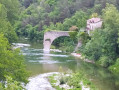
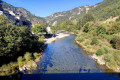
Park in a small car park by the bridge spanning the Tarn, on the left bank of the river.
(S/E) Set off west-south-west, towards the village of Le Rozier. You’ll soon reach the bottom of a flight of steps.
(1) Take the steps to the left, heading uphill, whilst following the red and white markings of the GR®6. At the top, turn left and you’ll immediately reach a platform with two benches.
(2) Then turn right, following the GR®. The path then leads onto a road. Follow it uphill, then turn left, taking the path along the new route of the GR®6. Reach the hamlet of Capluc and walk through it to reach a crossroads at the edge of the hamlet.
(3) Continue following the red and white markings of the GR®6, heading east–north-east (this is the Sentier Louis Armand). You will then come to the foot of a small flight of steps.
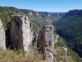
(4) Leave the GR® and head up to the left via this flight of steps (this is where the Sentier Brunet begins). After a steep but short climb, you’ll reach a small, unnamed pass. Continue to the right along the ridge path, marked in yellow on the rocks. This section involves some light scrambling until you reach a distinctive yellow and grey rock directly opposite.
(5) Before this rock, descend via a path on the right into a narrow, very steep valley. After an even steeper section, secured by a fixed rope, continue the descent to rejoin the GR®6 (Sentier Louis Armand).
(6) Follow the GR® to the right. Continue straight on to return to the junction you passed on the way there (staircase).
(4) Follow the route back in the opposite direction to the outward journey, as far as the hamlet of Capluc.
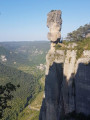
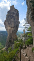
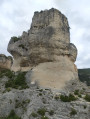
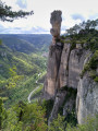
(3) At the top of the hamlet, turn right onto the steps carved into the rock. Continue the climb, using the metal ladders, to reach the viewpoint at the summit of the Rocher de Capluc.
(7) Walk round the Rocher de Capluc before heading back down, in the opposite direction, to the previous junction.
(3) Turn right and, following the GR®6 back along the same route as on the way up, return to the platform with the benches.
(2) Then turn right (leaving the GR®) and head downhill. At the next junction, take the sharp left-hand bend. Join the road and follow it to the right until you reach the car park (S/E).
 Visorando Member

 Moderate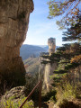
 Very difficult