


 Country:
 City:


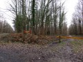
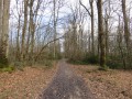
The starting point is at the car park for the fitness trail on the Route forestière des Orangeons in the Châteauroux State Forest. You can access this forest road from the junction of the D67 and D40 departmental roads.
(S/E) From the car park, take the forest track south-east towards the Bertrand junction (there are sometimes wooden barriers which you can go round).
(1) Carry on straight ahead until you reach the Druides crossroads.
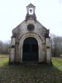
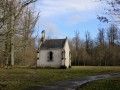
(2) Then take thesecond path on the right towards the Chapelle de la Bonne Dame du Chêne, on the Beauregard forest track.
After about 1 km, turn left onto the tarmac road leading to the Chapel of the Bonne Dame du Chêne.
(3) From the chapel, continue south along the narrow path that leads into the forest. At the next junction, turn left onto the cross-country path. You will then reach the Allée du Pèlerin, which you take to the right. Next, take the first left, which is a white gravel track.
At the end of this lane, turn left onto the ‘Route forestière de Henri de Bourbon’, which takes you back to the ‘Carrefour des Druides’.
(2) Then take the first right onto the Route forestière d’Artois. Follow this road for about 2.5 km until you reach the roundabout at the Carrefour du Riau de la Motte. Cross the D990 departmental road with care and continue straight on for about 1.5 km to reach the Carrefour Picard.
(4) Do not continue straight on, but turn left onto the Route forestière de Clavière towards the Étang de Berthommiers. Follow the Route de Clavière to the Chandaire junction.
(5) At the Chandaire junction, turn sharply left onto the Route forestière de l’Abbaye and follow it all the way to the Robinson junction.
(6) Then turn right onto the Route forestière de Lourouer, which will take you to the Lourouer-les-Bois Chapel.
(7) You will then reach the Berthommiers forest road and join theGR®46, which you follow to the left (tarmac road towards Châteauroux).
Carry on straight ahead along this road until you reach the D67 county road at a place called La Seigneurie.
(8) Cross this road carefully and continue along theGR® on the opposite side.
You’ll then walk alongside the forest before continuing straight on to reach a crossroads.
(9) Turn left towards the first houses. You will then enter the village of Le Poinçonnet via Allée Paul Rue, which you follow straight on until you reach the junction with Allée des Lauriers. Continue straight on along Rue Jean Bouin. Just before the cemetery, turn right onto Allée Rollinat.
(10) Take the pedestrian path opposite to walk past the church on your right, leading you to the village’s main square.
Carefully cross the esplanade and turn left onto Avenue de la Forêt (D990) until you reach the traffic lights.
(11) Turn right onto Rue des Pinsonnets. You’ll come to another junction where you turn left onto Rue de la Charbonnière.
You will then rejoin the D67, known here as Rue de la Croix Chabriant, which you follow to your right until you reach another junction with traffic lights.
(12) Turn left onto Allée des Druides. At the junction with Allée des Minerais and Allée des Cailloux, carry straight on.
(13) After a few metres, turn slightly to the right (do not take the dead-end road). At a sharp bend to the right
(14) you’ll turn left onto a tarmac road in poor condition heading towards the forest. You’ll then reach the Piéry crossroads.
(15) Turn right at a right angle onto Allée du Renard, which climbs slightly through the forest on a stony surface (do not take the tarmac forest road known as the ‘Trois Fouineaux’). After a gentle descent, you’ll reach the white-gravel Bertrand forest road; follow it straight on, which will take you back to the Bertrand crossroads.
(1) Then turn right onto the tarmac-surfaced Orangeons forest road to return to the car park where you started (S/E).



