Country:

 City:


Preliminary note: this route is not circular, returning to the starting point, but a journey between Labeaume and Balazuc, which requires transport arrangements to get to the start and to be picked up at the finish; however, the beauty of the landscape makes it well worth the effort.
With this in mind, the start and finish points of the walk are car parks accessible to coaches.
It is possible to park asecond car in the car park at Balazuc cemetery. To start the walk, head to the village of Labeaume and go to the car park near the cemetery where thefirst car will be parked.
(S) Head uphill along Rue du 19 Mars 1962. At thefirst junction, cross the main road to take Chemin Saint-Genest opposite, then continue straight on uphill until you reach a junction. Take thefirst road on the left, which is Chemin de Faveirolle. Carry on straight ahead along this track until you reach a large, isolated building on the left (the Recatadou community hall), at a place called Chamontin.
(1) Pass Chamontin, follow the signpost for the walking route onto the dirt track on the left and continue down this track. When you reach a Fork in the road, take the left-hand branch. You’ll reach the banks of the River Beaume and continue along this path beside the river until you reach the submersible bridge over the Beaume. (Before crossing the bridge, you can stop off for a stroll through the old streets of the village of Labeaume).
(2) Cross the bridge. At the junction just beyond the bridge, carry straight on, ignoring the path on the right.
Follow this track along the river. At the fork in the road, turn left and carry on until you reach a wider tarmac road. Turn left onto this – it is the Chemin de la Chandelette. Walk past the campsite and the riding centre, then you’ll come to a crossroads.
(3) Carry on straight ahead. Continue along the dirt track until you reach the hamlet of Bizac. Leave the Impasse des Falaises on your left and cross the Route de l’Impasse de Bizac to continue along the Impasse de la Grotte. Follow the descending dirt track until you reach the tarmac road, the Route de Ruoms.
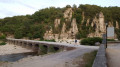
(4) Turn left onto it. Please note that, like all the roads taken during this walk, this road can be very busy during the summer months. Cross the bridge over the River La Beaume and continue to the junction with the Chemin de Peyroche.
(5) Turn left here and walk through Peyroche. Turn right onto Route de Labeaume, then left onto Rue des Défilés and follow the Ardèche river to reach the T-junction with Rue La Bigournette.
(6) Turn right and cross the Ardèche via the Pont de Ruoms. Continue straight ahead, entering the village of Ruoms via Rue des Brasseries. Then turn left onto Rue du Savel and continue straight up this road until you reach a roundabout.
(7) Carry on straight ahead along Rue du Petit Bois until it becomes a dirt track. Follow this track until you reach a sharp bend to the right.
(8) Ignore thefirst turn-off on the left and take thesecond one on the left. You’ll then come to a Fork in the road. Turn left and continue downhill until you reach the banks of the River Ardèche.
(9) Turn right onto the path running alongside the Ardèche and continue along a section that runs along the cliff face overlooking the river, a place known as the Cirque de Gens. The path descends from the cliff back towards the river and leads to the Moulin du Grazel.
(10) Continue along the river. Then leave the riverbank, passing through the vegetation to reach a tarmac road and the hamlet of Mas du Grazel.
(11) Pass through this hamlet, then continue along the tarmac road until you reach the junction with the old railway line, which has been converted into a cycle path. Take this path to the left. Cross the D579 and carry on straight ahead. At the next junction, turn left. About twenty metres further on, cross the D579 again, carry on straight ahead along the Route du Cirque de Gens and reach the Chauzon bridge.
(12) Cross the Ardèche via this bridge and take the dirt track leading uphill straight ahead. Continue along this track until you reach the Chemin du Cirque de Gens. Take this track and follow it to reach the village of Chauzon. Pass along the Route des Blaches, then the Rue Principale Étienne Georges. At the end of this street, turn right, then a few metres further on, turn left onto the Rue de la Mairie to reach Chauzon Town Hall.
(13) Continue slightly uphill along the Route du Boulodrome. Join a main road, the Route des Gras, and follow it until you reach a junction of paths. Turn right to reach the cliff edge and enjoy a view over the Ardèche Gorges.
(14) Carry on to the right, rejoin the Route des Gras and leave it at the next bend to turn right onto a footpath. At the next Fork in the road, stay on the path on the right. You’ll soon come to a wider track; take this and continue until you reach a hamlet of a few houses. Carry on until you reach a crossroads with a cross standing there. Continue straight ahead and reach another crossroads.
(15) Turn right and head for the village of Vieil Audon.
(16) Walk through the village and follow the Ardèche river until you reach the bridge at the Grotte du Pont.
(17) Cross this bridge to the right and then enter the village of Balazuc. Walk through the village along the Rue Principale to the top of the village, where you’ll find the cemetery car park (E).

 Visorando Member
 Easy
 Moderate