Country:

 City:
City:


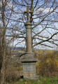
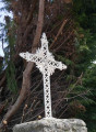
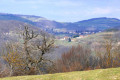
(S/E) Leaving the Rontalon hikers' car park, turn left onto Chemin des Chareilles (Croix des Chareilles and ogival well) then continue to the left of the cross on the Fondelys road. Cross the La Croix Blanche road (Croix de Fondelys) and go down the small path opposite.
(1) Opposite the Le Rantonnet farm building, turn left to see the Croix du Rantonnet 150 m away, then retrace your steps.
(1) On the way back, walk past the farm. Continue straight on towards La Grand Planche.
(2) Cross the Ruisseau de Cartelier stream and immediately turn left. The path climbs up through the Bois de la Dame forest towards the Croix Carye cross at a crossroads.
(3) At the cross, take the Marjon road on the right towards Le Boulard. Follow it for about 2 km (on a clear day, you can see the Alps and Mont Blanc, and Pilat on the left).
At the hamlet of Montplan, you will see two crosses on your left (Croix de Montplan).
Cross the D115 to reach Le Boulard (a very pretty old farmhouse). As you arrive, notice the 17th-century cross leaning against the wall on your left and continue climbing towards Les Ravières.
(4) At Bois de la Gorge, turn right and continue to Les Ravières.
(5) At a sharp left-hand bend, take the path on the right (you will see the statue of the Virgin Mary on the right) and climb about 100 metres across the field on the left to reach the Croix des Ravières (a large cross offered as a votive offering by prisoners of war in Germany on their return from captivity). A large conifer at the top of the hill marks its location.
(6) On a clear day, there is a beautiful view of the Lyon plain and the Alps. Retrace your steps.
(5) Continue along the road uphill to the right, which continues along a small path that descends into a wood.
(7) At Bois des Rivoires, turn right onto the path towards La Ferrandière. Cross the Cartelier stream, which flows into the Garon, then climb up to La Ferrandière.
(8) At the Croix de La Ferrandière, take the road on the left towards Monchard until you reach the hamlet of Le Surgeon (the last farm on the left dates back to the Middle Ages). Just after the cross, turn right and continue along the path towards Monchard.
(9) After passing a beautiful farmhouse, continue on the left along a small road (Chemin du petit Surgeon) until you reach the D34, which you will follow carefully, turning right for a few hundred metres.
(10) Take the road on the left in the bend before the electricity pole (Chemin de la Panonceliere Ouest) and follow it to Montchard.
At Montchard (the highest point of the route), descend to the right just after the cross towards Croix Forest.
(11) Pass under the bridge of the old Lyon - Saint-Symphorien-sur-Coise railway line (1912-1932) and follow the road that climbs to the right. Descend Chemin du Niguet (beautiful view of Notre-Dame de Rochefort, former barony and Château de la Bâtie) to the cross on the right.
(12) At the cross (note: it is almost hidden by the hedge - look for the fire hydrant next to it), turn right and follow the path down to Chemin des Assiers.
(13) At Les Assiers, continue straight ahead for about 300 metres downhill to see the Croix de Souzy.
(14) Retrace your steps.
(13) Turn left (there is a yurt on the corner) towards the village of Les Assiers. Follow the road until you reach Route du Paradis. Take this road to the village of Le Pinay.
(15) Turn onto the path that climbs to the right. Keep to the left-hand track that climbs alongside a building (ignore the one on the right). At the next crossroads, continue straight ahead until you reach the cross. Cross the road and continue straight ahead. You will arrive at the Rontalon Botanical Trail, which runs alongside the Bois du Bacha. Follow this trail and enjoy the explanations provided in a small wooden box. Ignore the path that climbs towards the antenna.
(16) At elevation 472, continue straight ahead (the path on the right shortens the route and takes you directly back to Rontalon via Le Roman).
(17) At the Croix de Faroussa (elevation 414), turn right towards La Petite Côte.
(18) Descend into the village, leave the well on your left, go around the buildings and continue on the right along the path that descends towards the stream, which you cross before climbing up the other side towards Le Plat.
(19) After the climb, turn slightly right and join Le Plat and the road to La Croix Blanche.
Turn right, then when you reach Rontalon, turn right towards a place called Le Roman.
(20) Climb a few dozen metres up into the hamlet to see the 17th-century cross and the old 16th-century gates. Retrace your steps.
(20) Take the path that climbs to the right to reach the car park (S/E).
(Don't hesitate to look behind you during the climb to admire the beautiful farmhouse).



 ).
). Visorando Member
 Moderate