Country:
 City:



The route starts from the car park behind the church, at Place de la Fontaine.
(S/E) With your back to the rear of the church, turn left then right onto Rue de Judée and continue to number 22.
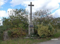
(1) Just before that, turn right onto the small Chemin de la Pommeraie. Continue along the tarmac road (Rue Beauséjour) and, at the end of it, turn left (Rue Pasteur). At the roundabout, turn right onto the D37 towards Tiffauges and head for the next junction, where you’ll find a magnificent wayside cross.
(2) Turn right onto Rue de Chasseloup, towards La Perverie, and head for number 7.
(3) Just after this, on the right, you’ll see the Croix du Massacre, erected in memory of the victims of the Vendée Wars on 7 February 1794. Continue along the road until you reach a fork at No. 2 in the hamlet of La Perverie.
(4) Keep left, continue along a track suitable for vehicles and, at the 90° left-hand bend, turn right onto the path and head towards a road (D72).
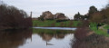
(5) Walk alongside it on the left, following the marked path, and head down to the bridge spanning the Crûme.
(6) Before the bridge, walk back up to the edge of the carriageway to cross the river. Continue for about 20 metres along the road, then cross the road – taking care of traffic – at the entrance to the small meadow, which is marked by a wooden archway and contains a small building housing public toilets. Cross the meadow and continue along the narrow path to a wooden footbridge over the Crûme.
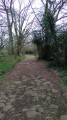
(7) Take this footbridge to cross the Crûme again, then follow the path uphill to the junction.
(8) Turn left and, when you reach the tarmac road at La Rondardière, turn right. Cross the Nalière and join the D755 at a wayside cross.
(9) Cross with care and follow the narrow path that branches off to the right and runs alongside the road. After a few metres, take thefirst path on the left. Ignore the access paths to the fields and carry on straight ahead. Continue along a small road until you reach the track on the right at the edge of the woodland.
(10) Take this track towards Le Chêne, then continue straight on along the tarmac and follow Rue François Charette until you reach a roundabout (D755) with a wayside cross on your right.
(11) Carry on straight ahead along Rue de la Métairie. Cross a road at the dairy farm of La Métairie and head towards the visitor centre.
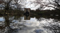
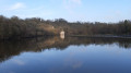
(12) At La Godelinière, take the small path to the right of the gatehouse and head to the edge of the pond. Walk round it anti-clockwise, then, facing the wooded strip, head back up towards the estate’s car park. Turn right, then left at the end of the car park.
(13) At the corner of No. 21, turn right and, at the roundabout, go straight ahead onto Rue d’Auvergne. Continue to the end of the street, where you’ll see a chapel on your left.
(14) Turn right onto the D755 and head for the car park behind the church, at Place de la Fontaine (S/E).

 Visorando Member

 Difficult

 Tourist office