Refine your search for walks in Lac de Pradelles
Lac de Pradelles walks
 The Pic de Nore

The Pic de Nore is the highest point and iconic summit of the Montagne Noire, with its transmitter visible for dozens of kilometres around. The circuit described here allows you to make the ascent without any difficulty, passing by several exceptional viewpoints over the Pyrenees. Two menhirs along the way and a visit to the old ice houses in Pradelles-Cabardès are a pleasant addition to this varied hike at medium altitude.
 The Pic de Nore

A fantastic hike starting from Lake Pradelles-Cabardès leading to Pic de Nore, the highest peak of the Montagne Noire, with its breathtaking 360° view stretching from Hérault to Tarn via Aude, Pyrénées Orientales, Ariège and Haute Garonne.
 Le Pas de Montsarrat

Facing the Pic de Nore, which saw the Tour de France pass through in 2018, the wind turbines installed on Mont Sarrat and spread across the municipalities of Pradelles-Cabardès and Cabrespine immediately catch the eye. TheGR®36, coming from Pic de Nore, winds its way at the foot of the masts before plunging towards Carcassonne via the Pas de Montsarrat, an ancient "Roman" communication route.
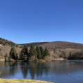
The short length of the route offers the opportunity to extend the hike along the lake (see practical information).
 Roc de Nouret from Pradelles-Cabardés

This hike is best done in spring in good weather to enjoy the magnificent views of the Pyrenees, the Carcassonne plain and the Mazametain. You will also have the opportunity to see an ice house and small menhirs. The vegetation is varied: sometimes Mediterranean, sometimes more mountainous. This hike is partially marked with a yellow line, a green line and a yellow dot.
