Tête de Bostan, starting from Les Allamands

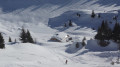
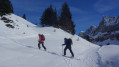
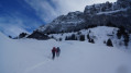
A beautiful ski tour offering sweeping panoramic views of the Chablais and a close-up view of the Dents Blanches.

Details

2957755
Creation:
Last update:
Last review:
  • Skiing
    Activity: Skiing
  • ↔
    Distance: 8.36 mi
  • ◔
    Duration according to the author: 6 hrs 
  • ▲
    Difficulty: Difficult

  • ⚐
    Back to start: Yes
  • ↗
    Ascent: + 4,488 ft
  • ↘
    Descent: - 4,472 ft

  • ▲
    Highest point: 7,881 ft
  • ▼
    Lowest point: 3,432 ft
  • ⚐ Country: France
  • ⚐
    Areas: Alps, Giffre
  • ⚐ City: Samoëns (74340)
  • ⚑
    Start/End: N 46.110986° / E 6.747146°
  • ❏
    IGN map(s): Ref. 3528ET, 3528ETR, 3530ET, 3530ETR
  • Hour-by-hour weather

Photos

Description of the walk

Head to the hamlet of Les Allamands via a small road starting from Samoëns. Depending on snow conditions, there are two possible starting points:
- At the edge of the hamlet (S/E), by the roadside. This is the option marked on the map.
- At the upper car park at Les Allamands, situated a little further on and higher up the road.

(S/E) Continue along the road and ski up to the car park.

(1) Follow the forest track which heads east and then turns north-east (the Ratrack track). Take several bends until you reach the Chalets de Bostan.

(2) Continue up the track, heading north-east. You’ll arrive near the Bostan Refuge.

(3) Pass the refuge on your right, leave the track and head north-east up the slope. Keep heading north-east until you reach the ridge.

(4) Turn right and follow the ridge eastwards , taking care of the steep drops and any overhangs on the left.

(5) Pass a small pass marking the exit from the Pas de la Latte and continue along the ridge, heading east-north-east. Reach the summit via a gentle slope.

(6) The return journey follows the same route in reverse, choosing the best possible sections of the valleys based on their aspect to ensure optimum snow conditions. This takes you back to Les Allamands (S/E).

Waypoints

  1. S/E : mi 0 - alt. 3,432 ft - Les Allamands
  2. 1 : mi 0.3 - alt. 3,652 ft - Upper Allamands car park
  3. 2 : mi 2.09 - alt. 5,200 ft - Chalets de Bostan
  4. 3 : mi 2.61 - alt. 5,735 ft - Access to the - Refuge de Bostan-Tornay
  5. 4 : mi 3.49 - alt. 7,106 ft - Ridge
  6. 5 : mi 3.67 - alt. 7,247 ft - Trip on - Pas de la Latte
  7. 6 : mi 4.22 - alt. 7,881 ft - Tête de Bostan
  8. S/E : mi 8.36 - alt. 3,432 ft - The Allamands

Notes

The Bostan Refuge (3) offers the option, if desired, of completing the route in two days: see the detailed information.

The mountains in winter are a hostile environment; only set out when properly accompanied by experienced guides. Weather and snow conditions can be highly changeable, and you may need to adapt; this is why a good knowledge of the mountains is essential for winter outings.

The trail you follow today may not necessarily be the same tomorrow. Therefore, a good knowledge of the mountains and caution are essential.

Don’t forget your avalanche transceiver, shovel and probe.

Worth a visit

Magnificent view of the Dents Blanches.
A sweeping panorama across the Chablais region.

Reviews and comments

4.5 / 5
Based on 2 reviews

Reliability of the description
4.5 / 5
Ease of following the route
4.5 / 5
Route interest
4.5 / 5
guigrou
guigrou
• Edited:

Overall rating : 4.7 / 5

Date of your route : Jun 27, 2020
Reliability of the description : ★★★★★ Very good
Ease of following the route : ★★★★★ Very good
Route interest : ★★★★☆ Good
Very busy route : Yes

A really lovely hike. Spending the night at the Bostan mountain hut is a real bonus: a warm welcome and stunning scenery.

Machine-translated

Anne FRANTZ
Anne FRANTZ
• Edited:

Overall rating : 4.3 / 5

Date of your route : Mar 15, 2020
Reliability of the description : ★★★★☆ Good
Ease of following the route : ★★★★☆ Good
Route interest : ★★★★★ Very good

It’s a really lovely walk. The warden at the Bostan mountain hut are very welcoming. From the hut, you can head up to the summit of Golèse and then walk back down to the Allamands car park. It makes for a brilliant circular walk… but best avoided in foggy weather.

Machine-translated

For more walks, use our search engine .

The GPS track and description are the property of this route's author. Please do not copy them without permission.