The Loubaresse mountain

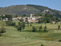
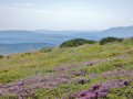
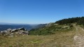
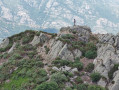
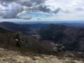
Climb up a drovers' road to a magnificent ridge. Views of Mont Ventoux, the Montselgues plateau and Mont Lozère. Descend to a viewpoint overlooking Loubaresse, nestled around its church, whose bell tower is a former watchtower.

Details

12999121
Creation:
Last update:
Last review:
  • Walking
    Activity: Walking
  • ↔
    Distance: 3.86 mi
  • ◔
    Average duration: 2h 35 
  • ▲
    Difficulty: Easy

  • ⚐
    Back to start: Yes
  • ↗
    Ascent: + 938 ft
  • ↘
    Descent: - 965 ft

  • ▲
    Highest point: 4,642 ft
  • ▼
    Lowest point: 3,655 ft

Photos

Description of the walk

Car park at the small cemetery along the D24.

(S/E) Walk past the cemetery on your right as you head towards the village, and keep to the right at the Fork in the road.

(1) Turn left at the corner of the house to reach the church. Walk past the church on your right, then follow the road uphill to the D24. Cross the road and take the drovers' road opposite, which forms part of theGR®4, up to the pass.

(2) Leave theGR®4 and take the track on the left towards Borne. Further on, ignore a path branching off to the right and carry straight on to the next junction.

(3) Leave the track and take a path on the left which descends steeply towards Loubaresse. Head for the Croix de Saint-Jean.

(4) Turn right, then a few dozen metres further on, turn left, heading towards Loubaresse.

(5) Cross the D24 road twice at Le Fer à Cheval, and continue along the track opposite. Keep left at the Fork in the road and continue along the track suitable for vehicles.

(6) Leave the track and take a path on the left which starts with a hairpin bend; cross the stream and join theGR® path below a farmhouse inn. Follow it to the left to come out onto the D24.

(7) Cross the road and head back up to the village via theGR®, which becomes a small tarmac road (Chemin du Pagel).

(1) Carry on straight ahead to return to the cemetery car park (S/E).

Waypoints

  1. S/E : mi 0 - alt. 3,973 ft - Cemetery car park
  2. 1 : mi 0.08 - alt. 3,937 ft - Junction of the circular loop. Passing close to the spring at - Beaume (rivière)
  3. 2 : mi 0.88 - alt. 4,495 ft - Pratarabiat Pass
  4. 3 : mi 1.65 - alt. 4,557 ft - Bravefont signpost
  5. 4 : mi 2.22 - alt. 3,996 ft - St John’s Cross
  6. 5 : mi 2.35 - alt. 3,921 ft - Junction on the D24
  7. 6 : mi 3.18 - alt. 3,684 ft - Trail ends – Path to the left
  8. 7 : mi 3.43 - alt. 3,766 ft - Junction with the D24
  9. S/E : mi 3.86 - alt. 3,973 ft - Cemetery car park

Notes

Drinking fountain in the village square.

Always be cautious and plan ahead when you're outdoors. Visorando and the author of this route cannot be held responsible for any accidents occurring on this route.

The GR® and PR® markings are the intellectual property of the Fédération Française de Randonnée Pédestre.

Reviews and comments

4.8 / 5
Based on 2 reviews

Reliability of the description
5 / 5
Ease of following the route
5 / 5
Route interest
4.5 / 5
Chaton 26
Chaton 26

Overall rating : 5 / 5

Date of your route : Aug 26, 2024
Reliability of the description : ★★★★★ Very good
Ease of following the route : ★★★★★ Very good
Route interest : ★★★★★ Very good
Very busy route : No

Wow! For such a short route, what stunning scenery. The initial climb offers views of the Loubaresse plateau and the valley below, whilst the final stretch is a fairly steep descent for younger walkers, with views to the south and its peaks.
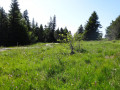
In between, a moment of weightlessness on the plateau amongst heather, broom, blueberries, flowering heather and granite boulders… it’s magical! And as you set off again, you find yourself thinking: “When can we come back?”

Machine-translated

Nginda
Nginda

Overall rating : 4.7 / 5

Date of your route : Aug 14, 2023
Reliability of the description : ★★★★★ Very good
Ease of following the route : ★★★★★ Very good
Route interest : ★★★★☆ Good
Very busy route : No

A lovely little walk around the charming village of Loubaresse, with magnificent views. It’s fairly easy and quite short, but there’s not much shade, especially in the first part.

Machine-translated

Other walks in the area

For more walks, use our search engine .

The GPS track and description are the property of this route's author. Please do not copy them without permission.