The Mission’s circular loop

Walks on the Mission Hills are firm favourites. There are numerous alternative routes. The best-known route is the ‘short circular’ or Chemin du Rosaire.
The recent restoration of old paths offers a different way to explore this area, particularly via the “long circular route” suggested here.
In my opinion, the direction chosen here is the best, as the first part of the circular route is a bit steep and the second part offers a gentler descent.

Details

2441306
Creation:
Last update:
Last review:
  • Walking
    Activity: Walking
  • ↔
    Distance: 4.58 mi
  • ◔
    Average duration: 3h 40 
  • ▲
    Difficulty: Moderate

  • ⚐
    Back to start: Yes
  • ↗
    Ascent: + 1,798 ft
  • ↘
    Descent: - 1,749 ft

  • ▲
    Highest point: 1,624 ft
  • ▼
    Lowest point: 374 ft

Photos

Description of the walk

In Papeete, on the island of Tahiti, park near the junction of Chemin de la Mission and Rue Putiaoro,
just before the start of the walk if there are no parking spaces.

(S/E) At the end of the tarmac road, go through the chain blocking access to cars and turn onto the dirt track. Walk up to the mission cross, where the view over Papeete harbour is magnificent.

(1) Continue along the path as it descends and take the small path on the left halfway down the steep descent. It’s a lovely shortcut that takes you round a rather uninteresting section.

(2) Join the main track and carry on until you can see the roof of the Chapel in the Biblical Park.

(3) This is where the circular path begins. Leave the main path and head right. The path is marked and easy to follow.

(4) You’ll pass the ‘Altar’, then come to a fork in the path a little further on. Take either one; they join up further up. The path on the left is steeper but shorter.

(5) Take the path on the right to continue climbing and leave the Rosary Path. It’s quite steep.

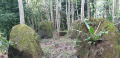
(6) You’ll pass a stone that looks like a kilometre marker. There’s a small, shaded clearing 50 metres further on where you can rest. The path then continues to climb. Before reaching the top, you’ll come across an old path on the left, which is currently impassable.

(7) The climb is over. Begin the descent along the path leading to the ridge.

(8) Join the main ‘short circular’ path, then walk past the chapel before returning to the start of the circle.

(3) Follow the path you took on the way up in the opposite direction, keeping to the right.

(2) Take the shortcut on the right again (don’t be put off if it looks steep – this section is very short) to reach the start of the path closed to vehicles (S/E).

Waypoints

  1. S/E : mi 0 - alt. 374 ft - Path closed to cars
  2. 1 : mi 0.43 - alt. 673 ft - Mission Cross
  3. 2 : mi 0.94 - alt. 620 ft - Return via the main path
  4. 3 : mi 1.39 - alt. 902 ft - Junction of the circular loop - Chapelle du parc biblique
  5. 4 : mi 1.73 - alt. 1,020 ft - The Altar
  6. 5 : mi 1.82 - alt. 1,060 ft - Turn right to go up
  7. 6 : mi 1.98 - alt. 1,266 ft - the pk
  8. 7 : mi 2.27 - alt. 1,545 ft - Ridge Path
  9. 8 : mi 3 - alt. 1,056 ft - Chapel Path
  10. S/E : mi 4.58 - alt. 397 ft - Path closed to cars

Notes

The walk is mainly in the shade.
Take one to two litres of water.
Avoid this walk when it’s raining, as the paths are very slippery and a section with a steep gradient can be dangerous.

Worth a visit

It is possible to climb up to the ridge of the mission, which overlooks Faataua at the crossing point (7). From there, take the path on the right instead of heading back down.

Reviews and comments

3.9 / 5
Based on 3 reviews

Reliability of the description
3.3 / 5
Ease of following the route
4 / 5
Route interest
4.3 / 5
neuneu69
neuneu69

Overall rating : 4 / 5

Date of your route : Mar 24, 2026
Reliability of the description : ★★★☆☆ Average
Ease of following the route : ★★★★☆ Good
Route interest : ★★★★★ Very good
Very busy route : No

We did the route after heavy rain and found it perfectly manageable. There were no dangerous sections, even though we didn’t have walking poles – just good shoes.
However, the vegetation is growing and some landmarks are obscured. The hike poses no navigation problems provided you use the app to follow the route.
Please note: there is nowhere to park nearby, so you’ll have to walk up through the housing estate.

Machine-translated

Mondine
Mondine

Overall rating : 3.7 / 5

Date of your route : Dec 31, 2021
Reliability of the description : ★★★★☆ Good
Ease of following the route : ★★★☆☆ Average
Route interest : ★★★★☆ Good
Very busy route : No

‘No entry’ signs prevented me from completing the circular route
Some very aggressive comments spoiled the walk

Machine-translated

Arno Pro
Arno Pro
• Edited:

Overall rating : 4 / 5

Date of your route : May 24, 2020
Reliability of the description : ★★★☆☆ Average
Ease of following the route : ★★★★★ Very good
Route interest : ★★★★☆ Good
Very busy route : No

A pleasant route through the woods behind the Mission Cross. Please note that the route description is rather sparse in places, so you’ll need to have the app on your smartphone to help you find your way back if you lose the route. The route is consistently hilly (there isn’t a single flat section) and is therefore more challenging than it appears.

Machine-translated

For more walks, use our search engine .

The GPS track and description are the property of this route's author. Please do not copy them without permission.