
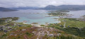
The ascent of Nordkollen on the island of Sommarøy

The island of Sommarøy has a population of around 300 and boasts a charming fishing village. It is situated west of Tromsø, beyond the Arctic Circle. It is famous for its white sandy beaches, turquoise waters and its unique concept of a ‘clockless’ island during the midnight sun. Climb to the top of Nordkollen to enjoy a panoramic view of the archipelago.

Details

n°103318115
Creation:
Last update:
Last review:
–
  • Walking
    Activity: Walking
  • ↔
    Distance: 2.78 mi
  • ◔
    Average duration: 1h 50 
  • ▲
    Difficulty: Moderate

  • ⚐
    Back to start: Yes
  • ↗
    Ascent: + 640 ft
  • ↘
    Descent: - 650 ft

  • ▲
    Highest point: 643 ft
  • ▼
    Lowest point: -20 ft

Photos

Description of the walk

The walk starts from the campsite car park, just before the bridge.

(S/E) Head west and cross the bridge to reach the island.

(1) Carry on straight ahead. At the T-junction, turn right and you’ll soon reach a crossroads near a car park.

(2) Turn left, leaving the car park on your left. At the Fork in the road just past a building, veer to the right. Head west-north-west and begin the ascent, using the chains for support and safety. This will take you to the summit of Nordkollen.

(3) Then turn left and begin the descent heading south.

(4) After descending a fair distance, turn left, heading due east. Walk along the coast on your right until you reach a small road.

(5) Follow the road to the left.

(6) After crossing a stream, take the first right, towards the cemetery. Go round the cemetery on the right and return to the junction you passed at the start of the walk.

(1) Turn right and, following the same route as on the way out but in the opposite direction, return to the campsite car park (S/E).

Waypoints

  1. S/E : mi 0 - alt. 3 ft - Campsite car park
  2. 1 : mi 0.31 - alt. -13 ft - Junction of the circular loop
  3. 2 : mi 0.56 - alt. 7 ft - Junction – Pay-and-display car park
  4. 3 : mi 1.03 - alt. 604 ft - Nordkollen (214 m)
  5. 4 : mi 1.69 - alt. 33 ft - Junction
  6. 5 : mi 1.97 - alt. 3 ft - Rue Sorvegen
  7. 6 : mi 2.22 - alt. 7 ft - Junction
  8. S/E : mi 2.78 - alt. 3 ft - Campsite car park

Notes

This walk is short but physically demanding; the chains at the start and on the descent provide safety. Not suitable for those prone to vertigo.

Worth a visit

The extraordinary view from the summit. You may spot reindeer roaming free and white-tailed eagles.

For more walks, use our search engine .

The GPS track and description are the property of this route's author. Please do not copy them without permission.

