


HIKE - Ullswater Way
Details
Creation:
Last update:
–
–
-
 Activity: Walking
 -
 Distance: 6.53 mi
 -
 Average duration: 3h 30
 -
 Difficulty: Not specified
 -
-
 Back to start: Yes
 -
 Ascent: + 591 ft
 -
 Descent: - 604 ft
 -
-
 Highest point: 1,093 ft
 -
 Lowest point: 476 ft
-
 Country:
United Kingdom
Country:
United Kingdom
-
 Area: Lake District
 -
 City:
Barton
City:
Barton -
 Start/End: N 54.603173° / W 2.824431°
 -


 Hour-by-hour weather


Waypoints
- S/E : mi 0 - alt. 502 ft
- S/E : mi 6.54 - alt. 505 ft
Other walks in the area
Dunmallard Hill Settlement, Pooley Hill
 Association / Club / Walk leader
 1.33 mi
+164 ft
-164 ft
0h 45
1.33 mi
+164 ft
-164 ft
0h 45
 Easy
Easy
 Departure from Dacre (Westmorland and Furness)
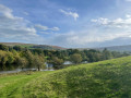
This circular walk brings you along River Eamont before going up into the woodlands around Dunmallard Hill. On the way enjoy views of the countryside and over Ullswater loch.
Howtown to Patterdale; Lakeside
 Visorando Member
 6.03 mi
+581 ft
-571 ft
3h 15
Easy
Departure from Martindale (Westmorland and Furness)
6.03 mi
+581 ft
-571 ft
3h 15
Easy
Departure from Martindale (Westmorland and Furness)
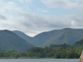
A lovely amble around the Southern Eastern shore of Ullswater with great views. An excellent family walk if combined with the Ullswater Steamer from Glenridding.
From Mayburgh Henge to Brougham Castle
 2.43 mi
+16 ft
-72 ft
1h 10
Easy
Departure from Yanwath and Eamont Bridge (Westmorland and Furness)
2.43 mi
+16 ft
-72 ft
1h 10
Easy
Departure from Yanwath and Eamont Bridge (Westmorland and Furness)
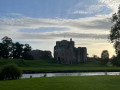
This flat, linear walk will allow you to discover some English Heritage with Mayburgh Henge and Brougham Castle while enjoying a riverside walk along River Eamont. Nearby you can also visit King Arthur's Round Table.
Gowbarrow Fell via Aira Force
 4.13 mi
+1,158 ft
-1,158 ft
2h 55
4.13 mi
+1,158 ft
-1,158 ft
2h 55
 Moderate
Departure from Matterdale (Westmorland and Furness)
Moderate
Departure from Matterdale (Westmorland and Furness)
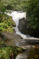
This is a lovely circular walk with continued interest and some great views over Ullswater. You will take in the dramatic Aira Force and upper cascades, then climb to the summit of Gowbarrow Fell where there are great views.
The descent is more gradual and passes the remains of an old shooting lodge before arriving at another great view point at Yew Crags. The return gives good views and the interesting Lyulph's Tower.
Gowbarrow Fell via Aira Force
3.47 mi
+1,007 ft
-1,010 ft
2h 30
Moderate
Departure from Matterdale (Westmorland and Furness)
A short and interesting walk to the top of Gowbarrow Fell via Aira Force. This is an out and return walk but uses paths on either side of Aira Beck to maintain interest and give different views of the waterfalls and cascades. It is useful for a short weather window if you want to stretch your legs and you get a couple of hours of dry weather between the rain. (A longer walk around the fell is also available here.)
Hike around Helvellyn Mountain
9.85 mi
+3,031 ft
-3,038 ft
7h 10
 Difficult
Departure from Patterdale (Westmorland and Furness)
Difficult
Departure from Patterdale (Westmorland and Furness)
An inevitable hike, to the most popular peak of the Lake District, Helwellyn. A hike made all the more pleasant by passing along two lakes: Red Tarn Lake and Grisedale Ran Lake.
YHA hopping in The Lake District - YHA Patterdale to YHA Keswick
18.81 mi
+4,931 ft
-5,157 ft
12h 55
 Very difficult
Departure from Patterdale (Westmorland and Furness)
Very difficult
Departure from Patterdale (Westmorland and Furness)
The YHA is a great institution and I guess most fell walkers have stayed at a hostel at some time in their lives. Funny how they were created "to help all, especially young people of limited means, to a greater knowledge, love and care of the countryside, particularly by providing hostels or other simple accommodation for them on their travels". Here's a collection of routes starting or finishing at a YHA in The Lakes. Along the way are 8 Wainwrights, 2 lakes, 1 tarn and 1 pub
For more walks, use our search engine .
The GPS track and description are the property of this route's author. Please do not copy them without permission.

