
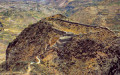
Pre-Inca fortress of Chimpa (Peru)

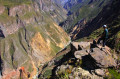
Set out to explore this ancient pre-Inca fortress which overlooks the entrance to the Colca Canyon. The climb is steep but rewarded by a superb view of the terraced fields of the Colca Valley and the start of the canyon. You may also spot condors away from the traditional tourist route.

Details

1981085
Creation:
Last update:
Last review:
  • Walking
    Activity: Walking
  • ↔
    Distance: 3.05 mi
  • ◔
    Average duration: 3h 00 
  • ▲
    Difficulty: Difficult

  • ⚐
    Back to start: Yes
  • ↗
    Ascent: + 1,804 ft
  • ↘
    Descent: - 1,811 ft

  • ▲
    Highest point: 11,850 ft
  • ▼
    Lowest point: 10,354 ft

Photos

Description of the walk

The start of the hike is about 5 km from Madrigal, heading towards the old mine. You can leave your car there.

(S/E) Cross the stream via the small bridge to begin the ascent on the opposite bank.

(1) Leave the path running parallel to the stream on your left and take the one on the right that winds its way up in zigzags. From there, there is only one path (although it does split occasionally… these are shortcuts that eventually converge). You’ll keep your destination in sight throughout the climb.

(2) Continue round a hairpin bend to the right (the path branching off to the left is only about a hundred metres long and leads to a sort of small cave containing human bones). Climb the winding path up to the Fortress of Chimpa (or Chimba), the highest point of the walk.

(3) The return journey follows the same route back to the starting point (S/E).

Waypoints

  1. S/E : mi 0 - alt. 10,374 ft - The old mine route
  2. 1 : mi 0.13 - alt. 10,367 ft - Fork in the path
  3. 2 : mi 0.73 - alt. 11,017 ft - Hairpin bend
  4. 3 : mi 1.52 - alt. 11,850 ft - Chimpa Fortress - Forteresse de Chimpa
  5. S/E : mi 3.05 - alt. 10,374 ft - The old mine road

Notes

There are no water sources or dwellings on this hike; you will be in complete solitude.

It is possible to extend the walk by setting off from the village of Madrigal and returning there (an extra 9 km or so with little change in altitude).

Worth a visit

The walk offers some superb views of the Andean landscapes of the Colca. A short detour from the path takes you past a site containing human bones, likely from pre-Columbian tombs.

Reviews and comments

4.5 / 5
Based on 2 reviews

Reliability of the description
4 / 5
Ease of following the route
4.5 / 5
Route interest
5 / 5
c_eynaud
c_eynaud

Overall rating : 4.7 / 5

Date of your route : Sep 14, 2025
Reliability of the description : ★★★★☆ Good
Ease of following the route : ★★★★★ Very good
Route interest : ★★★★★ Very good
Very busy route : No

The official starting point is a small car park at the end of the track. There is just over 300 metres of elevation gain left to reach the fortress.
There is a lovely view of the Colca Canyon and you can visit the small fort and its access ramp with zigzag bastions without any tourists.

Machine-translated

regrevud
regrevud

Overall rating : 4.3 / 5

Date of your route : Sep 07, 2024
Reliability of the description : ★★★★☆ Good
Ease of following the route : ★★★★☆ Good
Route interest : ★★★★★ Very good
Very busy route : No

A lovely walk – it’s quite a climb and the altitude can take it out of you. But the view from the top is breathtaking and the fortress is in good condition. You can park further up by crossing the bridge and heading to the first viewpoint. That cuts the climb a bit short.

Machine-translated

For more walks, use our search engine .

The GPS track and description are the property of this route's author. Please do not copy them without permission.

