Refine your search for walks in Ferme du Retord
Ferme du Retord walks
A walk on the Retord plateau
A gentle walk on the Retord plateau.
The Retord Sud mountain pasture
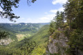
Explore the vast expanses of the Retord Plateau. Along the way, you will see a few typical farms, traces of life in an immaculate and unspoilt place.
La Ferme du Retord - Giron
Open from 1 April to 30 November – subject to there being no snow.
Second stage of the GRP® de la Valserine. Starting from the Ferme de Retord, the route crosses the open and wooded landscapes of the plateau before beginning the descent towards Lalleyriat, with a viewpoint overlooking the Autoroute des Titans. In Saint-Germain-de-Joux, a detour is a must to discover the impressive Marmites de Géant, carved out by the Semine. The stage ends on the northern slope, in Giron.
Valserhône - La Ferme du Retord
Open from 1 April to 30 November – subject to there being no snow.
First stage of the GRP® de la Valserine.
Starting from Bellegarde station, the route runs past Mussel Castle and the hamlet of Ochiaz before climbing up to the Retord plateau. After a 1½-hour climb through the forest, a splendid panorama of the Jura and the Alps awaits you. The stage ends at La Charnay, with the option of staying overnight at the Ferme de Retord or continuing on to the Refuge de la Conay.
GR® de Pays - Grand Tour de la Valserine
Open from 1 April to 30 November – subject to there being no snow.
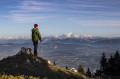
The GR® de Pays Grand Tour de la Valserine covers a vast area in the Ain department. This circular route winds through the Haut-Jura Regional Nature Park, passing through the contrasting landscapes of the Retord plateau, the Valserine valley, the Pays de Gex and the Haute Chaîne du Jura.
Part of the route passes through the Haute Chaîne du Jura National Nature Reserve, which is subject to specific regulations:Dogs are prohibited, even when kept on a lead, as is camping in tents.Please respect these rules to preserve the richness of this exceptional environment.
Walks near Ferme du Retord
La Charnay - Chalet d'Arvière
The section from La Charnay to Chalet d’Arvière is the fifth stage of the six-day walking tour “La GTJ from Mijoux”.
The GR®9 enters the Ain department via Mijoux, before following the spectacular ridges of the Monts-Jura, passing through the Crêt de la Neige, the highest point of the range. It then descends towards Bellegarde-sur-Valserine, crosses the Retord plateau and climbs the Grand Colombier. The trail continues its route to Culoz and the Rhône Valley, before leaving the Ain to reach Savoie and continuing southwards.
Part of the route passes through the Haute Chaîne du Jura National Nature Reserve, which is subject to specific regulations: dogs are prohibited, even when kept on a lead, as is camping in tents. Please respect these rules to preserve the richness of this exceptional environment.
La Charnay - Chalet d'Arvière
Open from 1 April to 30 November ( subject to there being no snow).
Fifth stage of the Grande Traversée du Jura walking route: from La Borne au Lion to Culoz, in 6 days.
The GTJ links Mandeure (Doubs) to Culoz (Ain) in 15 to 20 days, crossing the Jura Mountains and the Haut-Jura Regional Nature Park. The route suggested here covers the second half of the itinerary.
Lancrans - La Charnay
The stage from Lancrans to La Charnay is the fourth stage of the six-day walking tour “La GTJ fromMijoux”.
The GR®9 enters the Ain department via Mijoux, before following the spectacular ridges of the Monts-Jura, passing through the Crêt de la Neige, the highest point of the massif. It then descends towards Bellegarde-sur-Valserine, crosses the Retord plateau and climbs the Grand Colombier. The trail continues its route to Culoz and the Rhône Valley, before leaving the Ain to reach Savoie and continuing southwards.
Lancrans - La Charnay
Open from 1 April to 30 November ( subject to there being no snow).
Fourth stage of the Grande Traversée du Jura walking route: from La Borne au Lion to Culoz, in 6 days.
The GTJ links Mandeure (Doubs) to Culoz (Ain) in 15 to 20 days, crossing the Jura Mountains and the Haut-Jura Regional Nature Park. The route suggested here covers the second half of the itinerary.
Menthières - Valserhône
Open from 1 April to 30 November – subject to there being no snow.
The fifth and final stage of the GRP® de la Valserine. The stage begins in the forest before reaching the mountain pastures and the Pierre à Fromage. The Crêt de la Goutte (1,621 m) offers a breathtaking panorama of the Alps, Mont Blanc and the three great lakes — Lake Geneva, Lake Annecy and Lake Bourget. The descent crosses the nature reserve between the Crêt du Miroir and Crêt du Milieu to Sorgia-d’en-Haut, then the path heads into the forest before following the banks of the Valserine to Bellegarde-sur-Valserine.
Protected area: dogs and tent camping are prohibited in the Haute Chaîne du Jura National Nature Reserve.
If the Valserine riverside path is closed, follow the diversion via the Voie du Tram to reach the centre of Bellegarde.
Giron - Lélex
Open from 1 April to 30 November – subject to there being no snow.
Third stage of the GRP® de la Valserine. From the Roche Fauconnière viewpoint and its panoramic view of the Cirque d'Orvaz, the trail leads to the Lion marker, a historic landmark of the Franco-Comtois border in the 17th century and a key site of the Resistance. It is here that the GR® de Pays crosses the Grande Traversée du Jura and the GR® 5, before a long, gentle descent towards Lélex, a ski resort nestled in the Valserine valley.
La Poutouille Refuge - Lancrans
Open from 1 April to 30 November ( subject to there being no snow)
Third stage of the Grande Traversée du Jura walking route: from La Borne au Lion to Culoz, in 6 days.
The GTJ links Mandeure (Doubs) to Culoz (Ain) in 15 to 20 days, crossing the Jura Mountains and the Haut-Jura Regional Nature Park. The route proposed here corresponds to the second half of the itinerary.
The route winds through the heart of the Haut-Jura Regional Nature Park and the Haute Chaîne du Jura National Nature Reserve: a protected area to be explored with respect.
Part of the route crosses the Haute Chaîne du Jura National Nature Reserve.
Dogs arenot permitted, even on a lead, and camping in tents is prohibited
Please respect these rules to preserve this exceptional environment.
La Poutouille - Lancrans
Open from1 April to 30 November – subject to there being no snow.
The section between La Poutouille and Lancrans is the third stage of the six-day walking tour, “The GTJ from Mijoux”.
The GR®9 enters the Ain department via Mijoux, before following the spectacular ridges of the Monts-Jura, passing through the Crêt de la Neige, the highest point of the massif. It then descends towards Bellegarde-sur-Valserine, crosses the Retord plateau, and then crosses the Grand Colombier. The trail continues its route to Culoz and the Rhône Valley, before leaving the Ain to reach Savoie and continuing southwards.
Part of the route passes through the Haute Chaîne du Jura National Nature Reserve, which is subject to specific regulations:Dogs are not permitted, even on a lead, and camping in tents is also prohibited.
Please respect these rules to preserve the richness of this exceptional environment.
Chalet d'Arvière - Pont de La Loi
Open from 1 April to 30 November ( subject to there being no snow).
The final and sixth stage of the six-day “Grande Traversée du Jura à pied: from La Borne au Lion to Culoz” trek.
The GTJ links Mandeure (Doubs) to Culoz (Ain) in 15 to 20 days, crossing the Jura Mountains and the Haut-Jura Regional Nature Park. The route suggested here corresponds to the second half of the itinerary.
Chalet d'Arvière - Pont de La Loi
Open from 1 April to 30 November – subject to snow conditions.
The section from the Chalet d’Arvière to Pont de La Loi is the sixth stage of the six-day walking tour “La GTJ from Mijoux”.
The GR®9 enters the Ain department via Mijoux, before following the spectacular ridges of the Monts-Jura, passing through the Crêt de la Neige, the highest point of the massif. It then descends towards Bellegarde-sur-Valserine, crosses the Retord plateau and then crosses the Grand Colombier. The trail continues its route to Culoz and the Rhône Valley, before leaving the Ain to reach Savoie and continuing southwards.