


Refine your search for walks in Étang de l'Étange
Étang de l'Étange walks


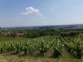
 Between vineyards and forests around Bulligny
 Visorando Member
 6.06 mi
 +610 ft
 -597 ft
 3h 20
 Easy
 Departure from Bulligny (Meurthe-et-Moselle)
A route to discover the heritage of the wine-growing village of Bulligny, its vineyards, woods and mysterious "blue pond". With a beautiful view of the Côtes de Toul vineyards.
Walks near Étang de l'Étange
The old Moselle valley
 16.70 mi
+1,391 ft
-1,286 ft
8h 55
 Difficult
Departure from Toul (Meurthe-et-Moselle)
This route follows the ancient valley of the Moselle, which used to flow into the Meuse at Pagny-sur-Meuse before it was diverted, some 200,000 years ago, towards the Meurthe due to the accumulation of alluvial deposits at the Foug weir.
Starting from Toul, you follow the Ingressin valley, which runs along the former course of the Moselle; you then cross the Foug weir to emerge into the Val de l’Asne and arrive at Pagny-sur-Meuse at the former confluence of the two rivers.