


 Country:

 City:
City:


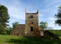
Park at the Yvernès dovecote. The ‘Yvernes’ sign indicates the road about 1 km after Murviel-les-Béziers and leads to a signposted car park.
(S/E) Follow the signposted route, which follows the tarmac access track, then turn right at the signpost and continue for a further 400 m or so.
(1) Leave the signposted route, which turns left, and continue straight on. Head up towards the large electricity pylon, pass it, and turn immediately right at the gate to a private property. The path crosses a small stream via a footbridge before reaching the junction where it meets the signposted route again. (Pigeon Lofts Route).
(2) Join the yellow-marked route on the left, which climbs north-west, then north, joining a wider track after a short stretch through fallow land, then the road leading to the hamlet of Veyran, which can be seen in the distance.
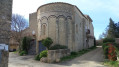
(3) Follow this road to the right and take a short round trip to explore the old priory
(4) Retrace your steps, then take the track on the left in front of the farm, which climbs alongside the vineyards for 500 m
(5) Turn left onto a farm track. The path runs alongside the vineyard for its entire length, then curves slightly to join a wider track which forms part of another signposted trail (Causses and Veyran Gourniès)
(6) Turn left onto this track and follow it as it climbs southwards, then ignore the track that heads straight on in a wide, descending bend.
(7) The track soon winds its way alongside a fenced-off area on the left (a wild boar reserve) amidst the pine forests, before reaching the foot of a huge electricity pylon supporting the power line that crosses the Orb.
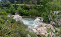
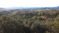
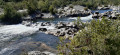
(8) Head towards the valley along a path that quickly begins a very steep descent. The view over the Orb is breathtaking. Carefully descend the steep but short section, which continues alongside the Orb as the gradient eases, then head due east, keeping a good distance from the river. Finally, walk past the fences bordering a property, which signal your return to the track running alongside the Orb, cross the Ruisseau de Pécan over a bridge before reaching the hamlet of Roucans.
(9) Continue along the road past the houses until you reach the main road. (There used to be a path allowing you to avoid the dangerous road by climbing the hill, but it has been privatised.) Cross the road for the first time at the bridge and follow it for 300 m in the opposite direction to a large house under construction, then cross it again to reach a small, uphill street between the houses.
(10) Turn left. After 200 m, the street leads onto the track at the top of the hillock (the upper section is marked ‘private road’ but this applies only to vehicles). Turn right and follow it towards the departmental road.
(11) Leave the road before the sharp right-hand bend to head due north, pass the turn-off for the estate and continue, winding your way along the vineyards to rejoin the signposted route.
(12) Turn right and head back to the junction from the outward leg.
(1) Turn right and, following the route in the opposite direction to the outward journey, head back to the dovecote car park (S/E).


 Visorando Member
 Easy
Easy 


 Difficult
