Between the Yvette and the Fort de Palaiseau

This walk will introduce you to the Yvette and Joncherettes neighbourhoods, as well as the town centre, whilst you discover the buildings that have shaped their history.

Details

n°35098611
Creation:
Last update:
Last review:
  • Walking
    Activity: Walking
  • ↔
    Distance: 5.77 mi
  • ◔
    Average duration: 3h 00 
  • ▲
    Difficulty: Easy

  • ⚐
    Back to start: Yes
  • ↗
    Ascent: + 387 ft
  • ↘
    Descent: - 377 ft

  • ▲
    Highest point: 509 ft
  • ▼
    Lowest point: 164 ft
  • ⚐ Country: France
  • ⚐ City: Palaiseau (91120)
  • ⚑
    Start/End: N 48.701417° / E 2.232946°
  • ❏
    IGN map(s): Ref. 2315OT
  • Hour-by-hour weather

Description of the walk

The walk starts at the Moulin de Lily car park.

(S/E) With your back to the mill, head straight ahead along Avenue du Moulin de la Planche until it ends. Cross Avenue du Général Leclerc carefully, using the pedestrian crossing on the left, before continuing straight ahead along a path running alongside a school. Turn right at the first junction. Cross Rue Marceau to reach the railway line.

(1) Cross the railway line via the underpass to reach Boulevard de Lozère. Turn right, then turn left at the next junction onto Chemin du Dessous du Rocher. Look for a dead-end road branching off to the right and follow it, then follow the path that continues from there. At the top of the hill, turn sharply left to reach Fort de Palaiseau and its two batteries.

(2) Carry on straight ahead to go round the fort. When you reach the road, continue to the left. Ignore the first junction, then at the second, take the path on the left, Chemin de la Hunière. Stay on this path until you reach the edge of the houses on the right. A few metres past the last house, take a path starting on the same side. Carry on straight ahead until you reach the cleared area where there is a Fork in the road.

(3) Take the middle branch. At the next junction, first turn right then left, then turn left again. Turn right when you reach the road (Chemin de la Vauve aux Granges) and leave it at the bend.

(4) Take the path on the left, then follow the one on the right back towards the houses. First turn left then right to walk alongside the buildings of a nursing practice. Cross the Route de Saclay and head opposite into a playground and picnic area. Turn right to stay within the playground and come out onto an avenue. Turn right and cross the Route de Saclay again to reach the Camille Claudel Eco-neighbourhood and the Place des Causeuses.

(5) Turn left. Continue straight on until you reach the woodland, where you’ll come out onto the Chemin de la Hunière et des Joncherettes. Turn right onto the path running alongside the road. Leave this path to enter the woodland on the right, rejoining it a little further on to the right. Once the path moves away from the road, continue along it until the next junction.

(6) Turn left, still on the Chemin de la Hunière. Cut across a path to stay on this track, then at the next junction, turn left. Turn left again at the end of the street, then right onto the first path, called the Sentier de la Vallée Française. Carry on straight ahead until you reach the next street, Rue du 11 Novembre 1918, and turn right. Turn left at the next junction to follow Boulevard Samson and go under the railway line.

(7) Turn left onto Rue Antoine Badour. At the end, turn left to go under the railway line again, cross Rue du 11 Novembre 1918 and carry on straight ahead to reach Saint-Martin Church.

(8) Carry on straight ahead. At the next junction, note the corner of the castle. Carry on straight along Rue de la Pie Voleuse and keep right at the T-junction to follow Boulevard Joseph Bara. Once at the end, turn left, then turn right to cross the bridge over the railway line and reach the next junction.

(9) Turn right onto Avenue de la République at the Théâtre de la Passerelle. Carry on straight ahead at the roundabout to reach the car park, then turn left onto Rue Voltaire and head for Place de la Victoire and the Hôtel Brière.

(10) Once on the other side of the square, turn right onto the street. At the next junction, carry on straight ahead along Rue de Paris and note the statue of Joseph Bara. Then take the first left, cross the 8 May 1945 car park and rejoin the departmental road (Avenue du 8 mai 1945) at the Curie/Einstein mural.

(11) Turn right and continue to Parc Jean-Pierre Chabrol. Cross the park via the Sentier des Marais and emerge onto Rue Blaise Pascal. Follow this street, turning sharply right. Take the first left, onto Rue Amable Tastu, and continue to where it ends at Rue Lazare Hoche. Turn left onto Rue Lazare Hoche to reach Rue George Sand.

(12) Turn right to reach the roundabout. Take the path on the right that runs alongside the Yvette and stay by the river until you reach the street. Continue to the junction.

(13) Turn right onto Rue du Parc à Foulons, then left when you reach the riverbank without crossing the river. Continue straight on along Chemin des Foulons.

(14) Turn right twice at the playground and cross the Yvette. At the junction, keep left and return to the starting point (S/E).


Waypoints

  1. S/E : mi 0 - alt. 174 ft - The Banks of the Yvette – car park - Yvette (l')
  2. 1 : mi 0.31 - alt. 276 ft - Underpass
  3. 2 : mi 0.84 - alt. 479 ft - The former fort of Palaiseau and its two batteries
  4. 3 : mi 1.65 - alt. 505 ft - Deforested area
  5. 4 : mi 1.95 - alt. 502 ft - Path on the left
  6. 5 : mi 2.36 - alt. 502 ft - C. Claudel Eco-neighbourhood and Place des Causeuses
  7. 6 : mi 3.02 - alt. 499 ft - Junction, on the left
  8. 7 : mi 3.63 - alt. 262 ft - Rue Antoine Badour
  9. 8 : mi 3.87 - alt. 295 ft - Saint-Martin Church
  10. 9 : mi 4.1 - alt. 302 ft - Théâtre de la Passerelle
  11. 10 : mi 4.29 - alt. 243 ft - Place de la Victoire and Hôtel Brière
  12. 11 : mi 4.47 - alt. 194 ft - Curie/Einstein mural
  13. 12 : mi 5.03 - alt. 167 ft - Rue George Sand - Yvette (l')
  14. 13 : mi 5.43 - alt. 171 ft - Crossroads - Yvette (l')
  15. 14 : mi 5.65 - alt. 171 ft - Playground - Yvette (l')
  16. S/E : mi 5.77 - alt. 174 ft - The banks of the Yvette – car park - Yvette (l')

Worth a visit

(S/E) The banks of the Yvette:
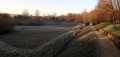
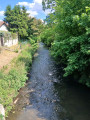
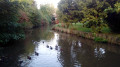
The river, which is around 50 km long, takes its name from its source, the hamlet of L’Yvette. The suggested route passes close to the Yvette riverbanks’ Sensitive Natural Area (ENS). You can admire the flora there and spot many species of birds, including the grey heron, a regular visitor to the area.

(2) The former fort at Palaiseau and its two batteries:
The fort and its two batteries (La Pointe and L’Yvette) were built between 1874 and 1879. These structures formed part of a defence system for the capital established by General Séré de Rivières following the defeat of 1870. Since 1947, the main fort has been occupied by ONERA (the National Office for Aerospace Studies and Research). The Pointe battery, owned by the town, is currently undergoing conservation work.

(5) Camille Claudel Eco-neighbourhood and Place des Causeuses:
Since March 2022, ‘Les Causeuses’, statues by the sculptor Iris Vargas, have graced the square of the same name at the heart of this young eco-neighbourhood, established in the 2010s. Echoing Camille Claudel, who sculpted ‘Les
‘Causeuses’ in 1895, these statues were chosen by the residents of Palaiseau following a lengthy participatory process initiated by the Plateau and Palaiseau neighbourhood council.

(8) Saint-Martin’s Church:
Now listed as a historic monument, it was built in the 12th and 13th centuries. Although time has taken its toll, there are several features worth noting: the crypt and the chancel. The nave was rebuilt around 1470 and the bell tower in 1856. Looking above the Romanesque-style portal, you can see a statue of the Virgin Mary. The church also houses an 18th-century wooden altarpiece and paintings from the 16th and 17th centuries.

Shortly after the (8): the castle gate
It remains the only visible remnant of the castle of the Lord of Palaciolo. This castle, whose construction is thought to have been completed around 1526, belonged to the Prince of Condé before being destroyed in 1802.

(9) Théâtre de la Passerelle
The original market hall was built in 1930. It was originally intended to host the flower shows of the ‘Foire de Fructidor’. Later, its sides were closed off to turn it into a village hall. Finally, in 2016, following extensive renovation work, the village hall was transformed into a theatre, where much of Palaiseau’s cultural life now takes place.

(10) Place de la Victoire and Hôtel Brière:
Situated in the heart of the town centre, this was the square where the old town hall once stood (now the local magistrates’ court). It took its current name in 1919. Until 1990, the Hôtel Brière, situated on the left, was occupied by the gendarmerie. Now owned by the local council, it is home to the Tourist Information Centre and the Hurepoix Museum of Palais, and provides access to the George Sand Media Library, which opened in 1991.

Statue of Joseph Bara:
It was erected in 1881 in honour of this young man from Palais, the son of a gamekeeper for the Prince of Condé, who was born at the château in 1779. Having joined the armies of the Revolution, he lost his life at the age of 14 during an ambush in the Vendée. Ordered to shout ‘Long live the King!’, he is said to have shouted ‘Long live the Republic!’.

(11) Curie/Einstein mural:
Two ‘giants’ of science have been immortalised on the walls of Palaiseau! The talent of the graffiti artist RAST led to the creation in 2020 of portraits of Marie Curie and Albert Einstein, following in the tradition of the murals springing up across the town. Where can you see them? They are located between the porch at 181 Rue de Paris and the 8 May 1945 car park.

Shortly after the (11): Parc Jean-Pierre Chabrol
It was developed and officially opened in the presence of the writer and storyteller’s daughters in May 2002. A native of Le Palais, Jean-Pierre Chabrol wrote, amongst other works, a novel entitled *Le Bout-Galeux*.

Reviews and comments

4.3 / 5
Based on 2 reviews

Reliability of the description
4.5 / 5
Ease of following the route
4 / 5
Route interest
4.5 / 5
User 16797947

Overall rating : 4.3 / 5

Date of your route : Oct 21, 2025
Reliability of the description : ★★★★★ Very good
Ease of following the route : ★★★★☆ Good
Route interest : ★★★★☆ Good
Very busy route : No

The designated departure car park (at Lily's Mill) is private = reserved for hotel guests. Therefore, we recommend parking on Avenue du Moulin de la Planche, nearby.

Machine-translated

Youmino9172
Youmino9172

Overall rating : 4.3 / 5

Date of your route : May 17, 2024
Reliability of the description : ★★★★☆ Good
Ease of following the route : ★★★★☆ Good
Route interest : ★★★★★ Very good
Very busy route : No

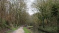
A surprising route that begins with the climb up to Palaiseau Fort, which you walk around via a narrow path. This is followed by country lanes that you wouldn’t expect to find in an urban setting, where it’s lovely to walk in complete tranquillity. The signposting is easy to follow using the app. All in all, a pleasant and easy route, with all the elevation gain at the start of the route.

Machine-translated

Other walks in the area

For more walks, use our search engine .

The GPS track and description are the property of this route's author. Please do not copy them without permission.