Country:

 City:
City:


Park in the car park at the entrance or exit of the bridge over the Orne, depending on which direction you’re coming from, on the west side.
(S/E) Cross the bridge over the Orne and join the Greenway, which follows the old railway line.
(1) Take this Voie Verte to the left, follow the River Orne and continue until you can see the houses at La Serverie. Then leave the Voie Verte to the right to reach the hamlet.
(2) Turn right, following the route of the Tour de la Suisse Normande: the ascent begins here and is quite challenging. You’ll reach the Pain de Sucre viewpoint.
(3) Carry on to the left, continuing the steep climb to reach the Route des Crêtes. Turn right onto it and continue to the three-way junction.
(4) Turn right, staying on the Route des Crêtes, to reach the paragliding launch site at the Rochers de la Haute: picnic tables and dry toilets.
(5) Continue along the route, passing a small car park on your right, until you reach a junction.
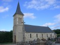
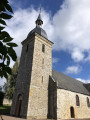
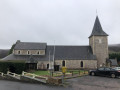
(6) Turn left towards Saint-Omer, following the sign for “Bar la Recup”. You’ll come out onto the D133 in the centre of the village, opposite the church.
(7) Turn right onto it for a few dozen metres, then cross the road and turn left towards the town hall, following the signs for the Tour de la Suisse Normande. Return to the D133, follow it to the left, then turn left again towards Les Basses Planches. Once you reach the hamlet, turn right, rejoin the D133 once more and cross it to take the path opposite. You’ll come to a T-junction.
(8) Head left, then turn right. Go downhill to reach the junction with a small road (D133a), and follow it to the left.
(9) Turn right to reach Corps du Sel. At the wash house, turn right and continue downhill.
(10) Take the road on the right towards Le Chesnay. At the houses, continue to the left and you’ll reach a junction where the road meets footpaths.
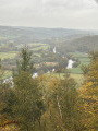
(11) Go straight ahead, then turn sharply right to follow the path that runs along the top of the Rochers des Parcs and leads to a viewpoint overlooking the River Orne and the viaduct.
(12) Carry on to the right, cross the Greenway and emerge opposite the campsite.
(13) Take the road on the right, rejoin the route you started on and turn left to cross the bridge over the Orne and return to the car park (S/E).
 Visorando Member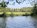
 Easy
Easy