Country:
 City:
City:


Car park near the school.
(S/E) Head towards the École des Noisettes, built in 1852 on land donated by Colonel Gleizes, lord of the manor and mayor of the village. At the junction, keep left then turn right.
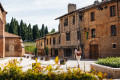
(1) Walk past the château, a15th-century residence, which has been home to the Tersac, d’Anceau, Caarelli, Gleizes, Alquier-Bouard and Bézard families in succession. In 1952, the property was purchased by the Parmentier-Delassus family. Then take the first path on the right to catch a view of the château from the garden side. Turn back and turn right. Continue straight ahead until you reach the railway line.
(2) Walk along the right-hand side of the Toulouse–Tarbes railway line for about 500 metres, noting the former cooperative wine cellar—which has been occupied since 2013 by the Baro d’Evel circus company—as well as the water tower built in 1972 and covered with a mural in 2012, whilst enjoying the view of the Pyrenees mountain range.
(3) At the second level crossing, turn right onto Chemin du Lac towards Lavelanet-en-Comminges. Continue until you reach a junction.
(4) Head towards the cemetery by taking Rue des Sources, opposite.
(5)Members of the Caffarelli, Gleizes and Alquier-Bouffard families, amongst others, have been buried in the present-day cemetery since 1840. Turn right onto Rue de la Comtesse. At the junction, turn left.
(6) Head towards the wash house on the right, fed by a spring, then walk up to the left towards the town hall – the former parish vicarage – along Rue des Marronniers.
(7) Turn right. The present church is thethird to have stood on this site since the village was founded. The first was destroyed by fire in 1419. Saint Cizy is regarded as the patron saint of the church in Lavelanet, whilst Saint Bartholomew is the patron saint of the parish. Head towards the public park and then onto Rue Joseph Cafferelli. You will then reach the car park a few metres behind the church (S/E).
 Tourist office


 Moderate
  Visorando Member