


East Lomond & Maspie Den
Details
Creation:
Last update:
-
 Activity: Walking
 -
 Distance: 4.57 mi
 -
 Average duration: 3h 10
 -
 Difficulty: Moderate
 -
-
 Back to start: Yes
 -
 Ascent: + 1,207 ft
 -
 Descent: - 1,184 ft
 -
-
 Highest point: 1,404 ft
 -
 Lowest point: 233 ft
-
 Country:
United Kingdom
Country:
United Kingdom
-
 City:
Fife
City:
Fife -
 Start/End: N 56.253899° / W 3.216424°
 -


 Hour-by-hour weather


Waypoints
- S/E : mi 0 - alt. 269 ft
- S/E : mi 4.57 - alt. 269 ft
Other walks in the area
Lomond Hills Circuit
 Association / Club / Walk leader 12.82 mi
+2,198 ft
-2,188 ft
7h 50
Association / Club / Walk leader 12.82 mi
+2,198 ft
-2,188 ft
7h 50
 Difficult
 Departure from Fife
The route starts from the Holl Reservoir car park and goes in an anti-clockwise direction. Walking anti-clockwise has the advantage of going down rather than up the steep south side of West Lomond, although what was just feint path amongst the heather is becoming well trodden nowadays.
Glen Burn waterfall
Association / Club / Walk leader 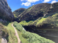 3.36 mi
+325 ft
-325 ft
1h 50
3.36 mi
+325 ft
-325 ft
1h 50
 Easy
Departure from Fife
Easy
Departure from Fife
This nice little walk brings you into sandstones along Glen Burn to reach a nice waterfall surrounded by little caves.
Jonathan's Cave via Macduff Castle, East Wemyss
Association / Club / Walk leader 1.13 mi
+82 ft
-69 ft
0h 35
Easy
Departure from Fife
This walk follows the well-known Fife Coastal Path and brings you to visit several little caves via Macduff Castle. If you are lucky, along the way, you will be able to spot some seals. The best time to spot them is at low tide.
Dumglow Via Dumifarline And The Inneans
Association / Club / Walk leader 4.28 mi
+748 ft
-719 ft
2h 35
Easy
Departure from Perthshire and Kinross
Dumglow is an unavoidable point in the area of The Cleish Hill. The Cleish Hills straddle the boundary between Perth & Kinross and Fife. Made up of tussocky grass moorland they have a real hill feel to them despite not being particularly high. The highest point Dumglow lies within Perth and Kinross, but at 339m the nearby Park Hill is the seventh highest hill within Fife. Although Park Hill could be approached from the Fife side, it is probably best included with an ascent of Dumglow.
Dumglow via Windy Gate
Association / Club / Walk leader 3.20 mi
+863 ft
-348 ft
2h 15
Easy
Departure from Perthshire and Kinross
Dumglow is an unavoidable point in the area of The Cleish Hill. The Cleish Hills straddle the boundary between Perth & Kinross and Fife. Made up of tussocky grass moorland they have a real hill feel to them despite not being particularly high. The highest point Dumglow lies within Perth and Kinross, but at 339m the nearby Park Hill is the seventh highest hill within Fife. Although Park Hill could be approached from the Fife side, it is probably best included with an ascent of Dumglow.
Dumglow Direct
Association / Club / Walk leader 3.52 mi
+587 ft
-571 ft
2h 10
Easy
Departure from Perthshire and Kinross
The Cleish Hills straddle the boundary between Perth & Kinross and Fife. Made up of tussocky grass moorland they have a real hill feel to them despite not being particularly high. The highest point Dumglow lies within Perth and Kinross, but at 339m the nearby Park Hill is the seventh highest hill within Fife. Although Park Hill could be approached from the Fife side, it is probably best included with an ascent of Dumglow.
Perth country
 Visorando Member 10.99 mi
+863 ft
-863 ft
5h 50
Moderate
Departure from Perthshire and Kinross
Visorando Member 10.99 mi
+863 ft
-863 ft
5h 50
Moderate
Departure from Perthshire and Kinross
The walk, 90% of which is on quiet country roads, on a good day offers truly brilliant country views. Many splendid views across extensive farmlands and on the latter half across the Tay Valley, the Tay Road bridge and towards the Earn river Valley.
Pittencrieff Park & Dunfermline Abbey
 Tourism professional
  1.58 mi
+154 ft
-154 ft
0h 50
Easy
Departure from Fife
1.58 mi
+154 ft
-154 ft
0h 50
Easy
Departure from Fife
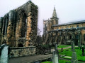
Known locally as “The Glen”, the beautiful 76 acre Pittencrieff Park was gifted to the people of Dunfermline by Andrew Carnegie. This short walk takes in some of the park’s best bits before allowing you to explore Dunfermline Abbey, burial site of King Robert the Bruce. Keep a look out for the resident peacocks whilst in the park!
For more walks, use our search engine .
The GPS track and description are the property of this route's author. Please do not copy them without permission.

