A circular route from Port de la Meule to Plage des Vieilles

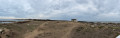
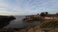
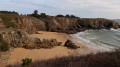
A magnificent walk starting from the picturesque Port de la Meule, overlooked by its famous little white chapel. The coastal path, wild and steep for around 4 km, runs along the granite cliffs facing the ocean and reveals superb coves, from Anse des Soux to Plage des Vieilles. After a stop on the fine sandy beach, the circular return is an easy walk, sheltered from the wind, along inland paths through the moorland and the undergrowth of maritime pines.

Details

n°111479180
Creation:
Last update:
Last review:
–
  • Walking
    Activity: Walking
  • ↔
    Distance: 4.56 mi
  • ◔
    Average duration: 2h 15 
  • ▲
    Difficulty: Easy

  • ⚐
    Back to start: Yes
  • ↗
    Ascent: + 138 ft
  • ↘
    Descent: - 102 ft

  • ▲
    Highest point: 105 ft
  • ▼
    Lowest point: 0 ft

Photos

Description of the walk

Park at the Port de la Meule car park on the Île d’Yeu.

(S/E) Head down towards the bottom of the cove. Right from the start, look out for the yellow and red markings of the GRP® Tour de l’Île d’Yeu, which you’ll need to follow for part of the route. At the far end of the harbour, cross the café terrace to reach the steps leading up the cliff. Continue climbing until you reach the Notre-Dame de Bonne Nouvelle Chapel.

(1) Walk round the building to the left and continue along the steep coastal path towards Pointe de la Tranche.

(2) Take a short detour via the wooden footbridge to enjoy the panoramic view of the ocean before rejoining the main path to the cliff edge at Anse des Soux , where you can head down for a break on the beach and in its sheltered cove.

(3) Continue along the coastline on the signposted path to reach the picturesque Port des Vieilles, known as one of the smallest ports in France, right next to Plage des Vieilles.

(4) Carry on along the beach, then leave the seaside by turning left onto the road to begin the circular return, following the yellow markings of the Sente des Meules.

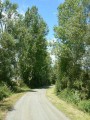
(5) At the Fork in the road, turn left and head due west through the moorland and woods, still following the yellow markings. You’ll reach the D22A, Rue de la Meule.

(6) Turn left and head down the road towards La Meule to reach the harbour car park (S/E).

Waypoints

  1. S/E : mi 0 - alt. 16 ft - Port de la Meule car park
  2. 1 : mi 0.14 - alt. 52 ft - Notre-Dame de Bonne Nouvelle Chapel
  3. 2 : mi 1.15 - alt. 30 ft - Wooden footbridge
  4. 3 : mi 1.7 - alt. 52 ft - Anse des Soux
  5. 4 : mi 2.47 - alt. 30 ft - Port des Vieilles
  6. 5 : mi 2.72 - alt. 33 ft - Junction with the PR trail
  7. 6 : mi 4.4 - alt. 43 ft - Turn left at the end of the path
  8. S/E : mi 4.56 - alt. 26 ft - Port de la Meule car park

Notes

Wear walking boots or trainers, but not flip-flops, as some sections are steep.
This route is not suitable for pushchairs, bicycles or scooters.

Worth a visit

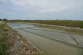
The entire stretch of coastline from Port de la Meule to Plage des Vieilles, passing by the chapel, the footbridge and Anse des Soux, is magnificent.

Other walks in the area

For more walks, use our search engine .

The GPS track and description are the property of this route's author. Please do not copy them without permission.